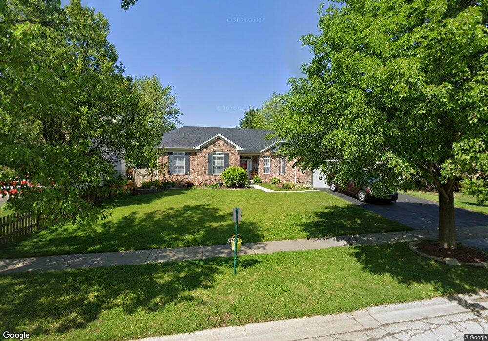
612 Manhattan Cir Unit 2 Oswego, IL 60543
Northwest Oswego NeighborhoodEstimated Value: $393,192 - $415,000
3
Beds
2
Baths
2,087
Sq Ft
$195/Sq Ft
Est. Value
About This Home
This home is located at 612 Manhattan Cir Unit 2, Oswego, IL 60543 and is currently estimated at $407,798, approximately $195 per square foot. 612 Manhattan Cir Unit 2 is a home located in Kendall County with nearby schools including Fox Chase Elementary School, Traughber Junior High School, and Oswego High School.
Ownership History
Date
Name
Owned For
Owner Type
Purchase Details
Closed on
Oct 29, 2009
Sold by
Grunschel Gail F
Bought by
Grunschel Gail F
Current Estimated Value
Purchase Details
Closed on
Oct 31, 2003
Sold by
Richard Smykal Inc
Bought by
Grunschel Gail F
Home Financials for this Owner
Home Financials are based on the most recent Mortgage that was taken out on this home.
Original Mortgage
$199,350
Outstanding Balance
$91,197
Interest Rate
5.81%
Mortgage Type
Purchase Money Mortgage
Estimated Equity
$316,601
Create a Home Valuation Report for This Property
The Home Valuation Report is an in-depth analysis detailing your home's value as well as a comparison with similar homes in the area
Home Values in the Area
Average Home Value in this Area
Purchase History
| Date | Buyer | Sale Price | Title Company |
|---|---|---|---|
| Grunschel Gail F | -- | None Available | |
| Grunschel Gail F | $262,000 | Chicago Title Insurance Co |
Source: Public Records
Mortgage History
| Date | Status | Borrower | Loan Amount |
|---|---|---|---|
| Open | Grunschel Gail F | $199,350 |
Source: Public Records
Tax History
| Year | Tax Paid | Tax Assessment Tax Assessment Total Assessment is a certain percentage of the fair market value that is determined by local assessors to be the total taxable value of land and additions on the property. | Land | Improvement |
|---|---|---|---|---|
| 2024 | $6,026 | $114,411 | $22,647 | $91,764 |
| 2023 | $6,762 | $101,249 | $20,042 | $81,207 |
| 2022 | $6,762 | $92,889 | $18,387 | $74,502 |
| 2021 | $7,006 | $89,317 | $17,680 | $71,637 |
| 2020 | $7,076 | $85,882 | $17,000 | $68,882 |
| 2019 | $7,602 | $85,200 | $17,000 | $68,200 |
| 2018 | $7,875 | $87,447 | $25,664 | $61,783 |
| 2017 | $7,609 | $80,227 | $23,545 | $56,682 |
| 2016 | $7,477 | $77,890 | $22,859 | $55,031 |
| 2015 | $7,361 | $73,481 | $21,565 | $51,916 |
| 2014 | -- | $69,321 | $20,344 | $48,977 |
| 2013 | -- | $70,021 | $20,549 | $49,472 |
Source: Public Records
Map
Nearby Homes
- 303 Fox Chase Dr N
- 404 Beaver Ct Unit 3
- 2300 Light Rd Unit 209
- 2600 Light Rd Unit 210
- 2600 Light Rd Unit 207
- 1415 State Route 31
- 435 Fawn Dr
- 149 Willowwood Dr N
- 7.43 Acres Vacant La State Route 31
- 123 Fox Chase Dr S
- 316 Ash Grove Ln
- 5.43 B-3 Commercial State Route 31
- 116 River Mist Dr
- 133 River Mist Dr Unit 3
- 135 River Mist Dr Unit 2
- 505 Parkland Ct
- 2110 State Route 31
- 238 Willowwood Dr
- 2240 State Route 31
- 125 Presidential Blvd Unit 3248
- 614 Manhattan Cir Unit 2
- 610 Manhattan Cir Unit 2
- 161 Dolores St
- 159 Dolores St
- 608 Manhattan Cir
- 163 Dolores St
- 616 Manhattan Cir Unit 2
- 157 Dolores St
- 611 Manhattan Cir Unit 2
- 613 Manhattan Cir Unit 2
- 165 Dolores St Unit 2
- 609 Manhattan Cir Unit 2
- 606 Manhattan Cir
- 615 Manhattan Cir Unit 2
- 155 Dolores St Unit 1
- 607 Manhattan Cir
- 730 Manhattan Cir Unit 2
- 604 Manhattan Cir
- 605 Manhattan Cir Unit 2
- 153 Dolores St
Your Personal Tour Guide
Ask me questions while you tour the home.