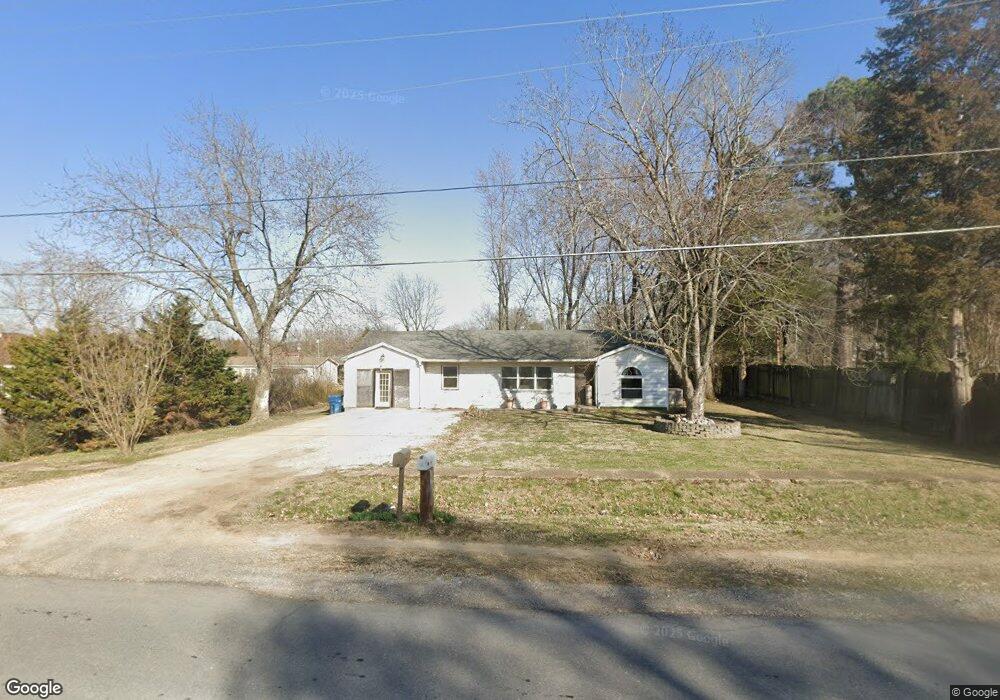
612 N Prairie St Bloomfield, MO 63825
Estimated Value: $81,000 - $117,000
3
Beds
1
Bath
1,172
Sq Ft
$81/Sq Ft
Est. Value
About This Home
This home is located at 612 N Prairie St, Bloomfield, MO 63825 and is currently estimated at $94,774, approximately $80 per square foot. 612 N Prairie St is a home located in Stoddard County with nearby schools including Bloomfield Elementary School, Bloomfield Middle School, and Bloomfield High School.
Create a Home Valuation Report for This Property
The Home Valuation Report is an in-depth analysis detailing your home's value as well as a comparison with similar homes in the area
Home Values in the Area
Average Home Value in this Area
Tax History Compared to Growth
Tax History
| Year | Tax Paid | Tax Assessment Tax Assessment Total Assessment is a certain percentage of the fair market value that is determined by local assessors to be the total taxable value of land and additions on the property. | Land | Improvement |
|---|---|---|---|---|
| 2025 | $415 | $8,151 | $0 | $0 |
| 2024 | $415 | $7,714 | $0 | $0 |
| 2023 | $415 | $7,714 | $0 | $0 |
| 2022 | $400 | $7,429 | $0 | $0 |
| 2021 | $400 | $7,429 | $0 | $0 |
| 2020 | $343 | $7,258 | $0 | $0 |
| 2019 | $343 | $7,277 | $0 | $0 |
| 2018 | $342 | $7,258 | $0 | $0 |
| 2016 | $336 | $7,144 | $0 | $0 |
| 2015 | -- | $7,144 | $0 | $0 |
| 2014 | -- | $7,163 | $0 | $0 |
| 2013 | -- | $0 | $0 | $0 |
Source: Public Records
Map
Nearby Homes
- 709 N Prairie St
- 610 N Spring St
- 100 E Shawnee St
- 503 S Viola St
- 301 W Shawnee St
- 17800 County Road 527
- 123 Link Rd
- 21895 County Road 550
- 0 County Road 237
- 23847 Friar Tuck Ct
- 14038 County Road 405
- 14033 County Road 405
- 21205 County Road 249
- 18049 Thomas Dr
- 13605 Duley Ln
- 25097 State Highway 25
- 18328 Lake Circle Dr
- 0 E Kenton Rd Unit MAR25009938
- 130 Hunt St
- 1207 W Kenton Rd
- 610 N Prairie St
- 613 N Prairie St
- 707 N Viola St
- 608 N Prairie St
- 613 N Prairie Winfred
- 701 N Prairie St
- 611 N Prairie St
- 606 N Prairie St
- 609 N Prairie St
- 103 Winfield St
- 607 N Prairie St
- 703 N Prairie St
- 702 N Viola St
- 706 N Viola St
- 605 N Prairie St
- 604 N Prairie St
- 707 N Prairie St
- 707 Allie St
- 603 N Prairie St
- 615 Allie St Unit 617