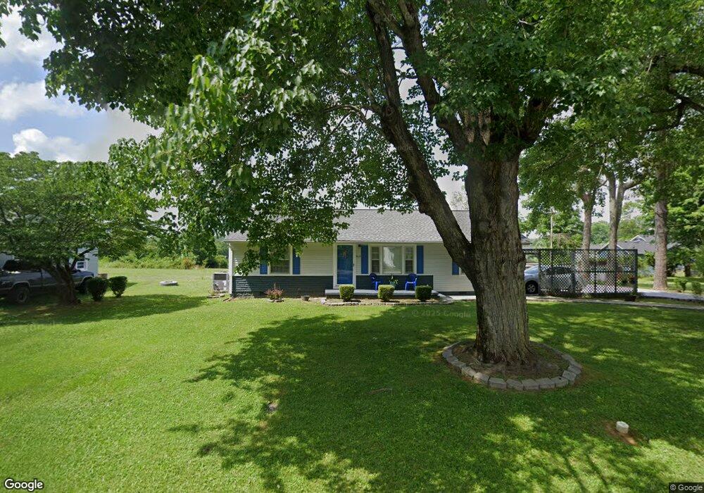
612 Riverside Dr Manchester, TN 37355
Estimated Value: $154,768 - $249,000
--
Bed
1
Bath
1,180
Sq Ft
$168/Sq Ft
Est. Value
About This Home
This home is located at 612 Riverside Dr, Manchester, TN 37355 and is currently estimated at $197,942, approximately $167 per square foot. 612 Riverside Dr is a home located in Coffee County with nearby schools including Westwood Middle School and Temple Baptist Christian School.
Ownership History
Date
Name
Owned For
Owner Type
Purchase Details
Closed on
Mar 3, 2025
Sold by
Parton Lisa
Bought by
Parton Forrest
Current Estimated Value
Purchase Details
Closed on
Aug 30, 2008
Sold by
Lewis Elizabeth
Bought by
Parton Lisa
Purchase Details
Closed on
Sep 27, 2005
Sold by
West Kevin M
Bought by
Lewis Elizabeth
Home Financials for this Owner
Home Financials are based on the most recent Mortgage that was taken out on this home.
Original Mortgage
$69,900
Interest Rate
8.5%
Purchase Details
Closed on
Feb 15, 2001
Sold by
Simerly Matthew and Simerly Wendy
Bought by
West Kevin M
Home Financials for this Owner
Home Financials are based on the most recent Mortgage that was taken out on this home.
Original Mortgage
$65,978
Interest Rate
7.06%
Purchase Details
Closed on
Nov 2, 1995
Bought by
Simerly Matthew
Create a Home Valuation Report for This Property
The Home Valuation Report is an in-depth analysis detailing your home's value as well as a comparison with similar homes in the area
Home Values in the Area
Average Home Value in this Area
Purchase History
| Date | Buyer | Sale Price | Title Company |
|---|---|---|---|
| Parton Forrest | -- | Access Title & Escrow | |
| Parton Lisa | $71,000 | -- | |
| Lewis Elizabeth | $69,900 | -- | |
| West Kevin M | $66,500 | -- | |
| Simerly Matthew | $4,500 | -- |
Source: Public Records
Mortgage History
| Date | Status | Borrower | Loan Amount |
|---|---|---|---|
| Previous Owner | Simerly Matthew | $69,900 | |
| Previous Owner | Simerly Matthew | $65,978 |
Source: Public Records
Tax History Compared to Growth
Tax History
| Year | Tax Paid | Tax Assessment Tax Assessment Total Assessment is a certain percentage of the fair market value that is determined by local assessors to be the total taxable value of land and additions on the property. | Land | Improvement |
|---|---|---|---|---|
| 2024 | $946 | $22,450 | $3,000 | $19,450 |
| 2023 | $946 | $22,450 | $0 | $0 |
| 2022 | $815 | $22,450 | $3,000 | $19,450 |
| 2021 | $804 | $17,575 | $2,500 | $15,075 |
| 2020 | $804 | $17,575 | $2,500 | $15,075 |
| 2019 | $804 | $17,575 | $2,500 | $15,075 |
| 2018 | $804 | $17,575 | $2,500 | $15,075 |
| 2017 | $862 | $16,425 | $2,500 | $13,925 |
| 2016 | $862 | $16,425 | $2,500 | $13,925 |
| 2015 | $862 | $16,425 | $2,500 | $13,925 |
| 2014 | $861 | $16,417 | $0 | $0 |
Source: Public Records
Map
Nearby Homes
- 440 Woodrow St
- 608 Oakdale St
- 800 Wood St
- 612 Maple St
- 512 W High St
- 711 S Spring St
- 434 S Ramsey St
- 309 Westwood Dr
- 400 S Ramsey St
- 709 Mill St
- 902 Mcarthur St
- 116 Ingram St
- 1980 Cat Creek Rd
- 210 Rigney Dr
- 475 Country Club Dr
- 550 Laurel Crown Rd
- 461 Hendrixson Dr
- 0 Lowry St
- 220 Mortons Lake Rd
- 1005 Thoma St
- 614 Riverside Dr
- 608 Riverside Dr
- 291 Stone Hollow Dr
- 616 Riverside Dr
- 613 Riverside Dr
- 611 Riverside Dr
- 606 Riverside Dr Unit 606
- 301 Stone Hollow Dr
- 277 Stone Hollow Dr
- 609 Riverside Dr
- 620 Riverside Dr
- 607 Riverside Dr
- 619 Riverside Dr
- 600 Riverside Dr
- 502 Casey St
- 624 Riverside Dr
- 280 280 Stone Hollow Dr
- 508 Riverside Dr
- 504 Casey St
- 298 Stone Hollow Dr