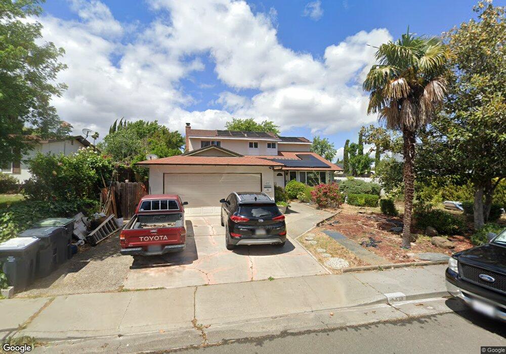
612 Whitehall Cir Fairfield, CA 94533
Estimated Value: $555,000 - $568,354
3
Beds
3
Baths
1,906
Sq Ft
$295/Sq Ft
Est. Value
About This Home
This home is located at 612 Whitehall Cir, Fairfield, CA 94533 and is currently estimated at $562,839, approximately $295 per square foot. 612 Whitehall Cir is a home located in Solano County with nearby schools including David Weir Preparatory Academy, Grange Middle School, and Fairfield High School.
Ownership History
Date
Name
Owned For
Owner Type
Purchase Details
Closed on
Mar 10, 2014
Sold by
Garcia Chris H
Bought by
Segura Arturo and Solorzano Laura A
Current Estimated Value
Home Financials for this Owner
Home Financials are based on the most recent Mortgage that was taken out on this home.
Original Mortgage
$265,109
Outstanding Balance
$201,172
Interest Rate
4.37%
Mortgage Type
FHA
Estimated Equity
$361,667
Purchase Details
Closed on
Oct 1, 1998
Sold by
Garcia Chris H
Bought by
Garcia Chris H
Create a Home Valuation Report for This Property
The Home Valuation Report is an in-depth analysis detailing your home's value as well as a comparison with similar homes in the area
Home Values in the Area
Average Home Value in this Area
Purchase History
| Date | Buyer | Sale Price | Title Company |
|---|---|---|---|
| Segura Arturo | $270,000 | Fidelity National Title Co | |
| Garcia Chris H | -- | -- |
Source: Public Records
Mortgage History
| Date | Status | Borrower | Loan Amount |
|---|---|---|---|
| Open | Segura Arturo | $265,109 |
Source: Public Records
Tax History
| Year | Tax Paid | Tax Assessment Tax Assessment Total Assessment is a certain percentage of the fair market value that is determined by local assessors to be the total taxable value of land and additions on the property. | Land | Improvement |
|---|---|---|---|---|
| 2025 | $3,707 | $330,970 | $73,544 | $257,426 |
| 2024 | $3,707 | $324,481 | $72,102 | $252,379 |
| 2023 | $3,593 | $318,120 | $70,689 | $247,431 |
| 2022 | $3,550 | $311,883 | $69,304 | $242,579 |
| 2021 | $3,515 | $305,769 | $67,946 | $237,823 |
| 2020 | $3,433 | $302,635 | $67,250 | $235,385 |
| 2019 | $3,348 | $296,702 | $65,932 | $230,770 |
| 2018 | $3,456 | $290,886 | $64,640 | $226,246 |
| 2017 | $3,297 | $285,183 | $63,373 | $221,810 |
| 2016 | $3,270 | $279,592 | $62,131 | $217,461 |
| 2015 | $3,053 | $275,393 | $61,198 | $214,195 |
| 2014 | $1,285 | $120,621 | $28,265 | $92,356 |
Source: Public Records
Map
Nearby Homes
- 751 Hillcrest Ct
- 1831 Clay St
- 519 Pacific Ave
- 937 Pacific Ave
- 831 Heath Ct
- 2034 Cambridge Dr
- 2256 Dorset Ln
- 1724 Fillmore St
- 2219 Nottingham Dr
- 1712 Arthur Ct
- 2292 Rutland Ct
- 74 Anza Ct
- 219 Wisconsin St
- 1217 Dana Dr
- 50 Anza Ct
- 46 Anza Ct
- 1500 Harrison St
- 1301 Sunningdale Ln
- 1300 Sunningdale Ln
- 1667 Vicksburg Dr
Your Personal Tour Guide
Ask me questions while you tour the home.