
6120 Benjestown Rd Memphis, TN 38127
Estimated payment $1,428/month
Highlights
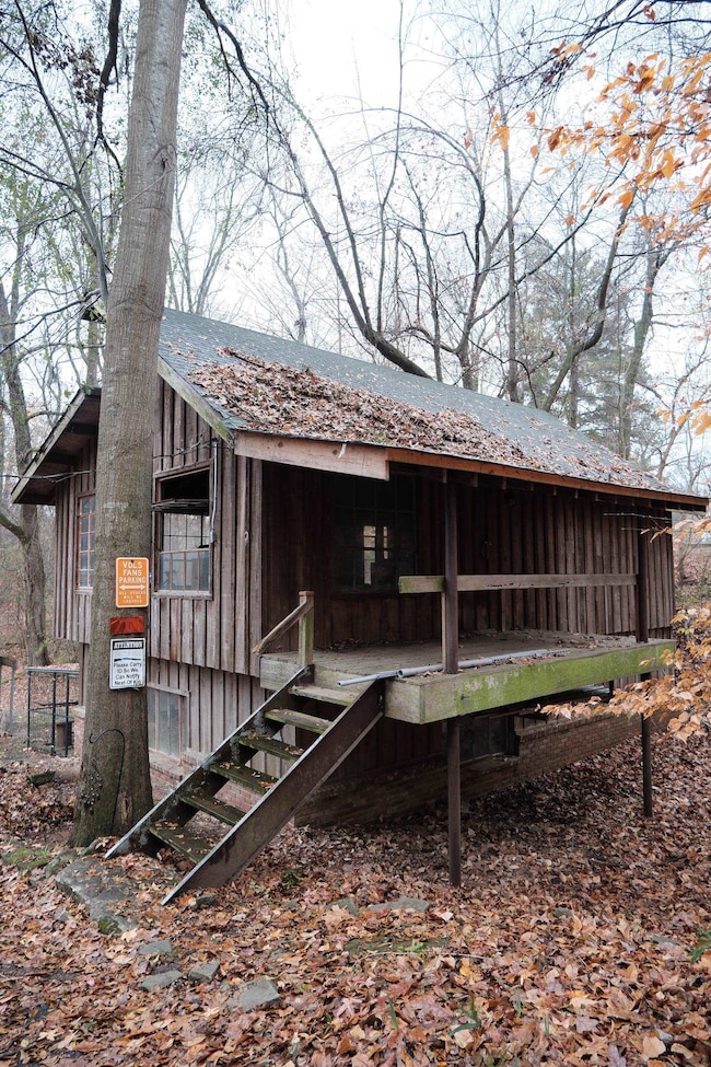
- Wood Burning Stove
- Vaulted Ceiling
- 2 Fireplaces
- Wooded Lot
- Wood Flooring
- Keeping Room
About This Home
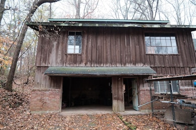
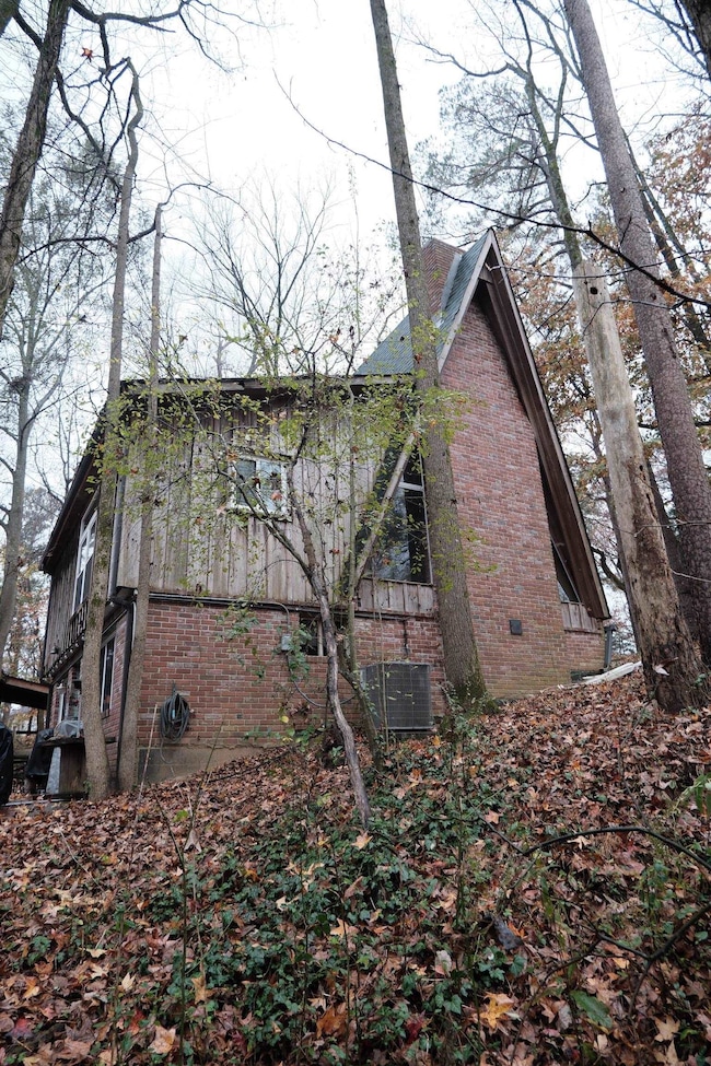
Escape to your own private, 4.5-acre wooded sanctuary where privacy and potential meet rustic charm. This iconic A-frame home is a truly unique offering, blending cozy cabin aesthetics with the wide-open possibilities of expansive acreage. Single bedroom layout boasts plenty of natural light, woodburning fireplaces, a 2 story shop and much more!
Home Details
Home Type
- Single Family
Est. Annual Taxes
- $1,396
Year Built
- Built in 1950
Lot Details
- 4.5 Acre Lot
- Wooded Lot
Home Design
- Brick Veneer
Interior Spaces
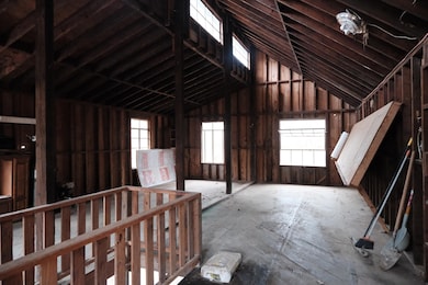
- 1,820 Sq Ft Home
- 1.2-Story Property
- Vaulted Ceiling
- 2 Fireplaces
- Wood Burning Stove
- Some Wood Windows
- Storage Room
- Keeping Room
- Eat-In Kitchen
- Storm Doors
Flooring
- Wood
- Partially Carpeted
- Tile
Bedrooms and Bathrooms
- 1 Bedroom
- Primary Bedroom Upstairs
- All Upper Level Bedrooms
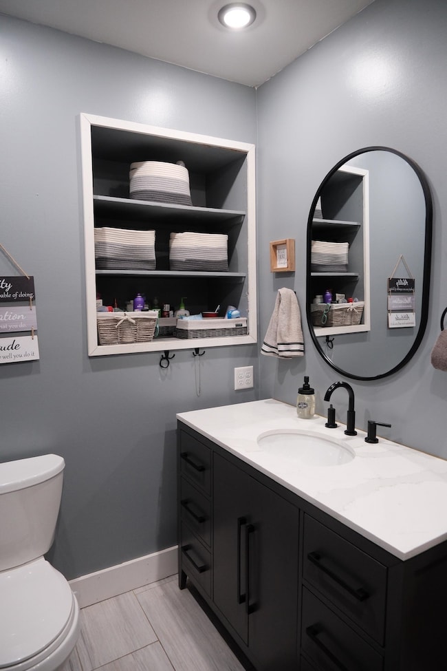
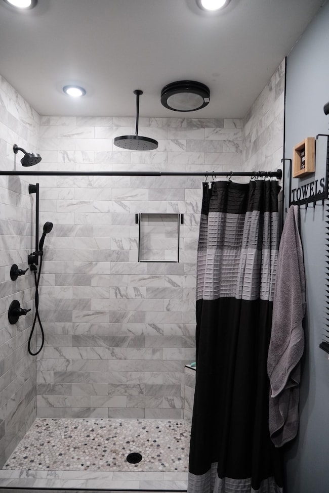
- Remodeled Bathroom
- 2 Full Bathrooms
Parking
- 4 Car Garage
- Workshop in Garage
- Rear-Facing Garage
- Garage Door Opener
- Driveway
Outdoor Features
- Patio
Utilities
- Central Heating and Cooling System
- Window Unit Cooling System
Community Details
- Aes Benjestown Road 1835.25Ft S Of Subdivision
Listing and Financial Details
- Assessor Parcel Number D0123 00103
Map
Home Values in the Area
Average Home Value in this Area
Tax History
| Year | Tax Paid | Tax Assessment Tax Assessment Total Assessment is a certain percentage of the fair market value that is determined by local assessors to be the total taxable value of land and additions on the property. | Land | Improvement |
|---|---|---|---|---|
| 2025 | $1,396 | $51,975 | $11,175 | $40,800 |
| 2024 | $1,396 | $41,175 | $10,625 | $30,550 |
| 2023 | $1,396 | $41,175 | $10,625 | $30,550 |
| 2022 | $1,396 | $41,175 | $10,625 | $30,550 |
| 2021 | $1,421 | $41,175 | $10,625 | $30,550 |
| 2020 | $1,123 | $27,725 | $10,625 | $17,100 |
| 2019 | $1,123 | $27,725 | $10,625 | $17,100 |
| 2018 | $1,123 | $27,725 | $10,625 | $17,100 |
| 2017 | $1,140 | $27,725 | $10,625 | $17,100 |
| 2016 | $1,154 | $26,400 | $0 | $0 |
| 2014 | $1,154 | $26,400 | $0 | $0 |
Property History
| Date | Event | Price | List to Sale | Price per Sq Ft |
|---|---|---|---|---|
| 12/01/2025 12/01/25 | For Sale | $250,000 | -- | $137 / Sq Ft |
Purchase History
| Date | Type | Sale Price | Title Company |
|---|---|---|---|
| Warranty Deed | $80,000 | None Available | |
| Warranty Deed | $60,000 | None Available |
Mortgage History
| Date | Status | Loan Amount | Loan Type |
|---|---|---|---|
| Open | $80,000 | Purchase Money Mortgage |
Source: Memphis Area Association of REALTORS®
MLS Number: 10210623
APN: D0-123-0-0103
Disclaimer: Certain information contained herein is derived from information provided by parties other than Homes.com. All information provided is deemed reliable, but is not guaranteed to be accurate and should be independently verified.
![]() Listing content and images Copyright 2025 Memphis Area Association of REALTORS®. Information provided is for the consumer’s personal, non-commercial use and may not be used for any purpose other than to identify prospective properties consumers may be interested in purchasing. Do not rely upon listing data without independently verifying it.
Listing content and images Copyright 2025 Memphis Area Association of REALTORS®. Information provided is for the consumer’s personal, non-commercial use and may not be used for any purpose other than to identify prospective properties consumers may be interested in purchasing. Do not rely upon listing data without independently verifying it.
Some or all of the listings displayed may not belong to the firm whose website is being visited.
- 6224 Benjestown Rd
- 5923 Island Forty Rd
- 766 Fite Rd
- 6443 N Watkins St
- 5423 Breckenwood Dr
- 5382 Beaverton Dr
- 5378 Beaverton Dr
- 6525 N Watkins Rd
- 5387 Cornstalk Cove
- 5371 Cedar Bluff Dr
- 5315 Braden Dr
- 823 Bitter Creek Cove
- 645 Mcwhirter Ave
- 759 Brandywine Blvd
- 0 N Watkins Unit 10203950
- 0 N Watkins Unit 10193620
- 5140 Blacksmith Dr
- 5096 Belfast Dr
- 5090 Belfast Dr
- 5072 Blacksmith Dr
- 658 Creekstone Cir
- 5343 Cedar Bluff Dr
- 858 Brandywine Blvd
- 5106 Blacksmith Dr
- 5072 Blacksmith Dr
- 5064 Bowdoin Dr
- 504 Elmfield Cove
- 745 Margie Dr
- 820 Archie Dr
- 640 Rouge Bluff Rd
- 7441 Walsh Rd
- 2266 Big Creek View Cir N
- 6150 Woodstock View Dr
- 1560 Dena Dr
- 1733 Carlyle Ave
- 2240 Lisa Ave
- 2097 Sharon Ln
- 4234 University St
- 4620 Sunnybrook St
- 1271 Carrolton Rd
