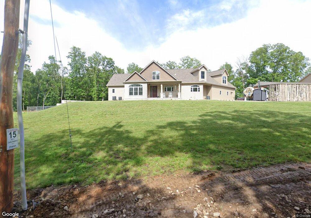
6121 Salamone Rd Cedar Hill, MO 63016
Estimated Value: $404,000 - $504,357
--
Bed
--
Bath
1,735
Sq Ft
$268/Sq Ft
Est. Value
About This Home
This home is located at 6121 Salamone Rd, Cedar Hill, MO 63016 and is currently estimated at $464,786, approximately $267 per square foot. 6121 Salamone Rd is a home with nearby schools including Northwest High School.
Ownership History
Date
Name
Owned For
Owner Type
Purchase Details
Closed on
May 28, 2021
Sold by
Surdyke Denise M and Stewart Denise M
Bought by
Stewart Denise M and Stewart Chad E
Current Estimated Value
Purchase Details
Closed on
Nov 6, 2020
Sold by
The Denise M Surdyke Revocable Trust
Bought by
Surdyke Denise M and Stewart Chad E
Home Financials for this Owner
Home Financials are based on the most recent Mortgage that was taken out on this home.
Original Mortgage
$200,000
Interest Rate
2.8%
Mortgage Type
New Conventional
Purchase Details
Closed on
Jan 24, 2019
Sold by
King John Carl and King Linda Kaye
Bought by
Surdyke Denise M and The Denise M Surdyke Revocable Trust
Purchase Details
Closed on
May 3, 2005
Sold by
Lewis Ronald T
Bought by
King John Carl and King Linda Kaye
Home Financials for this Owner
Home Financials are based on the most recent Mortgage that was taken out on this home.
Original Mortgage
$34,594
Interest Rate
6.03%
Mortgage Type
Fannie Mae Freddie Mac
Create a Home Valuation Report for This Property
The Home Valuation Report is an in-depth analysis detailing your home's value as well as a comparison with similar homes in the area
Home Values in the Area
Average Home Value in this Area
Purchase History
| Date | Buyer | Sale Price | Title Company |
|---|---|---|---|
| Stewart Denise M | -- | Title Partners | |
| Surdyke Denise M | -- | Title Partners Agency Llc | |
| Surdyke Denise M | -- | None Available | |
| King John Carl | -- | -- |
Source: Public Records
Mortgage History
| Date | Status | Borrower | Loan Amount |
|---|---|---|---|
| Previous Owner | Surdyke Denise M | $200,000 | |
| Previous Owner | King John Carl | $34,594 |
Source: Public Records
Tax History Compared to Growth
Tax History
| Year | Tax Paid | Tax Assessment Tax Assessment Total Assessment is a certain percentage of the fair market value that is determined by local assessors to be the total taxable value of land and additions on the property. | Land | Improvement |
|---|---|---|---|---|
| 2025 | $5,138 | $72,200 | $6,900 | $65,300 |
| 2024 | $5,138 | $67,800 | $6,900 | $60,900 |
| 2023 | $5,138 | $67,800 | $6,900 | $60,900 |
| 2022 | $5,066 | $67,800 | $6,900 | $60,900 |
| 2021 | $5,066 | $67,800 | $6,900 | $60,900 |
| 2020 | $2,595 | $33,700 | $6,300 | $27,400 |
| 2019 | $485 | $5,800 | $5,800 | $0 |
| 2018 | $445 | $5,800 | $5,800 | $0 |
| 2017 | $424 | $5,800 | $5,800 | $0 |
| 2016 | $424 | $5,800 | $5,800 | $0 |
| 2015 | $356 | $5,800 | $5,800 | $0 |
| 2013 | $356 | $5,200 | $5,200 | $0 |
Source: Public Records
Map
Nearby Homes
- 10725 Calvey Hills Rd
- 10723 Calvey Hills Rd
- 6105 Eime Rd
- 970 Honeyridge Rd
- 2 Canter Creek Farms
- 7033 Meadow View Dr
- 6650 Shenandoah Dr
- 1 Canter Creek Farms
- 5193 Athlone Ct
- 6703 Shenandoah Ln
- 196 Dunn Rd
- 525 Micah Rd
- 4487 Deer Run
- 126 Calvey Estates Dr
- 358 Rock Church Rd
- 5563 E Anding Dr
- 3858 Lindenwood Ct
- 3846 Oak Hill Rd
- 0 Oak Hill Rd
- 3830 Redwood Ln
- 5924 Sawdust Trail
- 9737 Highway Nn
- 0 Sawdust Trail Unit 90049539
- 0 Sawdust Trail Unit 90049520
- 0 Sawdust Trail Unit 90049496
- 0 Sawdust Trail Unit 10039303
- 2 Lot 2 Sawdust Trail (Plat 8a)
- 4 Lot 4a Sawdust Trail
- 2 Lot 2 Plat 8a Sawdust Trail
- 6 Lot 6a Sawdust Trail
- 40 + - Acres Sawdust Trail
- 0 Sawdust Trail 40 + - Unit 15033729
- 40 +- Acres Sawdust Trail
- 10 Acres Sawdust Trail
- 9800 Highway Nn
- 0 43+ - Acres Sawdust Trail Unit 12028310
- 11 Acres Sawdust Trail
- 6175 Salamone Rd
- 0 40 + - Acres - Salamone Rd Unit 11017227
- 0 Salamone 40 Acres + - Unit 15033752