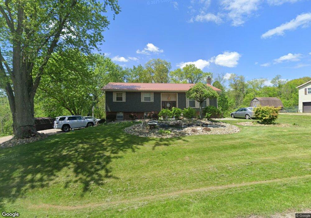
61249 Kadon Dr New Concord, OH 43762
Estimated Value: $217,867 - $257,000
--
Bed
1
Bath
1,184
Sq Ft
$201/Sq Ft
Est. Value
About This Home
This home is located at 61249 Kadon Dr, New Concord, OH 43762 and is currently estimated at $237,717, approximately $200 per square foot. 61249 Kadon Dr is a home with nearby schools including New Concord Elementary School, Larry Miller Intermediate Elementary School, and East Muskingum Middle School.
Ownership History
Date
Name
Owned For
Owner Type
Purchase Details
Closed on
Oct 4, 2023
Sold by
Pachuta Mary Ann and Pachuta Robert A
Bought by
Pachuta Mary Ann and Pachuta Robert A
Current Estimated Value
Create a Home Valuation Report for This Property
The Home Valuation Report is an in-depth analysis detailing your home's value as well as a comparison with similar homes in the area
Home Values in the Area
Average Home Value in this Area
Purchase History
| Date | Buyer | Sale Price | Title Company |
|---|---|---|---|
| Pachuta Mary Ann | -- | None Listed On Document |
Source: Public Records
Tax History Compared to Growth
Tax History
| Year | Tax Paid | Tax Assessment Tax Assessment Total Assessment is a certain percentage of the fair market value that is determined by local assessors to be the total taxable value of land and additions on the property. | Land | Improvement |
|---|---|---|---|---|
| 2024 | $2,238 | $57,173 | $14,847 | $42,326 |
| 2023 | $2,238 | $43,641 | $11,333 | $32,308 |
| 2022 | $1,871 | $43,630 | $11,320 | $32,310 |
| 2021 | $1,809 | $43,630 | $11,320 | $32,310 |
| 2020 | $1,690 | $40,960 | $9,320 | $31,640 |
| 2019 | $6 | $40,960 | $9,320 | $31,640 |
| 2018 | $1,556 | $40,960 | $9,320 | $31,640 |
| 2017 | $1,552 | $35,520 | $8,110 | $27,410 |
| 2016 | $1,404 | $35,520 | $8,110 | $27,410 |
| 2015 | $1,404 | $35,520 | $8,110 | $27,410 |
| 2014 | -- | $31,730 | $6,810 | $24,920 |
| 2013 | $1,269 | $31,730 | $6,810 | $24,920 |
Source: Public Records
Map
Nearby Homes
- 61220 Kadon Dr
- Lot 18 & 19 Greenbriar Dr
- 1420 Glenn Hwy
- 60936 Patch Rd
- 60040 Bliss Rd
- 67 E Main St
- 3859 Mayfair Ln
- 8 E Main St
- 53 Paden Rd
- 0 Maple Ln
- 154 Montgomery Blvd
- 112 Thompson Ave
- 760 Friendship Dr
- 930 Friendship Dr
- 1165 Friendship Dr
- 12985 John Glenn School Rd
- 62063 Savage Rd
- 4896 High Hill Rd
- 225 Homestead Dr
- 59915 Craig Rd
- 61239 Kadon Dr
- 61275 Kadon Dr
- 61250 Kadon Dr
- 61242 Kadon Dr
- 61219 Kadon Dr
- 61266 Kadon Dr
- 61299 Kadon Dr
- 60924 Greenbriar Dr
- 61196 Kadon Dr
- 61280 Kadon Dr
- 61313 Kadon Dr
- 61177 Kadon Dr
- 61294 Kadon Dr
- 61295 Heritage Ct
- 61266 Kent Ln
- 61317 Kadon Dr
- 60847 Greenbriar Dr
- 60897 Greenbriar Dr
- 60949 Greenbriar Dr
- 61200 Heritage Ct