Estimated Value: $227,000 - $314,000
3
Beds
2
Baths
1,056
Sq Ft
$256/Sq Ft
Est. Value
About This Home
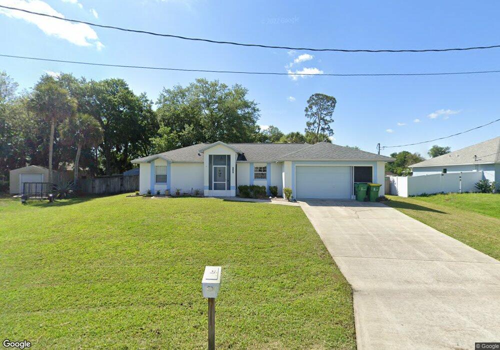
This home is located at 6125 Degan Rd, Cocoa, FL 32927 and is currently estimated at $270,825, approximately $256 per square foot. 6125 Degan Rd is a home located in Brevard County with nearby schools including Enterprise Elementary School, Space Coast Junior/Senior High School, and East Atlantic Prep of Brevard County.
Ownership History
Date
Name
Owned For
Owner Type
Purchase Details
Closed on
Apr 28, 1995
Sold by
Holiday Bldr Inc
Bought by
Macey Keith A
Current Estimated Value
Home Financials for this Owner
Home Financials are based on the most recent Mortgage that was taken out on this home.
Original Mortgage
$67,800
Interest Rate
8.35%
Purchase Details
Closed on
Nov 26, 1994
Sold by
Meeks Gary L and Meeks Sharon L
Bought by
Holiday Bldr Inc
Purchase Details
Closed on
Jun 12, 1993
Sold by
Nationsbank Fl N A
Bought by
Meeks Gary L and Meeks Sharon L
Create a Home Valuation Report for This Property
The Home Valuation Report is an in-depth analysis detailing your home's value as well as a comparison with similar homes in the area
Home Values in the Area
Average Home Value in this Area
Purchase History
| Date | Buyer | Sale Price | Title Company |
|---|---|---|---|
| Macey Keith A | $66,500 | -- | |
| Holiday Bldr Inc | $10,000 | -- | |
| Meeks Gary L | $9,400 | -- |
Source: Public Records
Mortgage History
| Date | Status | Borrower | Loan Amount |
|---|---|---|---|
| Closed | Macey Keith A | $67,800 |
Source: Public Records
Tax History
| Year | Tax Paid | Tax Assessment Tax Assessment Total Assessment is a certain percentage of the fair market value that is determined by local assessors to be the total taxable value of land and additions on the property. | Land | Improvement |
|---|---|---|---|---|
| 2025 | $944 | $71,510 | -- | -- |
| 2024 | $926 | $69,500 | -- | -- |
| 2023 | $926 | $67,480 | $0 | $0 |
| 2022 | $875 | $65,520 | $0 | $0 |
| 2021 | $878 | $63,620 | $0 | $0 |
| 2020 | $845 | $62,750 | $0 | $0 |
| 2019 | $794 | $61,340 | $0 | $0 |
| 2018 | $795 | $60,200 | $0 | $0 |
| 2017 | $798 | $58,970 | $0 | $0 |
| 2016 | $804 | $57,760 | $18,000 | $39,760 |
| 2015 | $810 | $57,360 | $15,000 | $42,360 |
| 2014 | $815 | $56,910 | $11,000 | $45,910 |
Source: Public Records
Map
Nearby Homes
- 6150 Baltimore Ave
- 6200 Edison St
- 00000 Golfview Ave
- 6085 Edison St
- 0 Golfview Ave
- 6230 Balsam St
- 6220 Golfview Ave
- 6180 Balboa St
- 6215 Balboa St
- 6010 Fay Blvd
- 23-35-21-J No Name
- 6120 Adele St
- 5812 Homestead Ave
- 6510 Aspen Ln
- 6365 Homestead Ave
- 23-35-21-JX-B-2 Aruin St
- 6470 Bamboo Ave
- 6177 Brandt St
- 5720 Flint Rd
- 6545 Addie Ave
Your Personal Tour Guide
Ask me questions while you tour the home.