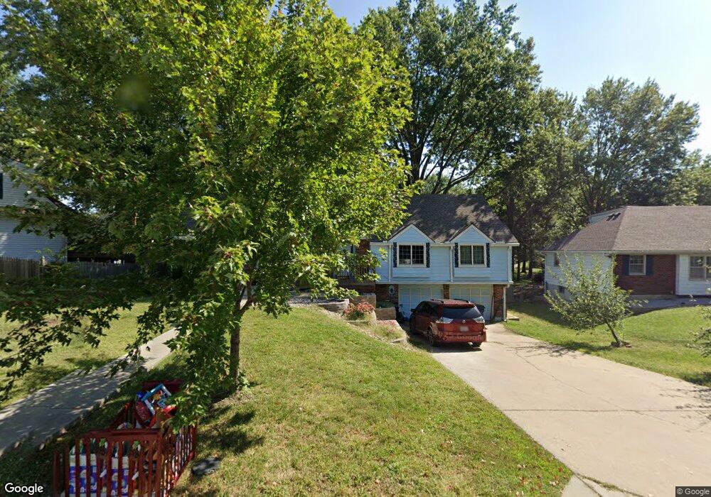
6125 N Monroe Ave Kansas City, MO 64119
Estimated Value: $291,000 - $327,000
3
Beds
2
Baths
1,536
Sq Ft
$204/Sq Ft
Est. Value
About This Home
This home is located at 6125 N Monroe Ave, Kansas City, MO 64119 and is currently estimated at $313,523, approximately $204 per square foot. 6125 N Monroe Ave is a home located in Clay County with nearby schools including Chapel Hill Elementary School, Antioch Middle School, and Oak Park High School.
Ownership History
Date
Name
Owned For
Owner Type
Purchase Details
Closed on
May 26, 2020
Sold by
Altherr Amy J
Bought by
Altherr Amy J and Amy J Altherr Revocable Trust
Current Estimated Value
Purchase Details
Closed on
Apr 29, 2011
Sold by
Altherr Rita J
Bought by
Altherr Steve C and Rita J Altherr Revocable Trust
Home Financials for this Owner
Home Financials are based on the most recent Mortgage that was taken out on this home.
Original Mortgage
$120,000
Interest Rate
4.86%
Mortgage Type
New Conventional
Purchase Details
Closed on
Oct 22, 2008
Sold by
Altherr Steve and Altherr Rita
Bought by
Altherr Steve C and Altherr Rita J
Create a Home Valuation Report for This Property
The Home Valuation Report is an in-depth analysis detailing your home's value as well as a comparison with similar homes in the area
Home Values in the Area
Average Home Value in this Area
Purchase History
| Date | Buyer | Sale Price | Title Company |
|---|---|---|---|
| Altherr Amy J | -- | None Available | |
| Altherr Steve C | -- | Superior Land Title | |
| Altherr Rita J | -- | Superior Land Title | |
| Altherr Steve C | -- | None Available |
Source: Public Records
Mortgage History
| Date | Status | Borrower | Loan Amount |
|---|---|---|---|
| Closed | Altherr Rita J | $120,000 |
Source: Public Records
Tax History Compared to Growth
Tax History
| Year | Tax Paid | Tax Assessment Tax Assessment Total Assessment is a certain percentage of the fair market value that is determined by local assessors to be the total taxable value of land and additions on the property. | Land | Improvement |
|---|---|---|---|---|
| 2025 | $3,449 | $53,540 | -- | -- |
| 2024 | $3,449 | $47,730 | -- | -- |
| 2023 | $3,428 | $47,730 | $0 | $0 |
| 2022 | $2,913 | $39,290 | $0 | $0 |
| 2021 | $2,917 | $39,292 | $6,080 | $33,212 |
| 2020 | $2,933 | $35,950 | $0 | $0 |
| 2019 | $2,928 | $35,948 | $4,750 | $31,198 |
| 2018 | $2,834 | $33,190 | $0 | $0 |
| 2017 | $2,668 | $33,190 | $4,750 | $28,440 |
| 2016 | $2,668 | $31,540 | $4,750 | $26,790 |
| 2015 | $2,668 | $31,540 | $4,750 | $26,790 |
| 2014 | $2,792 | $32,530 | $4,750 | $27,780 |
Source: Public Records
Map
Nearby Homes
- 3512 NE Shady Lane Dr
- 3511 NE 61st Terrace
- 6101 N Cleveland Ave
- 4000 NE 61st Terrace
- 4001 NE 60th Terrace
- Lot 2, Track 10 NE Brooktree Ln
- 6008 N Norton Ave
- 6011 N Bellefontaine Ave
- 6409 N Indiana Ave
- 6015 N Kansas Ave
- 6007 N Kansas Ave
- 5835 N College Ave
- 4308 NE 61st Ct
- 4301 NE 61st Ct
- 5820 N Indiana Ave
- 6028 N Spruce Ave
- 5976 N Kansas Ave
- 121 W Woodlands Dr
- 132 the Woodlands
- 6505 N Spruce Ave
- 6123 N Monroe Ave
- 3601 NE Shady Lane Dr
- 3605 NE Shady Lane Dr
- 6119 N Monroe Ave
- 3701 NE Shady Lane Dr
- 6120 N Cleveland Ave
- 3518 NE 61st Terrace
- 3519 NE Shady Lane Dr
- 6116 N Cleveland Ave
- 6115 N Monroe Ave
- 3703 NE Shady Lane Dr
- 3612 NE Shady Lane Dr
- 3608 NE Shady Lane Dr
- 3514 NE 61st Terrace
- 3515 NE Shady Lane Dr
- 6112 N Cleveland Ave
- 3616 NE Shady Lane Dr
- 3604 NE Shady Lane Dr
- 6109 N Monroe Ave