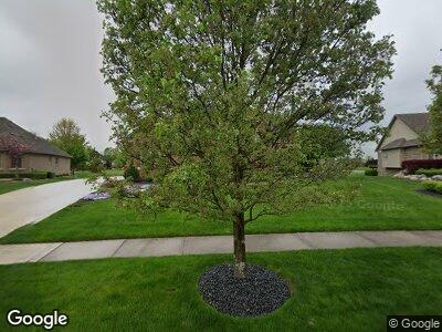
61255 Coralburst Dr Unit 155 Washington, MI 48094
Estimated Value: $730,000 - $844,000
4
Beds
3
Baths
3,427
Sq Ft
$228/Sq Ft
Est. Value
About This Home
This home is located at 61255 Coralburst Dr Unit 155, Washington, MI 48094 and is currently estimated at $782,038, approximately $228 per square foot. 61255 Coralburst Dr Unit 155 is a home located in Macomb County with nearby schools including Hevel Elementary School and Cross Of Glory Lutheran School.
Ownership History
Date
Name
Owned For
Owner Type
Purchase Details
Closed on
Mar 23, 2005
Sold by
Lassale Construction Inc
Bought by
Mohrbach Edward T and Mohrbach Diane
Current Estimated Value
Home Financials for this Owner
Home Financials are based on the most recent Mortgage that was taken out on this home.
Original Mortgage
$315,000
Interest Rate
4.87%
Mortgage Type
New Conventional
Purchase Details
Closed on
Jul 1, 2003
Sold by
Autumn Creek Llc
Bought by
Cornerstone Land Development Co Inc
Create a Home Valuation Report for This Property
The Home Valuation Report is an in-depth analysis detailing your home's value as well as a comparison with similar homes in the area
Home Values in the Area
Average Home Value in this Area
Purchase History
| Date | Buyer | Sale Price | Title Company |
|---|---|---|---|
| Mohrbach Edward T | $415,000 | First American Title Ins Co | |
| Cornerstone Land Development Co Inc | $122,452 | -- |
Source: Public Records
Mortgage History
| Date | Status | Borrower | Loan Amount |
|---|---|---|---|
| Open | Mohrbach Edward T | $161,000 | |
| Closed | Mohrbach Edward T | $254,500 | |
| Previous Owner | Mohrbach Edward T | $315,000 |
Source: Public Records
Tax History Compared to Growth
Tax History
| Year | Tax Paid | Tax Assessment Tax Assessment Total Assessment is a certain percentage of the fair market value that is determined by local assessors to be the total taxable value of land and additions on the property. | Land | Improvement |
|---|---|---|---|---|
| 2024 | $4,902 | $335,400 | $0 | $0 |
| 2023 | $4,725 | $295,100 | $0 | $0 |
| 2022 | $6,678 | $273,100 | $0 | $0 |
| 2021 | $6,534 | $259,500 | $0 | $0 |
| 2020 | $4,374 | $235,600 | $0 | $0 |
| 2019 | $6,003 | $229,000 | $0 | $0 |
| 2018 | $5,724 | $222,400 | $0 | $0 |
| 2017 | $5,692 | $210,100 | $42,900 | $167,200 |
| 2016 | $5,710 | $210,100 | $0 | $0 |
| 2015 | -- | $198,200 | $0 | $0 |
| 2013 | $5,263 | $194,100 | $30,200 | $163,900 |
| 2012 | $5,263 | $176,000 | $0 | $0 |
Source: Public Records
Map
Nearby Homes
- 13268 Cousins Ct
- 12185 Moore Ln
- 12147 Moore Ln
- 61563 Marino Ln
- 11997 Moore Ln
- 11976 Moore Ln
- 11899 Romeo Ln
- 12109 Romeo Ln
- 12061 Romeo Ln
- 11927 Romeo Ln
- 60778 Forest Creek Dr
- 11669 Powell Ridge Ln
- 11669 Powell Ridge Ln
- 11669 Powell Ridge Ln
- 11669 Powell Ridge Ln
- 11669 Powell Ridge Ln
- 11669 Powell Ridge Ln
- 11669 Powell Ridge Ln
- 61910 - 61970 Van Dyke Ave
- 8932 Tournament Dr
- 61255 Coralburst Dr Unit 155
- 61241 Coralburst Dr Unit 154
- 61269 Coralburst Dr Unit 156
- 61272 Coralburst Dr Unit 97
- 61244 Coralburst Dr Unit 98
- 61283 Coralburst Dr Unit 157
- 61227 Coralburst Dr Unit 153
- 61216 Coralburst Dr Unit 99
- 61300 Coralburst Dr Unit 96
- 61213 Coralburst Dr Unit 32
- 61314 Coralburst Dr Unit 95
- 13055 Burningwood Dr Unit 145
- 13071 Burningwood Dr Unit 146
- 13035 Burningwood Dr Unit 144
- 13215 Burningwood Dr Unit 151
- 13017 Burningwood Dr Unit 143
- 13107 Burningwood Dr Unit 147
- 13179 Burningwood Dr Unit 150
- 13233 Burningwood Dr Unit 100
- 13143 Burningwood Dr Unit Bldg-Unit
