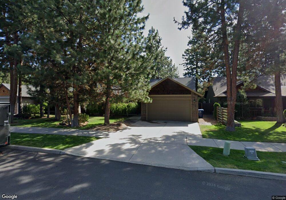
61294 Columbine Ln Bend, OR 97702
Southwest Bend NeighborhoodEstimated Value: $619,565 - $690,000
3
Beds
2
Baths
1,471
Sq Ft
$448/Sq Ft
Est. Value
About This Home
This home is located at 61294 Columbine Ln, Bend, OR 97702 and is currently estimated at $658,641, approximately $447 per square foot. 61294 Columbine Ln is a home located in Deschutes County with nearby schools including Pine Ridge Elementary School, Cascade Middle School, and Bend Senior High School.
Ownership History
Date
Name
Owned For
Owner Type
Purchase Details
Closed on
Feb 3, 2016
Sold by
Grindle Guy and Grindle Caryn
Bought by
Grindle Guy Raymond and Grindle Carlyn Lynn
Current Estimated Value
Purchase Details
Closed on
May 3, 2005
Sold by
Dubois William A
Bought by
Grindle Guy R and Grindle Caryn L
Home Financials for this Owner
Home Financials are based on the most recent Mortgage that was taken out on this home.
Original Mortgage
$206,800
Outstanding Balance
$106,988
Interest Rate
5.92%
Mortgage Type
Fannie Mae Freddie Mac
Estimated Equity
$551,653
Purchase Details
Closed on
Jan 6, 2005
Sold by
Rare Properties Llc
Bought by
Dubois William A
Home Financials for this Owner
Home Financials are based on the most recent Mortgage that was taken out on this home.
Original Mortgage
$170,800
Interest Rate
5%
Mortgage Type
Unknown
Create a Home Valuation Report for This Property
The Home Valuation Report is an in-depth analysis detailing your home's value as well as a comparison with similar homes in the area
Home Values in the Area
Average Home Value in this Area
Purchase History
| Date | Buyer | Sale Price | Title Company |
|---|---|---|---|
| Grindle Guy Raymond | -- | None Available | |
| Grindle Guy R | -- | Amerititle | |
| Dubois William A | $213,500 | First Amer Title Ins Co Or |
Source: Public Records
Mortgage History
| Date | Status | Borrower | Loan Amount |
|---|---|---|---|
| Open | Grindle Guy R | $206,800 | |
| Previous Owner | Dubois William A | $170,800 |
Source: Public Records
Tax History Compared to Growth
Tax History
| Year | Tax Paid | Tax Assessment Tax Assessment Total Assessment is a certain percentage of the fair market value that is determined by local assessors to be the total taxable value of land and additions on the property. | Land | Improvement |
|---|---|---|---|---|
| 2025 | $4,274 | $252,950 | -- | -- |
| 2024 | $4,112 | $245,590 | -- | -- |
| 2023 | $3,812 | $238,440 | $0 | $0 |
| 2022 | $3,556 | $224,760 | $0 | $0 |
| 2021 | $3,562 | $218,220 | $0 | $0 |
| 2020 | $3,379 | $218,220 | $0 | $0 |
| 2019 | $3,285 | $211,870 | $0 | $0 |
| 2018 | $3,192 | $205,700 | $0 | $0 |
| 2017 | $3,165 | $199,710 | $0 | $0 |
| 2016 | $3,021 | $193,900 | $0 | $0 |
| 2015 | $2,940 | $188,260 | $0 | $0 |
| 2014 | $2,855 | $182,780 | $0 | $0 |
Source: Public Records
Map
Nearby Homes
- 61375 Huckleberry Place
- 61257 Bronze Meadow Ln
- 19788 Chicory Ave
- 61279 Gorge View St
- 19779 Hollygrape St
- 61344 Elkhorn St
- 61369 Elkhorn St
- 20050 Elizabeth Ln
- 61193 Hitching Post Ln
- 19793 Astro Place
- 61388 Elkhorn St
- 61379 Sally Ln
- 19694 Harvard Place
- 20041 Voltera Place
- 60915 SE Epic Place
- 20839 SE Caldera Dr
- 19773 Astro Place
- 20076 Mount Hope Ln
- 19717 Mt Bachelor Dr Unit 330E
- 19717 Mount Bachelor Dr Unit 421
- 61290 Columbine Ln
- 61302 Columbine Ln
- 61286 Columbine Ln
- 61301 Osprey Nest Place
- 61293 Columbine Ln
- 61309 Osprey Nest Place
- 61297 Columbine Ln
- 61289 Columbine Ln
- 61306 Columbine Ln
- 61317 Osprey Nest Place
- 61285 Osprey Nest Place
- 61320 Columbine Ln
- 61325 Columbine Ln
- 61285 Columbine Ln
- 19844 Kenzie Ave
- 61310 Columbine Ln
- 61325 Osprey Nest Place
- 19840 Kenzie Ave
- 61333 Osprey Nest Place