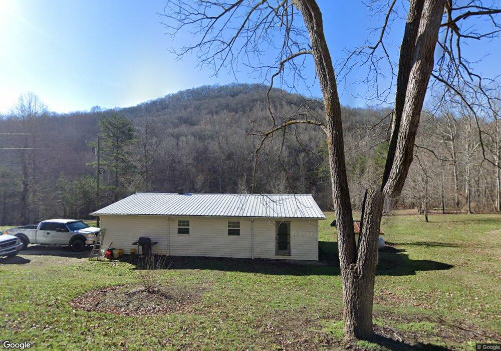
613 Douglas Branch Ln Pioneer, TN 37847
Estimated Value: $54,000 - $235,000
--
Bed
1
Bath
896
Sq Ft
$127/Sq Ft
Est. Value
About This Home
This home is located at 613 Douglas Branch Ln, Pioneer, TN 37847 and is currently estimated at $113,424, approximately $126 per square foot. 613 Douglas Branch Ln is a home located in Campbell County.
Ownership History
Date
Name
Owned For
Owner Type
Purchase Details
Closed on
Aug 31, 2015
Sold by
Collins Julie
Bought by
Perkins Lester Stanley
Current Estimated Value
Purchase Details
Closed on
Jul 23, 2014
Sold by
Collins Julie
Bought by
Perkins Lester Stanley
Purchase Details
Closed on
Oct 8, 2012
Sold by
Collins Roy W
Bought by
Collins Steve L
Purchase Details
Closed on
Dec 11, 2007
Sold by
Collins Ethel Ruth
Bought by
Collins Roy W
Purchase Details
Closed on
Dec 22, 2005
Sold by
Collins Roy W
Bought by
Collins Ethel Ruth
Purchase Details
Closed on
Apr 14, 1987
Bought by
Collins Roy W
Create a Home Valuation Report for This Property
The Home Valuation Report is an in-depth analysis detailing your home's value as well as a comparison with similar homes in the area
Home Values in the Area
Average Home Value in this Area
Purchase History
| Date | Buyer | Sale Price | Title Company |
|---|---|---|---|
| Perkins Lester Stanley | $15,000 | -- | |
| Perkins Lester Stanley | -- | -- | |
| Collins Julie | -- | -- | |
| Collins Steve L | -- | -- | |
| Collins Roy W | -- | -- | |
| Collins Ethel Ruth | -- | -- | |
| Collins Roy W | -- | -- |
Source: Public Records
Tax History Compared to Growth
Tax History
| Year | Tax Paid | Tax Assessment Tax Assessment Total Assessment is a certain percentage of the fair market value that is determined by local assessors to be the total taxable value of land and additions on the property. | Land | Improvement |
|---|---|---|---|---|
| 2024 | $139 | $11,400 | $2,225 | $9,175 |
| 2023 | $99 | $4,775 | $1,275 | $3,500 |
| 2022 | $99 | $4,775 | $1,275 | $3,500 |
| 2021 | $99 | $4,775 | $1,275 | $3,500 |
| 2020 | $97 | $4,775 | $1,275 | $3,500 |
| 2019 | $99 | $4,775 | $1,275 | $3,500 |
| 2018 | $82 | $3,650 | $700 | $2,950 |
| 2017 | $82 | $3,650 | $700 | $2,950 |
| 2016 | $82 | $3,650 | $700 | $2,950 |
| 2015 | $73 | $3,650 | $700 | $2,950 |
| 2014 | $73 | $3,650 | $700 | $2,950 |
| 2013 | -- | $3,650 | $700 | $2,950 |
Source: Public Records
Map
Nearby Homes
- 187 Grouse Ln
- 0 Tennessee 297
- 0 Lick Fork Ln
- Lot 82 Grouse Ln
- 0 I-75 Rd
- 207 Lick Fork Ln
- 580 Elk Fork Rd
- 6646 Tennessee 297
- 118 N Meredith Rd
- 137 Summerset Ln
- 0 Stinking Creek 61 Acres Rd
- 0 Lone Rd
- 976 Lone Rd
- 2506 Little Elk Creek Rd
- 142 Wagon Wheel Ln
- 0 Smith Creek Rd Unit 1309671
- 0 Smith Creek Rd Unit LotWP001
- 0 Stinking Creek Rd
- 0 Rock House Rd
- 63 Baker Ln
- 495 Douglas Branch Ln
- 357 Douglas Branch Ln
- 359 Douglas Branch Ln
- 0 Campbell Higlands Dr Unit 649447
- 0 Campbell Higlands Dr Unit 751103
- 0 Campbell Higlands Dr Unit 797587
- 0 Campbell Higlands Dr Unit 819239
- 246 Douglas Branch Ln
- 8160 Highway 297
- 1690 Campbell Highlands Dr
- 180 Douglas Branch Ln
- 8340 Highway 297
- 8340 Highway 297
- 197 Douglas Branch Ln
- 178 Douglas Branch Ln
- 1632 Campbell Highlands Dr
- 1632 Campbell Highlands Dr Unit 1A
- 317 Potato Knob Ln
- 228 Wilderness Ridge Ln
- 1652 Campbell Highlands Dr