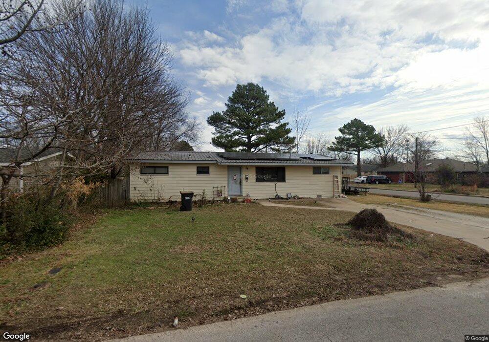
613 Harve St Springdale, AR 72762
Estimated Value: $210,000 - $242,000
3
Beds
1
Bath
1,257
Sq Ft
$178/Sq Ft
Est. Value
About This Home
This home is located at 613 Harve St, Springdale, AR 72762 and is currently estimated at $223,259, approximately $177 per square foot. 613 Harve St is a home located in Washington County with nearby schools including Westwood Elementary School, Southwest Junior High School, and Helen Tyson Middle School.
Ownership History
Date
Name
Owned For
Owner Type
Purchase Details
Closed on
Aug 20, 2022
Sold by
Ponce Steven G and Ponce Malanie
Bought by
Ponce Steven G and Ponce Melanie
Current Estimated Value
Purchase Details
Closed on
Oct 11, 2005
Sold by
Mayes Douglas Shay and Mayes Pamela A
Bought by
Ponce Steven G
Home Financials for this Owner
Home Financials are based on the most recent Mortgage that was taken out on this home.
Original Mortgage
$84,800
Interest Rate
5.69%
Mortgage Type
Fannie Mae Freddie Mac
Purchase Details
Closed on
Jan 1, 1985
Bought by
Barker Charles R
Create a Home Valuation Report for This Property
The Home Valuation Report is an in-depth analysis detailing your home's value as well as a comparison with similar homes in the area
Purchase History
| Date | Buyer | Sale Price | Title Company |
|---|---|---|---|
| Ponce Steven G | -- | Vylla Title | |
| Ponce Steven G | -- | Lenders | |
| Barker Charles R | -- | -- |
Source: Public Records
Mortgage History
| Date | Status | Borrower | Loan Amount |
|---|---|---|---|
| Previous Owner | Ponce Steven G | $84,800 |
Source: Public Records
Tax History
| Year | Tax Paid | Tax Assessment Tax Assessment Total Assessment is a certain percentage of the fair market value that is determined by local assessors to be the total taxable value of land and additions on the property. | Land | Improvement |
|---|---|---|---|---|
| 2025 | $476 | $35,390 | $14,000 | $21,390 |
| 2024 | $529 | $35,390 | $14,000 | $21,390 |
| 2023 | $577 | $35,390 | $14,000 | $21,390 |
| 2022 | $579 | $24,910 | $10,000 | $14,910 |
| 2021 | $537 | $24,910 | $10,000 | $14,910 |
| 2020 | $496 | $24,910 | $10,000 | $14,910 |
| 2019 | $455 | $15,740 | $5,000 | $10,740 |
| 2018 | $480 | $15,740 | $5,000 | $10,740 |
| 2017 | $472 | $15,740 | $5,000 | $10,740 |
| 2016 | $472 | $15,740 | $5,000 | $10,740 |
| 2015 | $472 | $15,740 | $5,000 | $10,740 |
| 2014 | $560 | $17,440 | $5,000 | $12,440 |
Source: Public Records
Map
Nearby Homes
- 500 W End St
- 614 Zachary St
- 2247 Emily Circle Dr Unit A
- 508 Geneva St
- 110 Rogers Circle Dr
- 506 Dyer St
- 126 Rogers Circle Dr
- 713 Carlton St
- 307 Michael St
- 712 Carlton St
- 301 Michael St
- 1510 Circle Dr
- 1405 Dyer St
- TBD W Emma (New) Ave
- 1807 Westwood Ave
- 2002 Monticello Ave
- 2003 Dee Ave
- 2005 Patti Ave
- 2002 Melissa Ln
- TBD N Westwood Ln
- 611 Harve St
- 1603 Watson Ave
- 620 S West End St
- 1605 Watson Ave
- 618 S West End St
- 1607 Watson Ave
- 614 Harve St
- 612 Harve St
- 612 W End St
- 1609 Watson Ave
- 607 Harve St
- 610 Harve St
- 1115 W End St
- 1799 Emily Circle Dr
- 1817 Emily Circle Dr
- 1817 Emily Circle Dr Unit A
- S S West End St
- 610 S West End St
- 608 Harve St
- 1615 Watson Ave
Your Personal Tour Guide
Ask me questions while you tour the home.