Estimated Value: $918,594
8
Beds
5
Baths
7,083
Sq Ft
$130/Sq Ft
Est. Value
About This Home
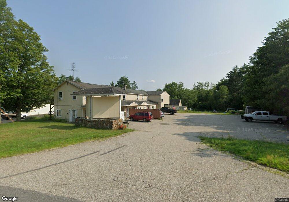
This home is located at 613 S Stark Hwy, Weare, NH 03281 and is currently estimated at $918,594, approximately $129 per square foot. 613 S Stark Hwy is a home located in Hillsborough County with nearby schools including Center Woods Elementary School, Weare Middle School, and John Stark Regional High School.
Ownership History
Date
Name
Owned For
Owner Type
Purchase Details
Closed on
Jan 7, 2015
Sold by
Garza Jesse and Abbott Pamela J
Bought by
Jvl Props
Current Estimated Value
Home Financials for this Owner
Home Financials are based on the most recent Mortgage that was taken out on this home.
Original Mortgage
$295,000
Outstanding Balance
$226,550
Interest Rate
3.99%
Mortgage Type
Commercial
Estimated Equity
$692,044
Purchase Details
Closed on
Dec 17, 2003
Sold by
Ajd Construction Inc
Bought by
Garza Jesse
Home Financials for this Owner
Home Financials are based on the most recent Mortgage that was taken out on this home.
Original Mortgage
$300,000
Interest Rate
5.96%
Mortgage Type
Commercial
Purchase Details
Closed on
Sep 11, 1998
Sold by
Cantin Marc
Bought by
Key Financial Services
Create a Home Valuation Report for This Property
The Home Valuation Report is an in-depth analysis detailing your home's value as well as a comparison with similar homes in the area
Home Values in the Area
Average Home Value in this Area
Purchase History
| Date | Buyer | Sale Price | Title Company |
|---|---|---|---|
| Jvl Props | $380,000 | -- | |
| Jvl Props | $380,000 | -- | |
| Garza Jesse | $375,000 | -- | |
| Garza Jesse | $375,000 | -- | |
| Key Financial Services | $128,500 | -- | |
| Key Financial Services | $128,500 | -- |
Source: Public Records
Mortgage History
| Date | Status | Borrower | Loan Amount |
|---|---|---|---|
| Open | Key Financial Services | $295,000 | |
| Closed | Key Financial Services | $295,000 | |
| Previous Owner | Key Financial Services | $300,000 |
Source: Public Records
Tax History Compared to Growth
Tax History
| Year | Tax Paid | Tax Assessment Tax Assessment Total Assessment is a certain percentage of the fair market value that is determined by local assessors to be the total taxable value of land and additions on the property. | Land | Improvement |
|---|---|---|---|---|
| 2024 | $17,077 | $837,500 | $134,100 | $703,400 |
| 2023 | $15,779 | $837,500 | $134,100 | $703,400 |
| 2022 | $14,562 | $836,900 | $134,100 | $702,800 |
| 2021 | $14,395 | $836,900 | $134,100 | $702,800 |
| 2020 | $10,404 | $434,400 | $101,200 | $333,200 |
| 2019 | $10,300 | $434,400 | $101,200 | $333,200 |
| 2018 | $10,004 | $434,400 | $101,200 | $333,200 |
| 2016 | $9,718 | $434,400 | $101,200 | $333,200 |
| 2015 | $9,116 | $406,800 | $82,700 | $324,100 |
| 2014 | $9,031 | $406,600 | $82,700 | $323,900 |
| 2013 | $8,844 | $406,600 | $82,700 | $323,900 |
Source: Public Records
Map
Nearby Homes
- 624 S Stark Hwy
- 103 Renshaw Rd
- 77 Gould Rd
- 93 Daniels Rd
- 196 Deering Center Rd
- 179 Oak Hill Rd
- 174 S Stark Hwy Unit 13
- 174 S Stark Hwy Unit 1
- 174 S Stark Hwy Unit 23
- 450 Weare Rd
- 238 Old Francestown Rd
- 95 Wright Dr
- 849 River Rd
- 10 Sap House Rd
- 342 Weare Rd
- 0 Huntington Hill Rd Unit 69
- 200 Mountain Rd
- 34 Lull Rd
- 3 Stephanie Rd
- 281 Hodgdon Rd
- 0 S Stark Hwy Unit 5017859
- 0 S Stark Hwy Unit 5017809
- 0 S Stark Hwy Unit 4209424
- 109-16-7&8 S Stark Hwy
- 109 Lot 16-7 S Stark Hwy
- Lot 16-7 S Stark Hwy
- Lot 16-1 S Stark Hwy
- 0 S Stark Hwy Unit 4097215
- 0 S Stark Hwy Unit 2799796
- Lot 116 S Stark Hwy Unit 116
- Lot 120 S Stark Hwy
- 0 S Stark Hwy Unit 120
- 302 S Stark Hwy
- 300 S Stark Hwy
- 45 Renshaw Rd
- 645 S Stark Hwy
- 648 S Stark Hwy
- 42 Renshaw Rd
- lot 110 S Stark Hwy
- 53 Renshaw Rd