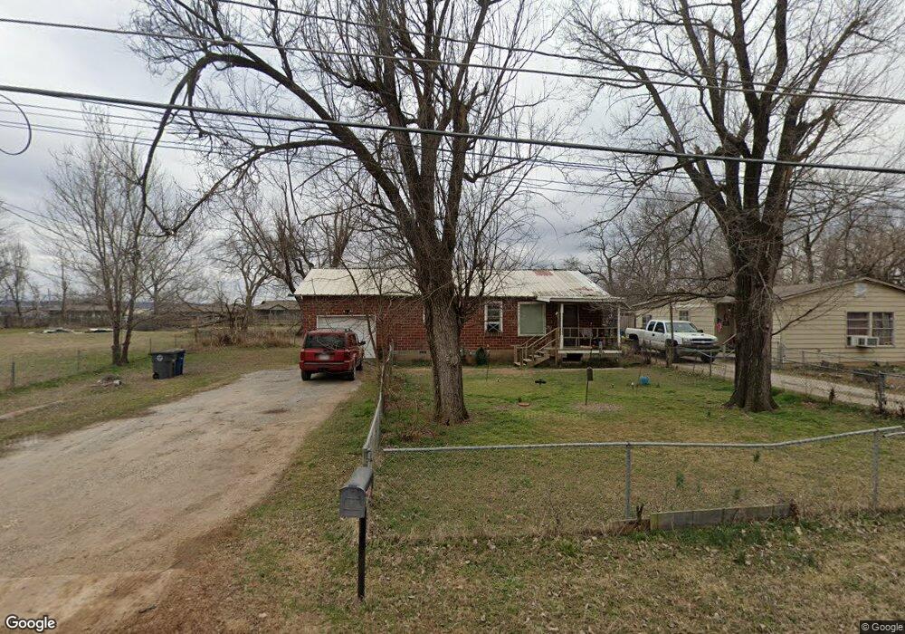
6130 W 10th St Tulsa, OK 74127
Charles Page NeighborhoodEstimated Value: $61,000 - $92,000
--
Bed
1
Bath
891
Sq Ft
$84/Sq Ft
Est. Value
About This Home
This home is located at 6130 W 10th St, Tulsa, OK 74127 and is currently estimated at $74,624, approximately $83 per square foot. 6130 W 10th St is a home located in Tulsa County with nearby schools including Wayman Tisdale Fine Arts Academy, Central Middle School, and Central Junior High School.
Ownership History
Date
Name
Owned For
Owner Type
Purchase Details
Closed on
Apr 13, 2009
Sold by
Hale Michael J and Hale Deborah
Bought by
Rent Pro Llc
Current Estimated Value
Purchase Details
Closed on
Nov 13, 2006
Sold by
Hale Michael J
Bought by
Hale Michael J and Hale Deborah
Home Financials for this Owner
Home Financials are based on the most recent Mortgage that was taken out on this home.
Original Mortgage
$42,500
Interest Rate
6.24%
Mortgage Type
Stand Alone Second
Purchase Details
Closed on
Jun 8, 2004
Sold by
Jones Ray R
Bought by
Hale Michael J
Create a Home Valuation Report for This Property
The Home Valuation Report is an in-depth analysis detailing your home's value as well as a comparison with similar homes in the area
Home Values in the Area
Average Home Value in this Area
Purchase History
| Date | Buyer | Sale Price | Title Company |
|---|---|---|---|
| Rent Pro Llc | -- | None Available | |
| Hale Michael J | -- | None Available | |
| Hale Michael J | -- | -- |
Source: Public Records
Mortgage History
| Date | Status | Borrower | Loan Amount |
|---|---|---|---|
| Previous Owner | Hale Michael J | $42,500 |
Source: Public Records
Tax History Compared to Growth
Tax History
| Year | Tax Paid | Tax Assessment Tax Assessment Total Assessment is a certain percentage of the fair market value that is determined by local assessors to be the total taxable value of land and additions on the property. | Land | Improvement |
|---|---|---|---|---|
| 2024 | $1,124 | $4,648 | $1,181 | $3,467 |
| 2023 | $562 | $4,427 | $1,125 | $3,302 |
| 2022 | $41 | $4,216 | $1,178 | $3,038 |
| 2021 | $45 | $4,015 | $1,122 | $2,893 |
| 2020 | $523 | $4,015 | $1,122 | $2,893 |
| 2019 | $550 | $4,015 | $1,122 | $2,893 |
| 2018 | $551 | $4,015 | $1,122 | $2,893 |
| 2017 | $594 | $4,015 | $1,122 | $2,893 |
| 2016 | $579 | $4,015 | $1,122 | $2,893 |
| 2015 | $588 | $4,015 | $1,122 | $2,893 |
| 2014 | $583 | $4,015 | $1,122 | $2,893 |
Source: Public Records
Map
Nearby Homes
- 5909 W 10th St
- 5779 W 2nd St
- 1126 S 53rd West Ave
- 5134 Charles Page Blvd
- 5128 Charles Page Blvd
- 104 S 65th West Ave
- 5112 W 10th St
- 5677 W 3rd St
- 30 S 64th Ave W
- 1120 S 51st West Ave
- 302 S 71st West Ave
- 5330 W 2nd St
- 4920 Charles Page Blvd
- 4732 W 8th St
- 422 S 49th West Ave
- 429 S 49th West Ave
- 6508 W Cameron St
- 4933 W 2nd St
- 4947 W 1st St
- 110 N 70th West Ave
- 6134 W 10th St
- 6142 W 10th St
- 6116 W 10th
- 6124 W 9th St
- 6146 W 10th St
- 6150 W 10th St
- 6143 W 10th St
- 1004 S 61st West Ave
- 1008 S 61st West Ave
- 6147 W 10th St
- 6132 W 9th St
- 6120 W 9th St
- 6160 W 10th St
- 931 S 63rd West Ave
- 1007 S 61st West Ave
- 6108 W 9th St
- 6144 W 9th St
- 1009 S 61st West Ave
- 911 S 61st West Ave