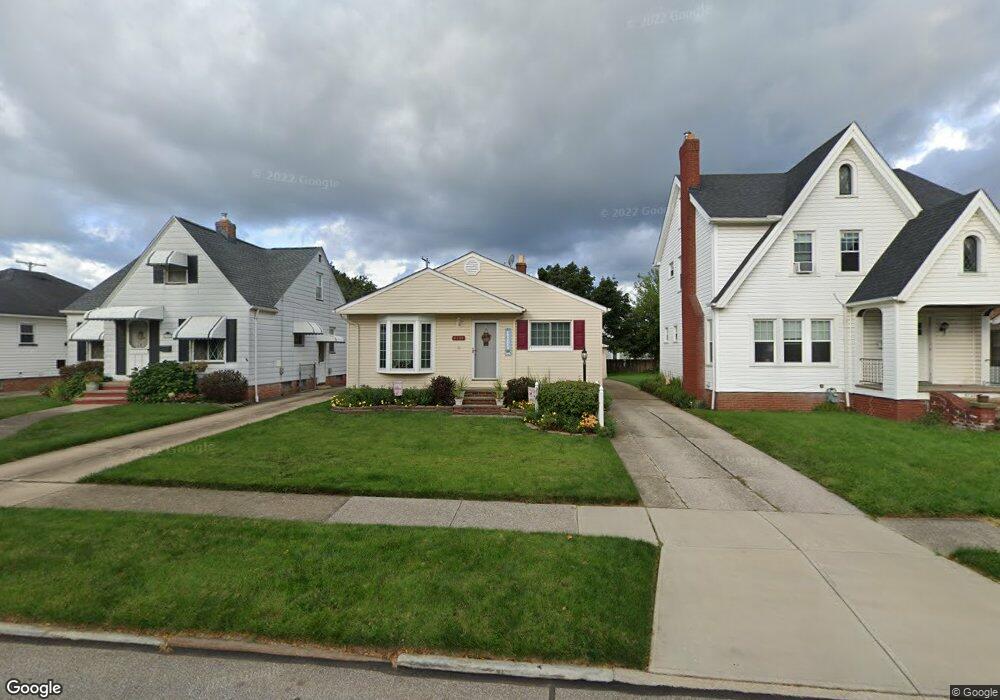
6134 Wareham Dr Cleveland, OH 44129
Estimated Value: $180,139 - $195,000
3
Beds
1
Bath
1,064
Sq Ft
$176/Sq Ft
Est. Value
About This Home
This home is located at 6134 Wareham Dr, Cleveland, OH 44129 and is currently estimated at $187,285, approximately $176 per square foot. 6134 Wareham Dr is a home located in Cuyahoga County with nearby schools including Thoreau Park Elementary School, Shiloh Middle School, and Valley Forge High School.
Ownership History
Date
Name
Owned For
Owner Type
Purchase Details
Closed on
Apr 3, 1999
Sold by
Czarnecki Robert A and Czarnecki Michelle M
Bought by
Cwiklinski Kevin J and Cwiklinski Irene L
Current Estimated Value
Home Financials for this Owner
Home Financials are based on the most recent Mortgage that was taken out on this home.
Original Mortgage
$87,000
Outstanding Balance
$21,755
Interest Rate
6.89%
Estimated Equity
$165,530
Purchase Details
Closed on
May 31, 1991
Sold by
Parente Joseph
Bought by
Czarnecki Robert A
Purchase Details
Closed on
May 26, 1989
Sold by
Lugli Albert D and Lugli Annie J
Bought by
Parente Joseph
Purchase Details
Closed on
Dec 12, 1984
Sold by
Holp Michael M
Bought by
Lugli Albert D and Lugli Annie J
Purchase Details
Closed on
Jan 19, 1983
Sold by
Holp Michael M and Holp Evelyn L
Bought by
Holp Michael M
Purchase Details
Closed on
Jan 1, 1975
Bought by
Holp Michael M and Holp Evelyn L
Create a Home Valuation Report for This Property
The Home Valuation Report is an in-depth analysis detailing your home's value as well as a comparison with similar homes in the area
Home Values in the Area
Average Home Value in this Area
Purchase History
| Date | Buyer | Sale Price | Title Company |
|---|---|---|---|
| Cwiklinski Kevin J | $102,500 | Midland Title Security Inc | |
| Czarnecki Robert A | $85,000 | -- | |
| Parente Joseph | $62,500 | -- | |
| Lugli Albert D | $54,500 | -- | |
| Holp Michael M | -- | -- | |
| Holp Michael M | -- | -- |
Source: Public Records
Mortgage History
| Date | Status | Borrower | Loan Amount |
|---|---|---|---|
| Open | Cwiklinski Kevin J | $87,000 |
Source: Public Records
Tax History
| Year | Tax Paid | Tax Assessment Tax Assessment Total Assessment is a certain percentage of the fair market value that is determined by local assessors to be the total taxable value of land and additions on the property. | Land | Improvement |
|---|---|---|---|---|
| 2024 | $3,443 | $56,490 | $10,500 | $45,990 |
| 2023 | $2,934 | $41,100 | $9,280 | $31,820 |
| 2022 | $2,906 | $41,090 | $9,275 | $31,815 |
| 2021 | $2,988 | $41,090 | $9,280 | $31,820 |
| 2020 | $2,618 | $31,610 | $7,140 | $24,470 |
| 2019 | $2,504 | $90,300 | $20,400 | $69,900 |
| 2018 | $2,377 | $31,610 | $7,140 | $24,470 |
| 2017 | $2,396 | $27,300 | $5,320 | $21,980 |
| 2016 | $2,381 | $27,300 | $5,320 | $21,980 |
| 2015 | $2,271 | $27,300 | $5,320 | $21,980 |
| 2014 | $2,271 | $27,870 | $5,430 | $22,440 |
Source: Public Records
Map
Nearby Homes
- 6406 Sunderland Dr
- 6502 Farnsworth Dr
- 6707 Thornton Dr
- 6808 Southington Dr
- 7610 Renwood Dr
- 7111 Hampstead Ave
- 7115 Hampstead Ave
- 5610 Renwood Dr
- 8014 Lanyard Dr
- 6365 Doncaster Ave
- 5603 Allanwood Dr
- 6501 Wilber Ave
- 8017 Wainstead Dr
- 6800 Wilber Ave
- 6361 S Canterbury Rd
- 6302 W 54th St
- 6312 W 54th St
- 6448 Ridge Rd
- 6914 Alber Ave
- 8012 Spring Garden Rd
- 6142 Wareham Dr
- 6126 Wareham Dr
- 6146 Wareham Dr
- 6120 Wareham Dr
- 6137 Manchester Rd
- 6150 Wareham Dr
- 6116 Wareham Dr
- 6129 Manchester Rd
- 6145 Manchester Rd
- 6121 Manchester Rd
- 6149 Manchester Rd
- 6156 Wareham Dr
- 6112 Wareham Dr
- 6137 Wareham Dr
- 6115 Manchester Rd
- 6155 Manchester Rd
- 6147 Wareham Dr
- 6127 Wareham Dr
- 6162 Wareham Dr
- 6108 Wareham Dr
Your Personal Tour Guide
Ask me questions while you tour the home.