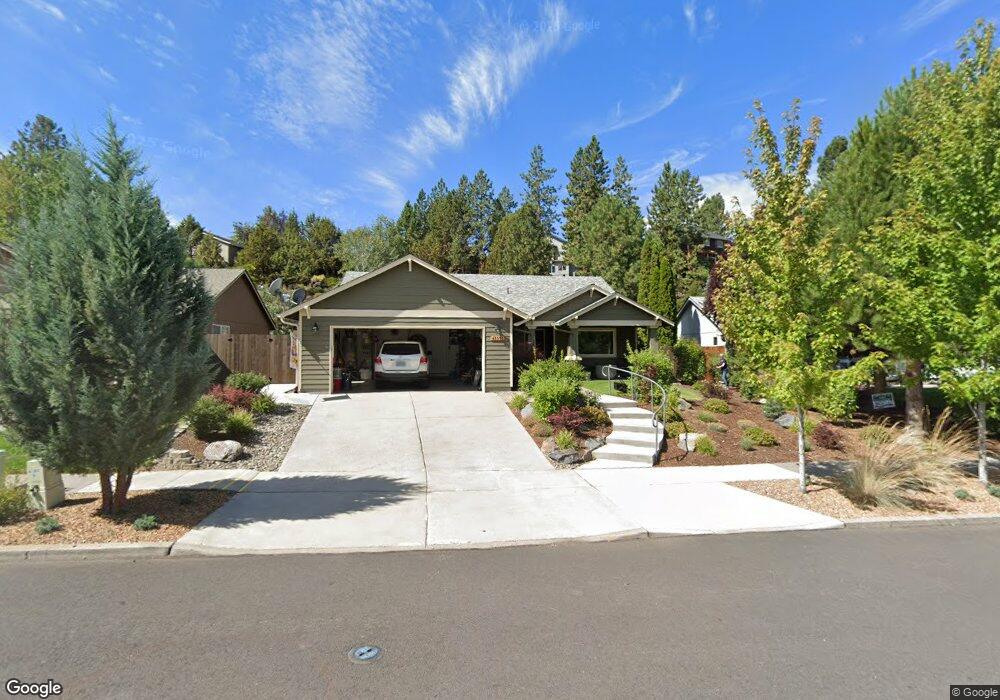
61351 Rock Bluff Ln Bend, OR 97702
Southwest Bend NeighborhoodEstimated Value: $664,934 - $696,000
3
Beds
2
Baths
1,656
Sq Ft
$412/Sq Ft
Est. Value
About This Home
This home is located at 61351 Rock Bluff Ln, Bend, OR 97702 and is currently estimated at $681,734, approximately $411 per square foot. 61351 Rock Bluff Ln is a home located in Deschutes County with nearby schools including Pine Ridge Elementary School, Cascade Middle School, and Bend Senior High School.
Ownership History
Date
Name
Owned For
Owner Type
Purchase Details
Closed on
Aug 16, 2017
Sold by
Miller Nancy E
Bought by
Miller Nancy E and Nancy E Miller Family Trust
Current Estimated Value
Purchase Details
Closed on
Mar 10, 2017
Sold by
C & N Rental Property Llc
Bought by
Miller Nancy E
Purchase Details
Closed on
May 31, 2013
Sold by
Miller Cameron T and Miller Nancy E
Bought by
C & N Rental Property Llc
Purchase Details
Closed on
Jul 27, 2004
Sold by
Nelson Dan E and Nelson Patricia L
Bought by
Miller Cameron T and Miller Nancy E
Create a Home Valuation Report for This Property
The Home Valuation Report is an in-depth analysis detailing your home's value as well as a comparison with similar homes in the area
Home Values in the Area
Average Home Value in this Area
Purchase History
| Date | Buyer | Sale Price | Title Company |
|---|---|---|---|
| Miller Nancy E | -- | None Available | |
| Miller Nancy E | -- | None Available | |
| C & N Rental Property Llc | -- | None Available | |
| Miller Cameron T | -- | Amerititle |
Source: Public Records
Tax History Compared to Growth
Tax History
| Year | Tax Paid | Tax Assessment Tax Assessment Total Assessment is a certain percentage of the fair market value that is determined by local assessors to be the total taxable value of land and additions on the property. | Land | Improvement |
|---|---|---|---|---|
| 2025 | $4,133 | $244,580 | -- | -- |
| 2024 | $3,976 | $237,460 | -- | -- |
| 2023 | $3,686 | $230,550 | $0 | $0 |
| 2022 | $3,439 | $217,330 | $0 | $0 |
| 2021 | $3,444 | $211,000 | $0 | $0 |
| 2020 | $3,267 | $211,000 | $0 | $0 |
| 2019 | $3,177 | $204,860 | $0 | $0 |
| 2018 | $3,087 | $198,900 | $0 | $0 |
| 2017 | $2,996 | $193,110 | $0 | $0 |
| 2016 | $2,858 | $187,490 | $0 | $0 |
| 2015 | $2,778 | $182,030 | $0 | $0 |
| 2014 | $2,697 | $176,730 | $0 | $0 |
Source: Public Records
Map
Nearby Homes
- 61257 Bronze Meadow Ln
- 61369 Elkhorn St
- 61344 Elkhorn St
- 61388 Elkhorn St
- 61379 Sally Ln
- 20050 Elizabeth Ln
- 20076 Mount Hope Ln
- 20085 Sally Ct
- 20082 Beth Ave
- 60915 SE Epic Place
- 20839 SE Caldera Dr
- 20041 Voltera Place
- 61375 Huckleberry Place
- 61193 Hitching Post Ln
- 61521 Sunny Breeze Ln
- 19788 Chicory Ave
- 0 Pinebrook Blvd Unit 220199740
- 61279 Gorge View St
- 20001 Mcclellan Rd
- 1202 SW Mcclellan Ln
- 61347 Rock Bluff Ln
- 61355 Rock Bluff Ln
- 61343 Rock Bluff Ln
- 61359 Rock Bluff Ln
- 19936 Heron Loop
- 19963 Covey Ln
- 19944 Heron Loop
- 19954 Covey Ln
- 61339 Rock Bluff Ln
- 61363 Rock Bluff Ln
- 19932 Heron Loop
- 61342 Rock Bluff Ln
- 19962 Covey Ln
- 19940 Heron Loop
- 61335 Rock Bluff Ln
- 19968 Covey Ln
- 61367 Rock Bluff Ln
- 19969 Covey Ln