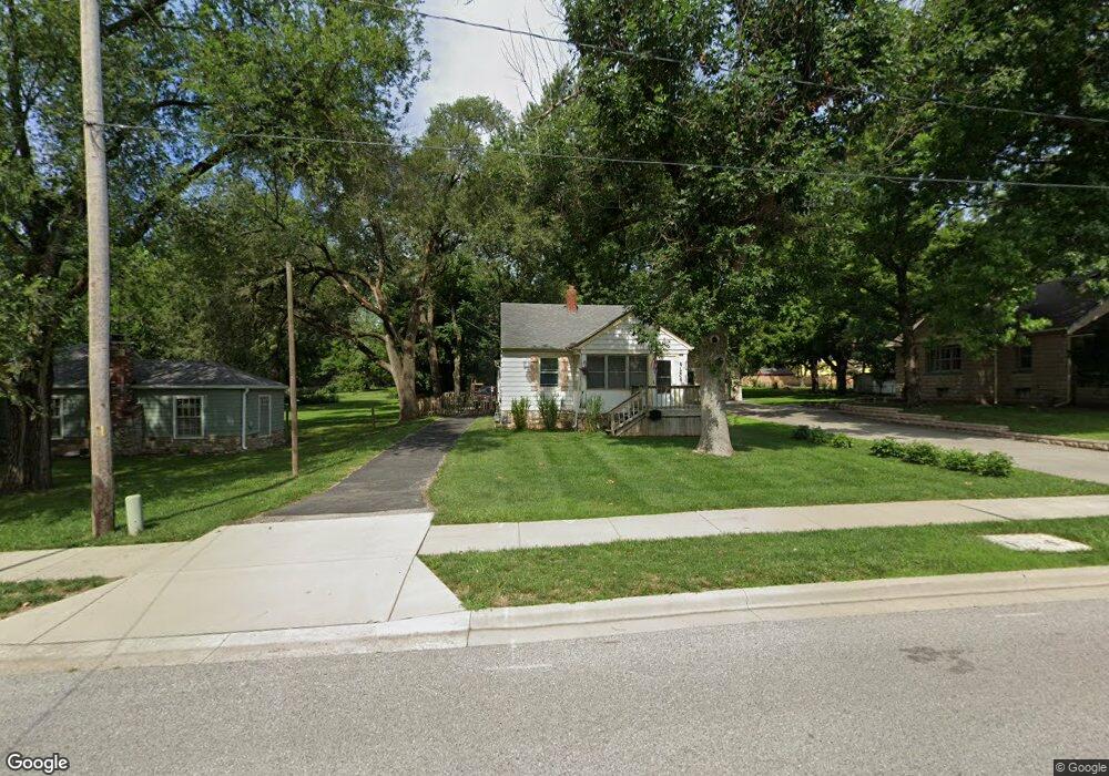
6136 Flint St Shawnee, KS 66203
Estimated Value: $242,761 - $260,000
2
Beds
1
Bath
894
Sq Ft
$279/Sq Ft
Est. Value
About This Home
This home is located at 6136 Flint St, Shawnee, KS 66203 and is currently estimated at $249,690, approximately $279 per square foot. 6136 Flint St is a home located in Johnson County with nearby schools including Bluejacket / Flint Elementary, Hocker Grove Middle School, and Shawnee Mission North High School.
Ownership History
Date
Name
Owned For
Owner Type
Purchase Details
Closed on
Oct 11, 2017
Sold by
Stringer William R and Stringer Barbara L
Bought by
36 Ers Llc
Current Estimated Value
Purchase Details
Closed on
May 5, 2005
Sold by
Burns Terry L
Bought by
Stringer William R and Stringer Barbara L
Home Financials for this Owner
Home Financials are based on the most recent Mortgage that was taken out on this home.
Original Mortgage
$80,000
Interest Rate
5.92%
Mortgage Type
Future Advance Clause Open End Mortgage
Create a Home Valuation Report for This Property
The Home Valuation Report is an in-depth analysis detailing your home's value as well as a comparison with similar homes in the area
Home Values in the Area
Average Home Value in this Area
Purchase History
| Date | Buyer | Sale Price | Title Company |
|---|---|---|---|
| 36 Ers Llc | -- | None Available | |
| Stringer William R | -- | Shawnee Land Title |
Source: Public Records
Mortgage History
| Date | Status | Borrower | Loan Amount |
|---|---|---|---|
| Previous Owner | Stringer William R | $80,000 |
Source: Public Records
Tax History Compared to Growth
Tax History
| Year | Tax Paid | Tax Assessment Tax Assessment Total Assessment is a certain percentage of the fair market value that is determined by local assessors to be the total taxable value of land and additions on the property. | Land | Improvement |
|---|---|---|---|---|
| 2024 | $2,546 | $24,426 | $5,725 | $18,701 |
| 2023 | $2,667 | $24,955 | $5,725 | $19,230 |
| 2022 | $2,432 | $22,667 | $5,203 | $17,464 |
| 2021 | $2,143 | $18,596 | $4,521 | $14,075 |
| 2020 | $1,871 | $15,996 | $4,112 | $11,884 |
| 2019 | $1,845 | $15,766 | $3,430 | $12,336 |
| 2018 | $1,702 | $14,467 | $3,112 | $11,355 |
| 2017 | $1,621 | $13,559 | $3,112 | $10,447 |
| 2016 | $1,518 | $12,524 | $3,112 | $9,412 |
| 2015 | $1,394 | $12,087 | $3,112 | $8,975 |
| 2013 | -- | $11,132 | $3,112 | $8,020 |
Source: Public Records
Map
Nearby Homes
- 6420 Ballentine St
- 12116 W 63rd Terrace
- 5845 Caenen St
- 12225 W 64th Terrace
- 10924 W 67th St
- 6610 Halsey St
- 11002 W 55th Terrace
- 6556 Charles St
- 11637 W 68th Terrace
- 6564 Charles St
- 10103 Johnson Dr
- 5620 Monrovia St
- Ashwood Plan at Bristol Highlands - North
- The Fleetwood Plan at Bristol Highlands - The Villas
- Cypress II Plan at Bristol Highlands - North
- The Fleetwood Plan at Bristol Highlands - The Manors
- The Brentwood Plan at Bristol Highlands - The Villas
- Yorkshire V Plan at Bristol Highlands - North
- The Kirkwood Plan at Bristol Highlands - The Villas
- 8013 Payne St
- 6130 Flint St
- 6152 Flint St
- 11320 W 61st Place
- 6120 Flint St
- 11415 W 61st Terrace
- 11323 W 61st Place
- 6121 Flint St
- 11421 W 61st Terrace
- 6210 Flint St
- 6145 Flint St
- 6136 King Ave
- 11505 W 61st Terrace
- 11424 W 62nd Terrace
- 6201 Flint St
- 6140 King Ave
- 6140 King St
- 6115 Flint St
- 11400 W 61st Terrace
- 6128 King Ave
- 11416 W 61st Terrace