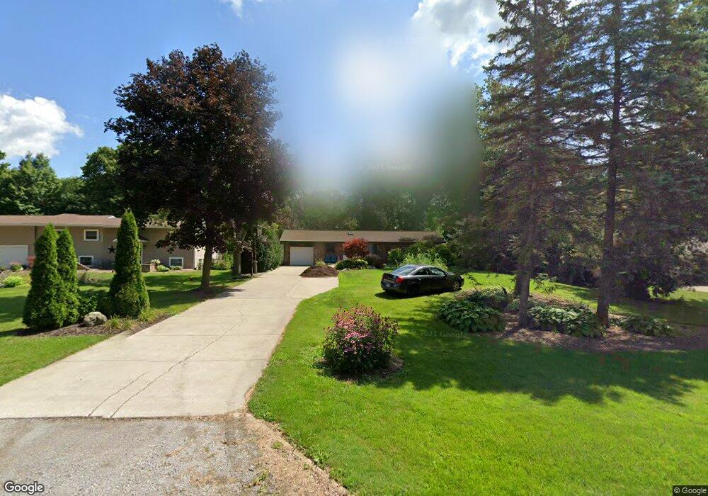
6139 Maple Rd Frankenmuth, MI 48734
Estimated Value: $253,000 - $319,000
3
Beds
2
Baths
1,176
Sq Ft
$239/Sq Ft
Est. Value
About This Home
This home is located at 6139 Maple Rd, Frankenmuth, MI 48734 and is currently estimated at $281,440, approximately $239 per square foot. 6139 Maple Rd is a home located in Saginaw County with nearby schools including List Elementary, E.F. Rittmueller Middle School, and Frankenmuth High School.
Ownership History
Date
Name
Owned For
Owner Type
Purchase Details
Closed on
Aug 15, 2019
Sold by
Hapworth Florence M
Bought by
Florence Hapworth Lt
Current Estimated Value
Purchase Details
Closed on
May 25, 2001
Home Financials for this Owner
Home Financials are based on the most recent Mortgage that was taken out on this home.
Original Mortgage
$108,000
Interest Rate
7.18%
Mortgage Type
Purchase Money Mortgage
Create a Home Valuation Report for This Property
The Home Valuation Report is an in-depth analysis detailing your home's value as well as a comparison with similar homes in the area
Purchase History
| Date | Buyer | Sale Price | Title Company |
|---|---|---|---|
| Florence Hapworth Lt | -- | None Available | |
| -- | $135,000 | -- | |
| Hapworth Scott L | $135,000 | -- |
Source: Public Records
Mortgage History
| Date | Status | Borrower | Loan Amount |
|---|---|---|---|
| Previous Owner | Hapworth Scott L | $108,000 |
Source: Public Records
Tax History
| Year | Tax Paid | Tax Assessment Tax Assessment Total Assessment is a certain percentage of the fair market value that is determined by local assessors to be the total taxable value of land and additions on the property. | Land | Improvement |
|---|---|---|---|---|
| 2025 | $807 | $104,400 | $0 | $0 |
| 2024 | $783 | $97,500 | $0 | $0 |
| 2023 | $746 | $89,600 | $0 | $0 |
| 2022 | $2,597 | $78,400 | $0 | $0 |
| 2021 | $2,372 | $74,300 | $0 | $0 |
| 2020 | $2,315 | $68,900 | $0 | $0 |
| 2019 | $2,205 | $64,800 | $0 | $0 |
| 2018 | $650 | $60,200 | $0 | $0 |
| 2017 | $1,990 | $66,300 | $0 | $0 |
| 2016 | $1,973 | $62,200 | $0 | $0 |
| 2014 | -- | $58,300 | $0 | $49,700 |
| 2013 | -- | $58,300 | $0 | $0 |
Source: Public Records
Map
Nearby Homes
- 4705 Weiss Rd
- 6450 Curtis Rd
- Parcel E W Rolling Hills Dr
- Parcel B W Rolling Hills Dr
- Parcel D W Rolling Hills Dr
- Parcel F W Rolling Hills Dr
- Parcel C W Rolling Hills Dr
- 12 Wilshire Dr
- 2 Wilshire Dr Unit A4
- 10 Harlan Ct
- 000 W Tuscola St
- 249 Churchgrove Rd
- 53 Pine Grove Dr
- 640 Heine St
- 456 Groveland Dr
- 10487 Roedel Rd
- 11 Cambridge Park
- 6260 Lange Rd
- 7720 Rookway Rd
- 5205 Baker Rd