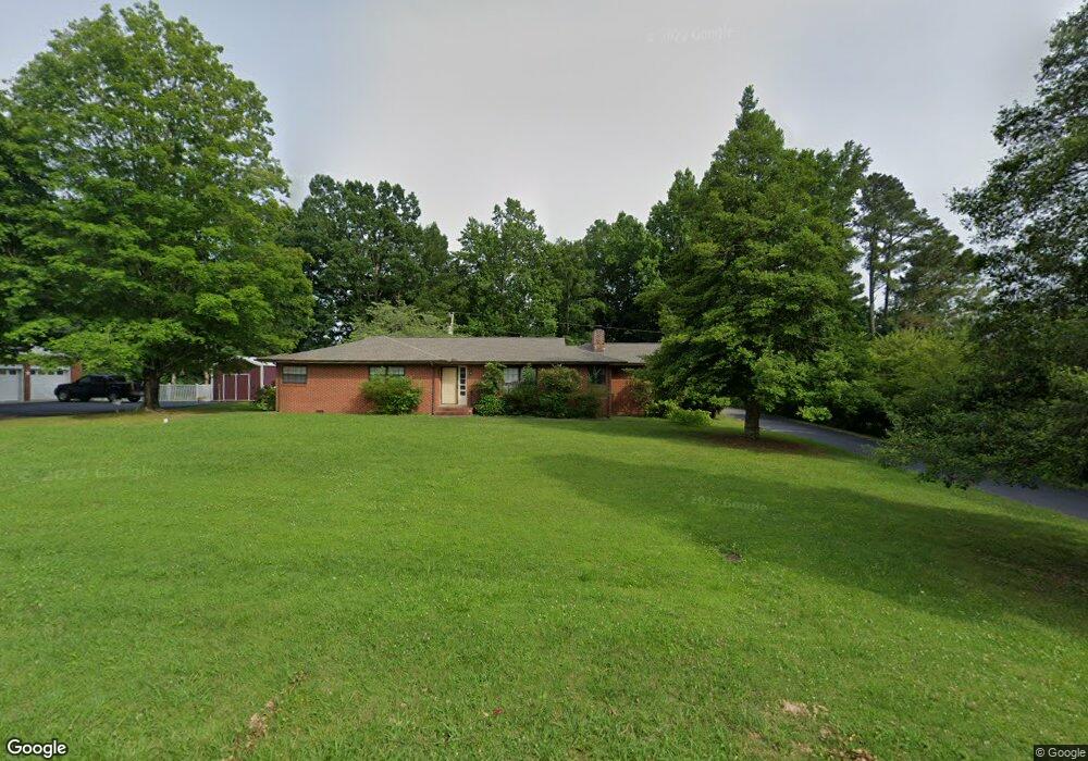
614 Adams St Manchester, TN 37355
Estimated Value: $221,000 - $269,000
--
Bed
2
Baths
1,655
Sq Ft
$147/Sq Ft
Est. Value
About This Home
This home is located at 614 Adams St, Manchester, TN 37355 and is currently estimated at $243,419, approximately $147 per square foot. 614 Adams St is a home located in Coffee County with nearby schools including Westwood Middle School and Temple Baptist Christian School.
Ownership History
Date
Name
Owned For
Owner Type
Purchase Details
Closed on
Oct 9, 2020
Sold by
Mckinney Amy E and Davis Barry A
Bought by
Mckee James Derek and Mckee Tammy R
Current Estimated Value
Home Financials for this Owner
Home Financials are based on the most recent Mortgage that was taken out on this home.
Original Mortgage
$144,465
Interest Rate
2.9%
Mortgage Type
Future Advance Clause Open End Mortgage
Purchase Details
Closed on
Nov 4, 1988
Create a Home Valuation Report for This Property
The Home Valuation Report is an in-depth analysis detailing your home's value as well as a comparison with similar homes in the area
Home Values in the Area
Average Home Value in this Area
Purchase History
| Date | Buyer | Sale Price | Title Company |
|---|---|---|---|
| Mckee James Derek | $90,000 | None Available | |
| -- | $52,000 | -- |
Source: Public Records
Mortgage History
| Date | Status | Borrower | Loan Amount |
|---|---|---|---|
| Closed | Mckee James Derek | $144,465 |
Source: Public Records
Tax History Compared to Growth
Tax History
| Year | Tax Paid | Tax Assessment Tax Assessment Total Assessment is a certain percentage of the fair market value that is determined by local assessors to be the total taxable value of land and additions on the property. | Land | Improvement |
|---|---|---|---|---|
| 2024 | $1,166 | $27,650 | $5,250 | $22,400 |
| 2023 | $1,166 | $27,650 | $0 | $0 |
| 2022 | $1,004 | $27,650 | $5,250 | $22,400 |
| 2021 | $973 | $21,250 | $4,375 | $16,875 |
| 2020 | $973 | $21,250 | $4,375 | $16,875 |
| 2019 | $973 | $21,250 | $4,375 | $16,875 |
| 2018 | $973 | $21,250 | $4,375 | $16,875 |
| 2017 | $1,029 | $19,625 | $4,375 | $15,250 |
| 2016 | $1,029 | $19,625 | $4,375 | $15,250 |
| 2015 | $1,029 | $19,625 | $4,375 | $15,250 |
| 2014 | $1,029 | $19,622 | $0 | $0 |
Source: Public Records
Map
Nearby Homes
- 608 Henley St
- 537 Shelton Rd
- 515 Mckellar Dr
- 107 Grace Ct
- 1610 Summer St
- 605 Johnson St
- 602 Johnson St
- 416 Powers Rd
- 1014 Hills Chapel Rd
- 1203 Woodland Dr
- 390 Oak Hollow Rd
- 223 Duck River Rd
- 113 Creek Wood Rd
- 711 Lowry St
- 802 Lowry St
- 1005 Thoma St
- 793 Old Bushy Branch Rd
- 1005 Keylon St
- 200 Reynard St
- 333 Blanford Cir