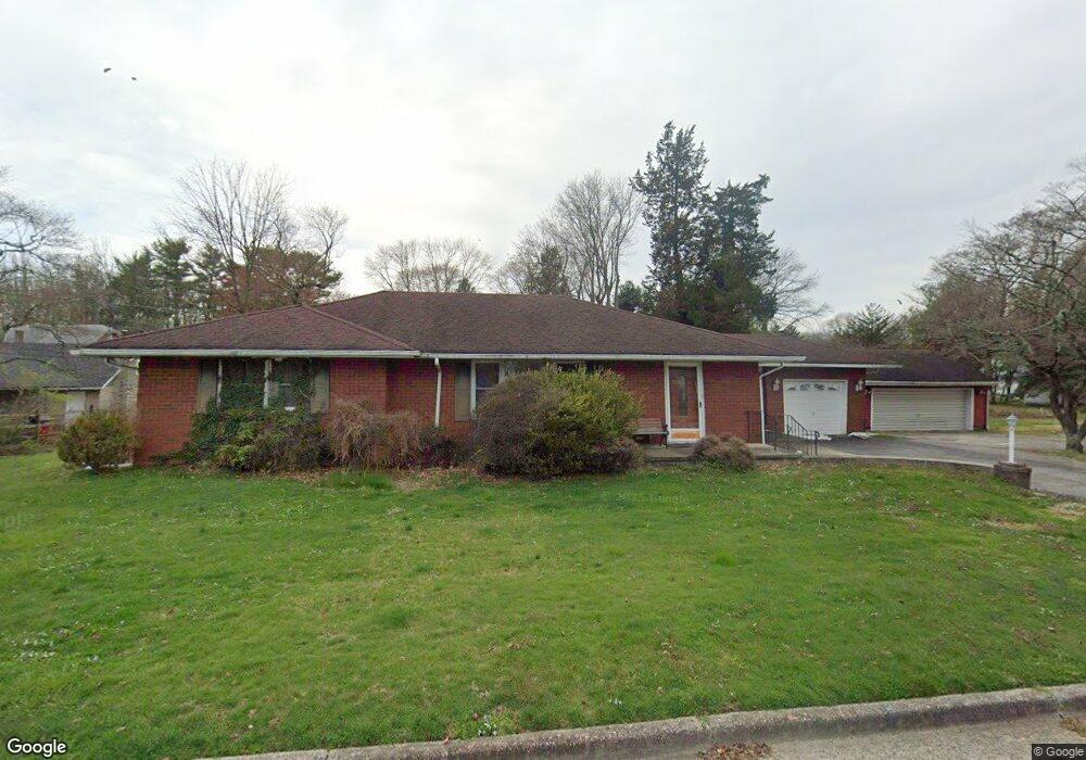
614 Cedar Crest Dr Penns Grove, NJ 08069
Estimated Value: $246,613 - $367,000
--
Bed
--
Bath
1,504
Sq Ft
$195/Sq Ft
Est. Value
About This Home
This home is located at 614 Cedar Crest Dr, Penns Grove, NJ 08069 and is currently estimated at $293,403, approximately $195 per square foot. 614 Cedar Crest Dr is a home located in Salem County with nearby schools including Lafayette-Pershing Elementary School, Paul W. Carleton Elementary School, and Field Street Elementary School.
Ownership History
Date
Name
Owned For
Owner Type
Purchase Details
Closed on
Dec 18, 2009
Sold by
Cox Troy David and Cox Kristin
Bought by
Bomba Patrick
Current Estimated Value
Purchase Details
Closed on
Jul 31, 2003
Sold by
Bibeau John
Bought by
Cox Troy David
Home Financials for this Owner
Home Financials are based on the most recent Mortgage that was taken out on this home.
Original Mortgage
$109,250
Interest Rate
5.28%
Mortgage Type
Purchase Money Mortgage
Purchase Details
Closed on
Mar 24, 2000
Sold by
Poeta Kathy Lynn
Bought by
The Terminix International Company Lp
Create a Home Valuation Report for This Property
The Home Valuation Report is an in-depth analysis detailing your home's value as well as a comparison with similar homes in the area
Home Values in the Area
Average Home Value in this Area
Purchase History
| Date | Buyer | Sale Price | Title Company |
|---|---|---|---|
| Bomba Patrick | $134,133 | -- | |
| Cox Troy David | $115,000 | West Jersey Title Agency | |
| The Terminix International Company Lp | $125,000 | -- |
Source: Public Records
Mortgage History
| Date | Status | Borrower | Loan Amount |
|---|---|---|---|
| Previous Owner | Cox Troy David | $109,250 |
Source: Public Records
Tax History Compared to Growth
Tax History
| Year | Tax Paid | Tax Assessment Tax Assessment Total Assessment is a certain percentage of the fair market value that is determined by local assessors to be the total taxable value of land and additions on the property. | Land | Improvement |
|---|---|---|---|---|
| 2025 | $6,364 | $286,500 | $48,400 | $238,100 |
| 2024 | $6,145 | $172,600 | $40,000 | $132,600 |
| 2023 | $6,145 | $172,600 | $40,000 | $132,600 |
| 2022 | $5,782 | $172,600 | $40,000 | $132,600 |
| 2021 | $5,727 | $172,600 | $40,000 | $132,600 |
| 2020 | $5,777 | $172,600 | $40,000 | $132,600 |
| 2019 | $5,825 | $172,600 | $40,000 | $132,600 |
| 2018 | $6,544 | $207,800 | $41,600 | $166,200 |
| 2017 | $6,101 | $207,800 | $41,600 | $166,200 |
| 2016 | $5,879 | $207,800 | $41,600 | $166,200 |
| 2015 | $5,604 | $207,800 | $41,600 | $166,200 |
| 2014 | $5,305 | $207,800 | $41,600 | $166,200 |
Source: Public Records
Map
Nearby Homes
- 613 Hawks Bridge Rd
- 609 Hawks Bridge Rd
- 604 Hawks Bridge Rd
- 371 Route 40
- 370 Route 40
- 371 40 Route
- 613 Soders Rd
- 1 Victory Ave Unit 84
- 1 Victory Ave Unit 82
- 1 Victory Ave Unit 74
- 1 Victory Ave Unit 72
- 1 Victory Ave Unit 8
- 1 Victory Ave Unit 93
- 1 Victory Ave
- 1 Victory Ave Unit 56
- 1 Victory Ave Unit 22
- 29 Chester Ave
- 94 White Oak Dr
- 62 Penns Ave
- 12 Chester Ave
- 615 Hawks Bridge Rd
- 594 Orchard Dr
- 615 Cedar Crest Dr
- 613 Cedar Crest Dr
- 617 Cedar Crest Dr
- 617 Hawks Bridge Rd
- 610 Cedar Crest Dr
- 611 Hawks Bridge Rd
- 590 Orchard Dr
- 595 Orchard Dr
- 593 Orchard Dr
- 619 Hawks Bridge Rd
- 612 Hawks Bridge Rd
- 591 Orchard Rd
- 611 Cedar Crest Dr
- 617 Sorenson Dr
- 591 Orchard Dr
- 621 Hawks Bridge Rd
- 583 Orchard Rd
- 622 Cedar Crest Dr