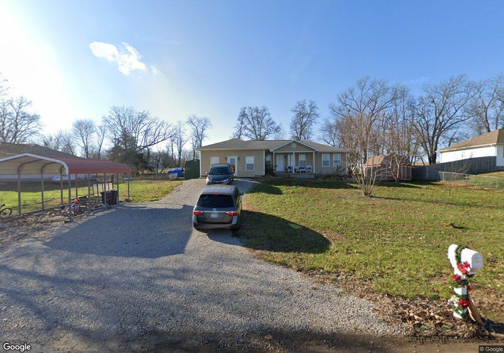
614 Michael Stihl Rd Mountain View, MO 65548
Estimated Value: $169,316 - $250,000
--
Bed
--
Bath
1,440
Sq Ft
$147/Sq Ft
Est. Value
About This Home
This home is located at 614 Michael Stihl Rd, Mountain View, MO 65548 and is currently estimated at $211,329, approximately $146 per square foot. 614 Michael Stihl Rd is a home with nearby schools including Liberty Senior High School.
Ownership History
Date
Name
Owned For
Owner Type
Purchase Details
Closed on
Jan 4, 2023
Sold by
Pierce Gavin
Bought by
Dunkin Michael A and Dunkin Antonina I
Current Estimated Value
Home Financials for this Owner
Home Financials are based on the most recent Mortgage that was taken out on this home.
Original Mortgage
$150,000
Outstanding Balance
$146,261
Interest Rate
6.58%
Mortgage Type
New Conventional
Estimated Equity
$65,068
Purchase Details
Closed on
Oct 22, 2013
Sold by
Holford Richard W and Holford Janice M
Bought by
Pierce Christopher and Pierce Sarina
Home Financials for this Owner
Home Financials are based on the most recent Mortgage that was taken out on this home.
Original Mortgage
$83,000
Interest Rate
4.56%
Mortgage Type
Construction
Create a Home Valuation Report for This Property
The Home Valuation Report is an in-depth analysis detailing your home's value as well as a comparison with similar homes in the area
Home Values in the Area
Average Home Value in this Area
Purchase History
| Date | Buyer | Sale Price | Title Company |
|---|---|---|---|
| Dunkin Michael A | -- | Wiles Abstract & Title | |
| Pierce Christopher | -- | None Available |
Source: Public Records
Mortgage History
| Date | Status | Borrower | Loan Amount |
|---|---|---|---|
| Open | Dunkin Michael A | $150,000 | |
| Previous Owner | Pierce Christopher | $83,000 |
Source: Public Records
Tax History Compared to Growth
Tax History
| Year | Tax Paid | Tax Assessment Tax Assessment Total Assessment is a certain percentage of the fair market value that is determined by local assessors to be the total taxable value of land and additions on the property. | Land | Improvement |
|---|---|---|---|---|
| 2025 | $939 | $24,800 | $1,700 | $23,100 |
| 2024 | $924 | $22,140 | -- | -- |
| 2023 | $924 | $22,140 | $0 | $0 |
| 2022 | $871 | $20,900 | $0 | $0 |
| 2021 | $822 | $20,900 | $0 | $0 |
| 2020 | $822 | $19,670 | $0 | $0 |
| 2019 | $820 | $19,670 | $0 | $0 |
| 2018 | $810 | $19,290 | $0 | $0 |
| 2017 | $712 | $17,060 | $0 | $0 |
| 2015 | -- | $17,060 | $0 | $0 |
| 2014 | -- | $17,060 | $0 | $0 |
| 2013 | -- | $17,060 | $0 | $0 |
Source: Public Records
Map
Nearby Homes
- 703 Washington St
- 517 W Ann Ave
- 00 Track 3 State Route W
- 00 Track 5 State Route W
- 00 Track 4 State Route W
- 308 E James St
- 220 State Route W
- 100 Pennycuick Dr
- 105 Pennycuick Dr
- 407 S Elm St
- 157 State Route O
- 601 E 3rd St
- 104 S Pine St
- 1006 E 5th St
- 301 N Elm St
- 230 W 2nd St
- 225 N Pine St
- 108 W 2nd St
- 413 E 7th St
- 300 E 6th St
- 612 Michael Stihl Rd
- 612 Michael Stihl Rd
- 616 Michael Stihl Rd
- 620 Michael Stihl Rd
- 615 Michael Stihl Rd
- 613 Michael Stihl Rd
- 610 Michael Stihl Rd
- 618 Michael Stihl Rd
- 617 Michael Stihl Rd
- 611 Michael Stihl Rd
- 619 Michael Stihl Rd
- 608 Michael Stihl Rd
- 609 Michael Stihl Rd
- 621 Michael Stihl Rd
- 606 Michael Stihl Rd
- 607 Michael Stihl Rd
- 604 Michael Stihl Rd
- 605 Michael Stihl Rd
- 605 Michael Stihl Rd
- 602 Michael Stihl Rd