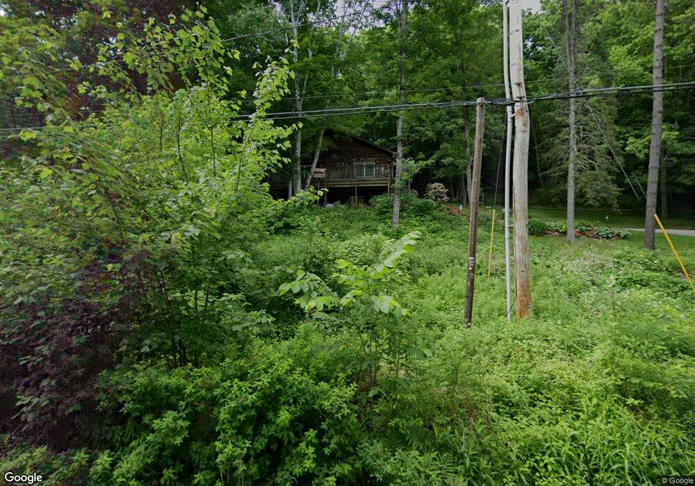
614 Mount Eustis Rd Littleton, NH 03561
Estimated Value: $262,000 - $360,000
3
Beds
2
Baths
1,188
Sq Ft
$262/Sq Ft
Est. Value
About This Home
This home is located at 614 Mount Eustis Rd, Littleton, NH 03561 and is currently estimated at $311,611, approximately $262 per square foot. 614 Mount Eustis Rd is a home located in Grafton County with nearby schools including Mildred C. Lakeway School, North Country Charter Academy (M), and North Country Charter Academy.
Ownership History
Date
Name
Owned For
Owner Type
Purchase Details
Closed on
Jul 13, 2012
Sold by
Wigget Ann C
Bought by
Ann C Wigget Ret
Current Estimated Value
Purchase Details
Closed on
Sep 7, 2007
Sold by
Finkle Jason L and Finkle Amy L
Bought by
Wiggett Floyd D and Wiggett Ann C
Home Financials for this Owner
Home Financials are based on the most recent Mortgage that was taken out on this home.
Original Mortgage
$142,400
Interest Rate
6.74%
Create a Home Valuation Report for This Property
The Home Valuation Report is an in-depth analysis detailing your home's value as well as a comparison with similar homes in the area
Home Values in the Area
Average Home Value in this Area
Purchase History
| Date | Buyer | Sale Price | Title Company |
|---|---|---|---|
| Ann C Wigget Ret | -- | -- | |
| Wiggett Floyd D | $178,000 | -- |
Source: Public Records
Mortgage History
| Date | Status | Borrower | Loan Amount |
|---|---|---|---|
| Previous Owner | Wiggett Floyd D | $137,000 | |
| Previous Owner | Wiggett Floyd D | $142,400 |
Source: Public Records
Tax History Compared to Growth
Tax History
| Year | Tax Paid | Tax Assessment Tax Assessment Total Assessment is a certain percentage of the fair market value that is determined by local assessors to be the total taxable value of land and additions on the property. | Land | Improvement |
|---|---|---|---|---|
| 2024 | $4,921 | $197,300 | $23,800 | $173,500 |
| 2023 | $4,447 | $197,300 | $23,800 | $173,500 |
| 2022 | $4,550 | $197,300 | $23,800 | $173,500 |
| 2021 | $4,550 | $197,300 | $23,800 | $173,500 |
| 2020 | $4,272 | $197,300 | $23,800 | $173,500 |
| 2019 | $4,086 | $176,900 | $21,400 | $155,500 |
| 2018 | $4,086 | $176,900 | $21,400 | $155,500 |
| 2017 | $3,434 | $133,000 | $19,000 | $114,000 |
| 2016 | $3,213 | $124,000 | $19,000 | $105,000 |
| 2015 | $3,064 | $131,400 | $28,100 | $103,300 |
| 2014 | $2,917 | $131,400 | $28,100 | $103,300 |
| 2013 | $3,079 | $137,100 | $33,800 | $103,300 |
Source: Public Records
Map
Nearby Homes
- 92-29 Birchcroft Dr
- 165 Bethlehem Rd
- 134 Cottage St
- 251 Bethlehem Rd
- 166 Riverside Dr
- 36 MacIver Rd
- 60-70 Meadow St
- 194 Main St
- 34 Union St
- 33 Pleasant St
- 000 Dells Rd Unit 1
- 93 Pleasant St
- 114 Highland Ave
- 180 Beacon St
- 191 Washington St
- 11 Richmond St
- 45 Point of View Dr
- 00 Guider Ln
- 80 Guider Ln
- 14 Hilltop Manor Mobile Home Park
- 640 Mount Eustis Rd
- 639 Mount Eustis Rd
- 582 Mount Eustis Rd
- 7 Cyr Rd
- 16 Cyr Rd
- 659 Mount Eustis Rd
- 40 Cyr Rd
- 672 Mount Eustis Rd
- 39 Cyr Rd
- 571 Mount Eustis Rd
- 708 Mount Eustis Rd
- 641 Mount Eustis Rd
- 80 Cyr Rd
- 741 Mount Eustis Rd
- 0 Mount Eustis Rd
- 761 Mount Eustis Rd
- 772 Mount Eustis Rd
- 124 Cyr Rd
- 1 Mount Eustis Rd
- 793 Mount Eustis Rd