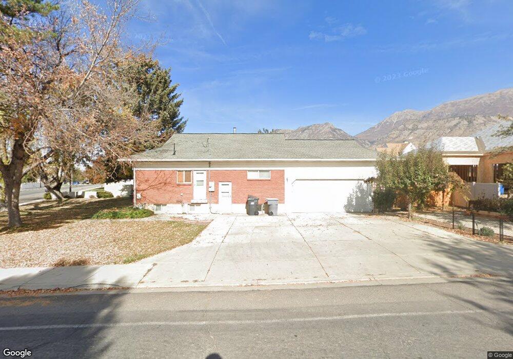
614 N Locust Ave Lindon, UT 84042
Estimated Value: $510,000 - $566,000
4
Beds
2
Baths
2,098
Sq Ft
$261/Sq Ft
Est. Value
About This Home
This home is located at 614 N Locust Ave, Lindon, UT 84042 and is currently estimated at $547,140, approximately $260 per square foot. 614 N Locust Ave is a home located in Utah County with nearby schools including Lindon Elementary School, Oak Canyon Junior High School, and Pleasant Grove High School.
Ownership History
Date
Name
Owned For
Owner Type
Purchase Details
Closed on
Jul 18, 2022
Sold by
Steven Gurney
Bought by
Gurney Steven and Gurney Jessica
Current Estimated Value
Home Financials for this Owner
Home Financials are based on the most recent Mortgage that was taken out on this home.
Original Mortgage
$220,000
Outstanding Balance
$209,557
Interest Rate
5.23%
Mortgage Type
New Conventional
Estimated Equity
$337,583
Purchase Details
Closed on
Sep 23, 2016
Sold by
Bowman Kathryn Naoma
Bought by
Gurney Steven D and Momberger Nathan
Home Financials for this Owner
Home Financials are based on the most recent Mortgage that was taken out on this home.
Original Mortgage
$172,975
Interest Rate
3.45%
Mortgage Type
FHA
Purchase Details
Closed on
May 3, 2011
Sold by
The Secretary Of Housing & Urban Develop
Bought by
Bowman Kathryn Naoma
Home Financials for this Owner
Home Financials are based on the most recent Mortgage that was taken out on this home.
Original Mortgage
$137,750
Interest Rate
4.77%
Mortgage Type
New Conventional
Purchase Details
Closed on
Jan 6, 2011
Sold by
Utah Housing Corporation
Bought by
The Secretary Of Housing & Urban Develop
Purchase Details
Closed on
Dec 9, 2010
Sold by
Cook William G and Cook Leslee K
Bought by
Utah Housing Corporation
Purchase Details
Closed on
Feb 1, 2008
Sold by
Walker Clayton W
Bought by
Cook William G and Cook Leslee K
Home Financials for this Owner
Home Financials are based on the most recent Mortgage that was taken out on this home.
Original Mortgage
$11,732
Interest Rate
6.04%
Mortgage Type
Stand Alone Second
Purchase Details
Closed on
Nov 8, 2006
Sold by
Walker Clay W and Walker Dee H
Bought by
Walker Clayton W
Home Financials for this Owner
Home Financials are based on the most recent Mortgage that was taken out on this home.
Original Mortgage
$44,000
Interest Rate
6.36%
Mortgage Type
Stand Alone Second
Purchase Details
Closed on
Feb 19, 2004
Sold by
Brooks Paulette H
Bought by
Brookline Farms Inc
Create a Home Valuation Report for This Property
The Home Valuation Report is an in-depth analysis detailing your home's value as well as a comparison with similar homes in the area
Home Values in the Area
Average Home Value in this Area
Purchase History
| Date | Buyer | Sale Price | Title Company |
|---|---|---|---|
| Gurney Steven | -- | Lydolph & Weierholt Title | |
| Gurney Steven | -- | Lydolph & Weierholt Title | |
| Gurney Steven D | -- | First American Title Ins Age | |
| Bowman Kathryn Naoma | -- | Monument Title Insurance Inc | |
| The Secretary Of Housing & Urban Develop | -- | Lincoln Title Insurance Age | |
| Utah Housing Corporation | -- | Lincoln Title Insurance Age | |
| Cook William G | -- | Equity Title Orem Blvd | |
| Walker Clayton W | -- | Surety Title | |
| Brookline Farms Inc | -- | -- |
Source: Public Records
Mortgage History
| Date | Status | Borrower | Loan Amount |
|---|---|---|---|
| Open | Gurney Steven | $220,000 | |
| Previous Owner | Gurney Steven D | $172,975 | |
| Previous Owner | Bowman Kathryn Naoma | $137,750 | |
| Previous Owner | Cook William G | $11,732 | |
| Previous Owner | Walker Clayton W | $44,000 | |
| Previous Owner | Walker Clayton W | $176,000 |
Source: Public Records
Tax History
| Year | Tax Paid | Tax Assessment Tax Assessment Total Assessment is a certain percentage of the fair market value that is determined by local assessors to be the total taxable value of land and additions on the property. | Land | Improvement |
|---|---|---|---|---|
| 2025 | $2,071 | $279,015 | -- | -- |
| 2024 | $2,071 | $255,310 | $0 | $0 |
| 2023 | $1,961 | $259,655 | $0 | $0 |
| 2022 | $1,980 | $253,275 | $0 | $0 |
| 2021 | $1,653 | $318,900 | $172,700 | $146,200 |
| 2020 | $1,538 | $292,100 | $154,200 | $137,900 |
| 2019 | $1,364 | $270,100 | $132,200 | $137,900 |
| 2018 | $1,271 | $237,400 | $117,500 | $119,900 |
| 2017 | $1,118 | $111,925 | $0 | $0 |
| 2016 | $1,062 | $98,340 | $0 | $0 |
| 2015 | $1,123 | $98,340 | $0 | $0 |
| 2014 | $966 | $83,820 | $0 | $0 |
Source: Public Records
Map
Nearby Homes
- 355 W 600 N
- 517 N 80 W
- 461 W 490 N
- 465 W 490 N
- 469 W 490 N
- 1135 E 900 S
- 696 S Locust Ave
- 793 E Orchard Dr
- 1172 E Murdock Dr
- 130 E 800 N
- 190 E 800 N Unit 4
- 170 E 800 N Unit 3
- 150 E 800 N Unit 2
- 494 E Apple Blossom Dr
- 308 E 750 N
- 1176 E 470 S
- 435 E 790 S Unit 8
- 271 N 400 E Unit 1
- 271 N 400 E
- 1515 E 200 S
- 628 N Locust Ave
- 597 N Locust Ave
- 315 W 600 N
- 182 W 600 N
- 594 N Locust Ave
- 595 N Locust Ave
- 642 N Locust Ave
- 134 W 600 N
- 581 N Locust Ave
- 321 W 600 N
- 312 W 600 N
- 266 W 570 N
- 125 W 660 N
- 568 N Locust Ave
- 101 W 600 N
- 433 N Locust Ave
- 600 N Locust Ave
- 100 W 600 N Unit 4
- 631 N Locust Ave
- 676 N Locust Ave
Your Personal Tour Guide
Ask me questions while you tour the home.