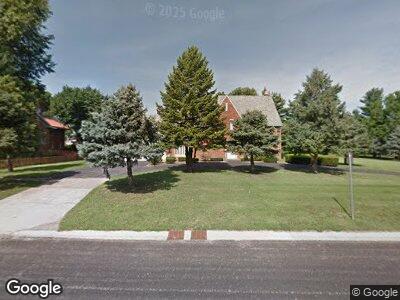
614 N Vine St Mount Pulaski, IL 62548
Estimated Value: $233,814 - $306,000
4
Beds
3
Baths
3,179
Sq Ft
$84/Sq Ft
Est. Value
About This Home
This home is located at 614 N Vine St, Mount Pulaski, IL 62548 and is currently estimated at $267,454, approximately $84 per square foot. 614 N Vine St is a home located in Logan County with nearby schools including Mount Pulaski Elementary School, Mount Pulaski High School, and Zion Lutheran School.
Ownership History
Date
Name
Owned For
Owner Type
Purchase Details
Closed on
Sep 28, 2019
Sold by
Cowan Kimberly M
Bought by
Cowan Eric S
Current Estimated Value
Purchase Details
Closed on
Feb 24, 2016
Sold by
Marcinek Kathryn M
Bought by
Cowan Eric and Cowan Kimberly
Create a Home Valuation Report for This Property
The Home Valuation Report is an in-depth analysis detailing your home's value as well as a comparison with similar homes in the area
Home Values in the Area
Average Home Value in this Area
Purchase History
| Date | Buyer | Sale Price | Title Company |
|---|---|---|---|
| Cowan Eric S | -- | None Available | |
| Cowan Eric | $168,000 | -- |
Source: Public Records
Mortgage History
| Date | Status | Borrower | Loan Amount |
|---|---|---|---|
| Open | Cowan Eric S | $164,582 | |
| Closed | Cowan Eric | $174,236 |
Source: Public Records
Tax History Compared to Growth
Tax History
| Year | Tax Paid | Tax Assessment Tax Assessment Total Assessment is a certain percentage of the fair market value that is determined by local assessors to be the total taxable value of land and additions on the property. | Land | Improvement |
|---|---|---|---|---|
| 2024 | $4,731 | $68,560 | $10,630 | $57,930 |
| 2023 | $4,731 | $62,320 | $9,660 | $52,660 |
| 2022 | $4,432 | $57,700 | $8,940 | $48,760 |
| 2021 | $4,397 | $56,660 | $8,780 | $47,880 |
| 2020 | $4,514 | $56,660 | $8,780 | $47,880 |
| 2019 | $4,567 | $56,660 | $8,780 | $47,880 |
| 2018 | $4,287 | $55,550 | $8,610 | $46,940 |
| 2017 | $4,203 | $54,460 | $8,440 | $46,020 |
| 2016 | $4,108 | $53,390 | $8,270 | $45,120 |
| 2015 | $4,225 | $62,690 | $7,920 | $54,770 |
| 2014 | $4,225 | $62,690 | $7,920 | $54,770 |
| 2013 | $4,225 | $56,580 | $7,150 | $49,430 |
| 2012 | $4,225 | $58,890 | $7,440 | $51,450 |
Source: Public Records
Map
Nearby Homes
- 113 N Mason St
- 118 S Park St
- 0 1025th St
- 1247 County Road 480 St
- 204 Mulberry St
- 0 Us Bypass 20 Unit MRD12016238
- 0 Us Bypass 20 Unit 202305188
- 1166 350th St
- 64 1725th Ave
- 1422 1307 St
- 261 E 4th St
- 785 2400th Ave
- 1528 Pulaski St
- 1604 Broadway St
- 1202 Clinton St
- 0 Prairie Pointe Dr Unit RMACA1028503
- 0 Prairie Pointe Dr Unit RMACA1027909
- 839 Sunset Dr
- 1028 Clinton St
- 1429 Pekin St
- 614 N Vine St
- 606 N Vine St
- 606 N Vine St Unit 620 N Vine Street
- 700 N Vine St
- 621 N Lafayette Ct
- 607 N Lafayette Ct
- 304 E Chestnut St
- 307 E Chestnut St
- 621 N Vine St
- 704 N Vine St
- 627 N Vine St
- 529 N Vine St
- 701 N Lafayette Ct
- 516 N Vine St
- 204 E Maple St
- 604 N Lafayette St
- 710 N Vine St
- 127 Scott Ct
- 614 N Lafayette Ct
- 604 N Lafayette Ct