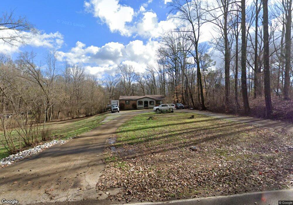
6140 Benjestown Rd Memphis, TN 38127
Estimated Value: $183,840 - $268,000
3
Beds
1
Bath
1,537
Sq Ft
$146/Sq Ft
Est. Value
About This Home
This home is located at 6140 Benjestown Rd, Memphis, TN 38127 and is currently estimated at $224,960, approximately $146 per square foot. 6140 Benjestown Rd is a home located in Shelby County with nearby schools including E.E. Jeter Elementary School and Trezevant High School.
Ownership History
Date
Name
Owned For
Owner Type
Purchase Details
Closed on
Feb 9, 1998
Sold by
Blackwell Calen C and Blackwell Brenda J
Bought by
Green Robert E
Current Estimated Value
Home Financials for this Owner
Home Financials are based on the most recent Mortgage that was taken out on this home.
Original Mortgage
$114,660
Interest Rate
7.07%
Mortgage Type
FHA
Create a Home Valuation Report for This Property
The Home Valuation Report is an in-depth analysis detailing your home's value as well as a comparison with similar homes in the area
Home Values in the Area
Average Home Value in this Area
Purchase History
| Date | Buyer | Sale Price | Title Company |
|---|---|---|---|
| Green Robert E | $115,000 | -- |
Source: Public Records
Mortgage History
| Date | Status | Borrower | Loan Amount |
|---|---|---|---|
| Closed | Green Robert E | $114,660 |
Source: Public Records
Tax History Compared to Growth
Tax History
| Year | Tax Paid | Tax Assessment Tax Assessment Total Assessment is a certain percentage of the fair market value that is determined by local assessors to be the total taxable value of land and additions on the property. | Land | Improvement |
|---|---|---|---|---|
| 2025 | $557 | $50,675 | $5,950 | $44,725 |
| 2024 | $1,353 | $39,925 | $5,650 | $34,275 |
| 2023 | $1,353 | $39,925 | $5,650 | $34,275 |
| 2022 | $1,353 | $39,925 | $5,650 | $34,275 |
| 2021 | $1,377 | $39,925 | $5,650 | $34,275 |
| 2020 | $1,232 | $30,425 | $5,650 | $24,775 |
| 2019 | $1,232 | $30,425 | $5,650 | $24,775 |
| 2018 | $1,232 | $30,425 | $5,650 | $24,775 |
| 2017 | $1,250 | $30,425 | $5,650 | $24,775 |
| 2016 | $1,228 | $28,100 | $0 | $0 |
| 2014 | $1,228 | $28,100 | $0 | $0 |
Source: Public Records
Map
Nearby Homes
- 6224 Benjestown Rd
- 6007 Island Forty Rd
- 5921 Benjestown Rd
- 6621 Benjestown Rd
- 5423 Breckenwood Dr
- 1 Robertson Rd
- 5382 Beaverton Dr
- 6525 N Watkins Rd
- 6642 Benjestown Rd
- 5387 Cornstalk Cove
- 5371 Cedar Bluff Dr
- 5315 Braden Dr
- 5306 Beaverton Dr
- 635 Mcwhirter Ave
- 0 N Watkins Unit 10203950
- 0 N Watkins Unit 10193620
- 5204 Black Diamond Cove
- 5140 Blacksmith Dr
- 5096 Belfast Dr
- 5072 Blacksmith Dr
- 6120 Benjestown Rd
- 6160 Benjestown Rd
- 6100 Benjestown Rd
- 6125 Benjestown Rd
- 6101 Benjestown Rd
- 6170 Benjestown Rd
- 6193 Benjestown Rd
- 6076 Benjestown Rd
- 6216 Benjestown Rd
- 6181 Island Forty Rd
- 6161 Island Forty Rd
- 6165 Benjestown Rd
- 6233 Island Forty Rd
- 6135 Island Forty Rd
- 6217 Benjestown Rd
- 6031 Benjestown Rd
- 6061 Benjestown Rd
- 6240 Benjestown Rd
- 6178 Island Forty Rd
- 6198 Island Forty Rd