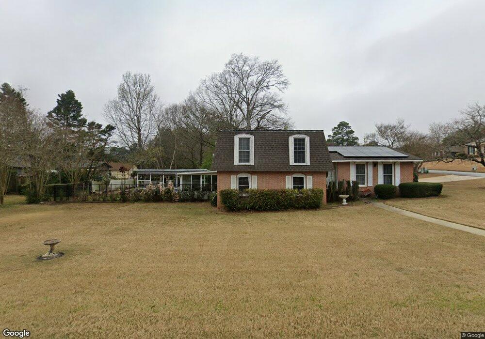
6141 Windsor Dr Columbus, GA 31909
North Columbus NeighborhoodEstimated Value: $170,000 - $282,000
3
Beds
3
Baths
2,579
Sq Ft
$95/Sq Ft
Est. Value
About This Home
This home is located at 6141 Windsor Dr, Columbus, GA 31909 and is currently estimated at $246,041, approximately $95 per square foot. 6141 Windsor Dr is a home located in Muscogee County with nearby schools including Blanchard Elementary School, Veterans Memorial Middle School, and Hardaway High School.
Ownership History
Date
Name
Owned For
Owner Type
Purchase Details
Closed on
Jun 22, 2021
Sold by
Byrnside Elaine Marie Estate
Bought by
Byrnside John F
Current Estimated Value
Create a Home Valuation Report for This Property
The Home Valuation Report is an in-depth analysis detailing your home's value as well as a comparison with similar homes in the area
Home Values in the Area
Average Home Value in this Area
Purchase History
| Date | Buyer | Sale Price | Title Company |
|---|---|---|---|
| Byrnside John F | $91,200 | -- |
Source: Public Records
Tax History
| Year | Tax Paid | Tax Assessment Tax Assessment Total Assessment is a certain percentage of the fair market value that is determined by local assessors to be the total taxable value of land and additions on the property. | Land | Improvement |
|---|---|---|---|---|
| 2025 | $717 | $81,116 | $10,892 | $70,224 |
| 2024 | $716 | $81,116 | $10,892 | $70,224 |
| 2023 | $26 | $81,116 | $10,892 | $70,224 |
| 2022 | $746 | $67,516 | $10,892 | $56,624 |
| 2021 | $739 | $72,960 | $10,892 | $62,068 |
| 2020 | $740 | $72,960 | $10,892 | $62,068 |
| 2019 | $744 | $67,468 | $10,892 | $56,576 |
| 2018 | $744 | $66,768 | $10,892 | $55,876 |
| 2017 | $748 | $66,768 | $10,892 | $55,876 |
| 2016 | $752 | $55,564 | $6,396 | $49,168 |
| 2015 | $302 | $55,564 | $6,396 | $49,168 |
| 2014 | $303 | $55,564 | $6,396 | $49,168 |
| 2013 | -- | $55,564 | $6,396 | $49,168 |
Source: Public Records
Map
Nearby Homes
- 4001 Twilight Dr
- 6104 Windsor Dr
- 2 Biltmore Ct
- 4202 Cheshire Bridge Rd
- 6411 Michael Ave
- 3845 Arrel Dr
- 5829 Moon Rd
- 3646 Weems Rd
- 6002 Canterbury Dr
- 5820 Windsor Dr
- 6221 Charing Dr
- 5921 Canterbury Dr
- 4320 Canady St
- 6158 Arrington Dr
- 4437 Ansley Ave
- 5836 Sherborne Dr
- 6697 Springlake Dr
- 4465 Weems Rd
- 5823 Pratt Ave
- 19 Nettle Ct
- 3952 Biltmore Dr
- 6129 Windsor Dr
- 3951 Eve Ct
- 6142 Windsor Dr
- 3944 Biltmore Dr
- 3957 Biltmore Dr
- 6132 Windsor Dr
- 6150 Windsor Dr
- 3951 Biltmore Dr
- 3945 Eve Ct
- 6124 Windsor Dr
- 6156 Windsor Dr
- 3940 Biltmore Dr
- 6211 Windsor Dr
- 4004 Twilight Dr
- 3939 Eve Ct
- 6132 Candlestick Loop
- 3958 Eve Ct
- 6128 Candlestick Loop
- 6118 Windsor Dr
Your Personal Tour Guide
Ask me questions while you tour the home.