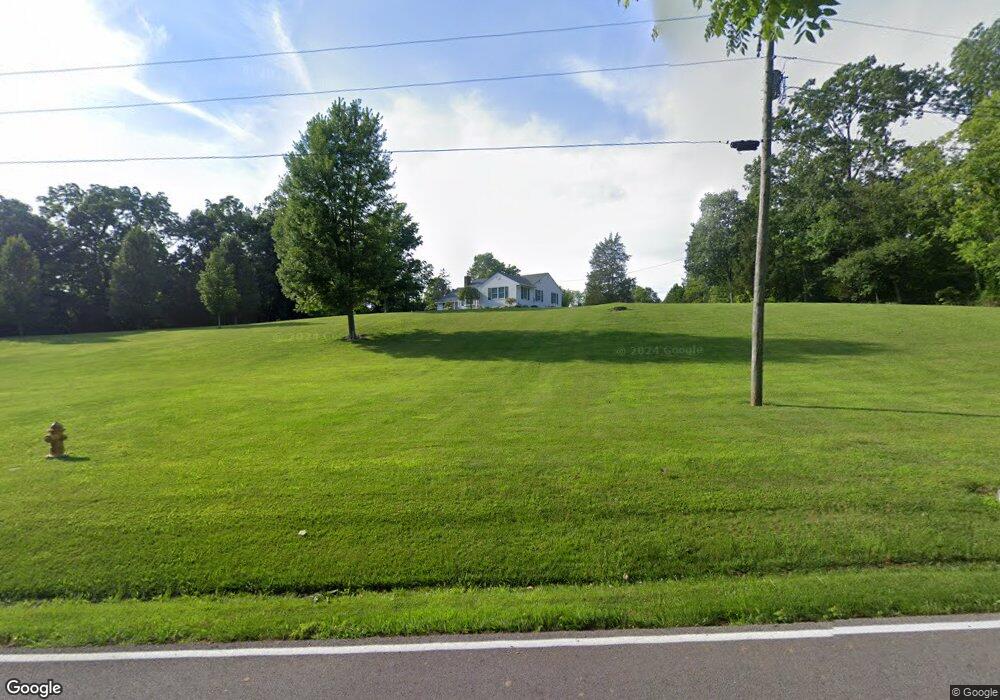
6146 Michael Rd Middletown, OH 45042
Madison Township NeighborhoodEstimated Value: $414,000 - $537,000
3
Beds
1
Bath
2,140
Sq Ft
$219/Sq Ft
Est. Value
About This Home
This home is located at 6146 Michael Rd, Middletown, OH 45042 and is currently estimated at $467,639, approximately $218 per square foot. 6146 Michael Rd is a home located in Butler County with nearby schools including Madison High School.
Ownership History
Date
Name
Owned For
Owner Type
Purchase Details
Closed on
Apr 27, 2007
Sold by
Morgan Rose E
Bought by
Conner Phillip Waynce and Conner Irene
Current Estimated Value
Home Financials for this Owner
Home Financials are based on the most recent Mortgage that was taken out on this home.
Original Mortgage
$136,000
Outstanding Balance
$82,860
Interest Rate
6.2%
Mortgage Type
Purchase Money Mortgage
Estimated Equity
$384,779
Purchase Details
Closed on
May 13, 1998
Sold by
Morgan David T
Bought by
Morgdan David T
Create a Home Valuation Report for This Property
The Home Valuation Report is an in-depth analysis detailing your home's value as well as a comparison with similar homes in the area
Home Values in the Area
Average Home Value in this Area
Purchase History
| Date | Buyer | Sale Price | Title Company |
|---|---|---|---|
| Conner Phillip Waynce | $305,000 | None Available | |
| Morgdan David T | -- | -- |
Source: Public Records
Mortgage History
| Date | Status | Borrower | Loan Amount |
|---|---|---|---|
| Open | Conner Phillip Waynce | $136,000 |
Source: Public Records
Tax History Compared to Growth
Tax History
| Year | Tax Paid | Tax Assessment Tax Assessment Total Assessment is a certain percentage of the fair market value that is determined by local assessors to be the total taxable value of land and additions on the property. | Land | Improvement |
|---|---|---|---|---|
| 2024 | $4,397 | $106,740 | $31,200 | $75,540 |
| 2023 | $4,365 | $106,740 | $31,200 | $75,540 |
| 2022 | $3,728 | $78,780 | $31,200 | $47,580 |
| 2021 | $3,342 | $78,780 | $31,200 | $47,580 |
| 2020 | $3,476 | $78,780 | $31,200 | $47,580 |
| 2019 | $3,612 | $62,390 | $31,550 | $30,840 |
| 2018 | $2,981 | $62,390 | $31,550 | $30,840 |
| 2017 | $3,574 | $62,390 | $31,550 | $30,840 |
| 2016 | $3,508 | $59,070 | $31,550 | $27,520 |
| 2015 | $2,940 | $59,070 | $31,550 | $27,520 |
| 2014 | $3,541 | $59,070 | $31,550 | $27,520 |
| 2013 | $3,541 | $58,690 | $31,550 | $27,140 |
Source: Public Records
Map
Nearby Homes
- 1675 Middletown Eaton Rd
- 6136 Hursh Rd
- 5386 Mosiman Rd
- 5801 Elk Creek Rd
- 6190 Joann Ln
- 6823 Michael Rd
- 881 Middletown Eaton Rd
- 5438 Middletown Oxford Rd
- 5750 Trenton Franklin Rd
- 526 Hill St
- 5357 Front St
- 4750 Eck Rd
- 433 Leichty Ave
- 4849 Trenton Franklin Rd
- 6250 Howe Rd
- 4348 Elk Creek Rd
- 6423 Howe Rd
- 6256 Paullin Dr
- 4510 Trenton Franklin Rd
- 6262 Jacksonburg Rd
- 6178 Michael Rd
- 6151 Michael Rd
- 6198 Michael Rd
- 6198 Michael Rd
- 6191 Michael Rd
- 6111 Michael Rd
- 6120 Michael Rd
- 6141 Michael Rd
- 5779 Mosiman Rd
- 1522 Blair Ct
- 1534 Blair Ct
- 1512 Blair Ct
- 1540 Blair Ct
- 1620 Middletown Eaton Rd
- 5769 Mosiman Rd
- 6011 Beverly Ln
- 5984 Beverly Ln
- 5999 Beverly Ln
- 5830 Mosiman Rd
- 1535 Blair Ct
