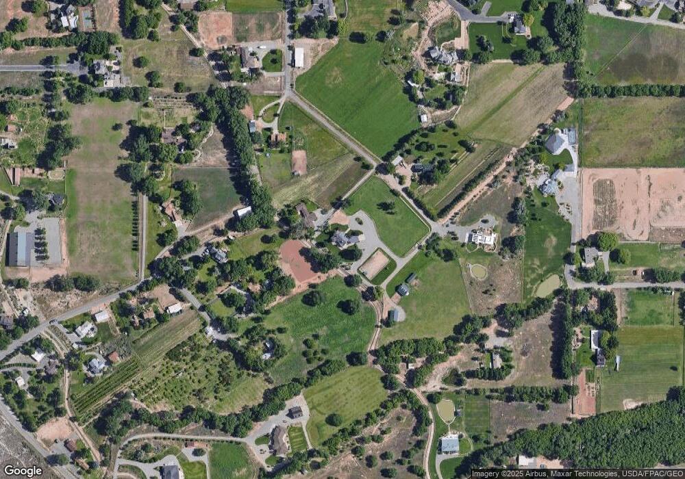
615 19 1/2 Rd Grand Junction, CO 81507
Redlands NeighborhoodEstimated Value: $1,022,000 - $2,859,000
3
Beds
3
Baths
3,180
Sq Ft
$517/Sq Ft
Est. Value
About This Home
This home is located at 615 19 1/2 Rd, Grand Junction, CO 81507 and is currently estimated at $1,644,604, approximately $517 per square foot. 615 19 1/2 Rd is a home located in Mesa County with nearby schools including Wingate Elementary School, Redlands Middle School, and Fruita 8/9 School.
Ownership History
Date
Name
Owned For
Owner Type
Purchase Details
Closed on
Mar 3, 2011
Sold by
Miller Kathie B
Bought by
Kathie B Miller Revocable Trust
Current Estimated Value
Purchase Details
Closed on
Jul 8, 2009
Sold by
Miller Kathie B
Bought by
Miller Kathie B
Purchase Details
Closed on
May 1, 2001
Sold by
Jesse Carla Jean
Bought by
Miller Joseph S and Miller Kathie B
Purchase Details
Closed on
Aug 1, 1997
Sold by
Trustees William Leyda Jesse Carla Jean Jess
Bought by
Jesse William Leyda and Jesse Carla Jean
Home Financials for this Owner
Home Financials are based on the most recent Mortgage that was taken out on this home.
Original Mortgage
$214,600
Interest Rate
7.6%
Purchase Details
Closed on
Jun 1, 1995
Sold by
Copeland M Larry
Bought by
Miller Kathie B Revoc Trust
Create a Home Valuation Report for This Property
The Home Valuation Report is an in-depth analysis detailing your home's value as well as a comparison with similar homes in the area
Home Values in the Area
Average Home Value in this Area
Purchase History
| Date | Buyer | Sale Price | Title Company |
|---|---|---|---|
| Kathie B Miller Revocable Trust | -- | None Available | |
| Miller Kathie B | -- | None Available | |
| Miller Joseph S | $685,000 | -- | |
| Jesse William Leyda | -- | -- | |
| Miller Kathie B Revoc Trust | $130,000 | -- |
Source: Public Records
Mortgage History
| Date | Status | Borrower | Loan Amount |
|---|---|---|---|
| Previous Owner | Jesse William Leyda | $214,600 |
Source: Public Records
Tax History Compared to Growth
Tax History
| Year | Tax Paid | Tax Assessment Tax Assessment Total Assessment is a certain percentage of the fair market value that is determined by local assessors to be the total taxable value of land and additions on the property. | Land | Improvement |
|---|---|---|---|---|
| 2024 | $2,775 | $39,280 | $2,970 | $36,310 |
| 2023 | $2,775 | $39,280 | $2,970 | $36,310 |
| 2022 | $2,243 | $31,250 | $2,310 | $28,940 |
| 2021 | $2,332 | $32,320 | $2,540 | $29,780 |
| 2020 | $2,241 | $32,160 | $2,040 | $30,120 |
| 2019 | $2,102 | $32,160 | $2,040 | $30,120 |
| 2018 | $1,971 | $27,290 | $2,690 | $24,600 |
| 2017 | $2,369 | $27,290 | $2,690 | $24,600 |
| 2016 | $2,369 | $36,780 | $2,180 | $34,600 |
| 2015 | $2,389 | $36,780 | $2,180 | $34,600 |
| 2014 | $2,326 | $35,840 | $1,560 | $34,280 |
Source: Public Records
Map
Nearby Homes
- 651 Eagles Nest Ct
- 1944 Straight St
- 1942 Straight St
- 659 Ellen Dr
- 663 Soaring Eagle Dr
- 664 Ellen Dr
- 584 20 Rd
- 1940 Rose Marie Ct
- 668 Ellen Dr
- 1945 Hidden Hollow Ct
- 1934 Hidden Hollow Ct
- 1933 Hidden Hollow Ct
- 1946 Hidden Hollow Ct
- 2034 Rodeo Way
- 1938 Hidden Hollow Ct
- 2035 Wrangler Way
- 2023 S Broadway
- 2069 Thomas Ivy Ln
- 2068 Shamsi Dr
- 1994 Bison Ct
- 619 19 1/2 Rd
- 1940 Star Canyon Dr
- 614 19 1/2 Rd
- 620 19 1 2 Rd
- 623 19 1/2 Rd
- 1934 Star Canyon Dr
- 610 19 1/2 Rd
- 1950 Star Canyon Dr
- 1939 Star Canyon Dr
- 630 19 1 2 Rd
- 1977 Cunningham Ct
- 1946 Star Canyon Dr
- 629 19 1/2 Rd
- 1963 Broadway
- 1977 Cunningham Ave
- 1944 S Broadway
- 1978 Cunningham Ct
- 1978 Cunningham Ave
- 636 19 1/2 Rd
- 1982 Cunningham Ave
