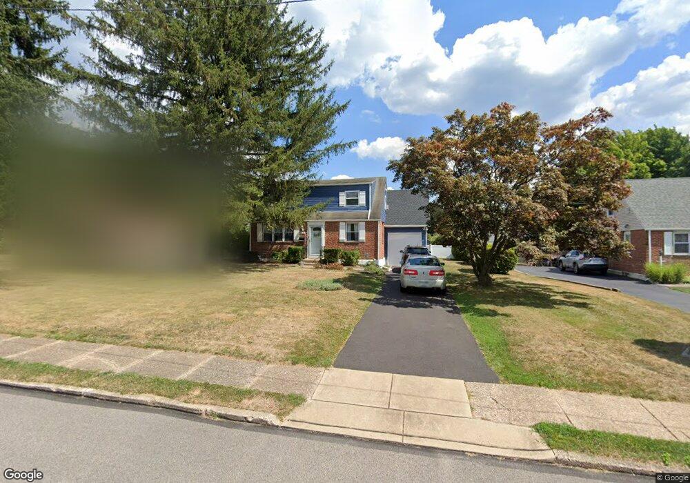
615 Aintree Rd Hatboro, PA 19040
Estimated Value: $420,164 - $450,000
3
Beds
2
Baths
1,418
Sq Ft
$306/Sq Ft
Est. Value
About This Home
This home is located at 615 Aintree Rd, Hatboro, PA 19040 and is currently estimated at $433,291, approximately $305 per square foot. 615 Aintree Rd is a home located in Montgomery County with nearby schools including Upper Moreland Intermediate School, Upper Moreland Primary School, and Upper Moreland Middle School.
Ownership History
Date
Name
Owned For
Owner Type
Purchase Details
Closed on
Oct 30, 2009
Sold by
Morris Virginia R and Morris Daniel A
Bought by
Flanigan Joyce Marie and Flanigan David M
Current Estimated Value
Home Financials for this Owner
Home Financials are based on the most recent Mortgage that was taken out on this home.
Original Mortgage
$185,600
Outstanding Balance
$121,065
Interest Rate
4.98%
Estimated Equity
$312,226
Create a Home Valuation Report for This Property
The Home Valuation Report is an in-depth analysis detailing your home's value as well as a comparison with similar homes in the area
Home Values in the Area
Average Home Value in this Area
Purchase History
| Date | Buyer | Sale Price | Title Company |
|---|---|---|---|
| Flanigan Joyce Marie | $232,000 | None Available |
Source: Public Records
Mortgage History
| Date | Status | Borrower | Loan Amount |
|---|---|---|---|
| Open | Flanigan Joyce Marie | $185,600 |
Source: Public Records
Tax History Compared to Growth
Tax History
| Year | Tax Paid | Tax Assessment Tax Assessment Total Assessment is a certain percentage of the fair market value that is determined by local assessors to be the total taxable value of land and additions on the property. | Land | Improvement |
|---|---|---|---|---|
| 2025 | $5,408 | $113,790 | $44,060 | $69,730 |
| 2024 | $5,408 | $113,790 | $44,060 | $69,730 |
| 2023 | $5,184 | $113,790 | $44,060 | $69,730 |
| 2022 | $4,875 | $113,790 | $44,060 | $69,730 |
| 2021 | $4,810 | $113,790 | $44,060 | $69,730 |
| 2020 | $4,651 | $113,790 | $44,060 | $69,730 |
| 2019 | $4,549 | $113,790 | $44,060 | $69,730 |
| 2018 | $4,550 | $113,790 | $44,060 | $69,730 |
| 2017 | $4,346 | $113,790 | $44,060 | $69,730 |
| 2016 | $4,302 | $113,790 | $44,060 | $69,730 |
| 2015 | $4,082 | $113,790 | $44,060 | $69,730 |
| 2014 | $4,082 | $113,790 | $44,060 | $69,730 |
Source: Public Records
Map
Nearby Homes
- 69 Crooked Billet Rd
- 160 Crooked Billet Rd
- 109 Loller Rd
- 348 Warren Rd
- 438 Moreboro Rd
- 1708 Magnolia Ave
- 2714 Fair Oaks Ave
- 1714 Willow Ave
- 40 W Lehman Ave
- 1014 N York Rd
- 14 Knock N Knoll Cir Unit L-14
- 1006 N York Rd Unit 1
- 11 Jessop Ln
- 2615 Horsham Rd
- 36 Jessop Ln
- 315 Arionne Dr
- 612 Brook St
- 47 Fairview Ave
- 605 Fairhill St
- 885 N York Rd Unit 12C