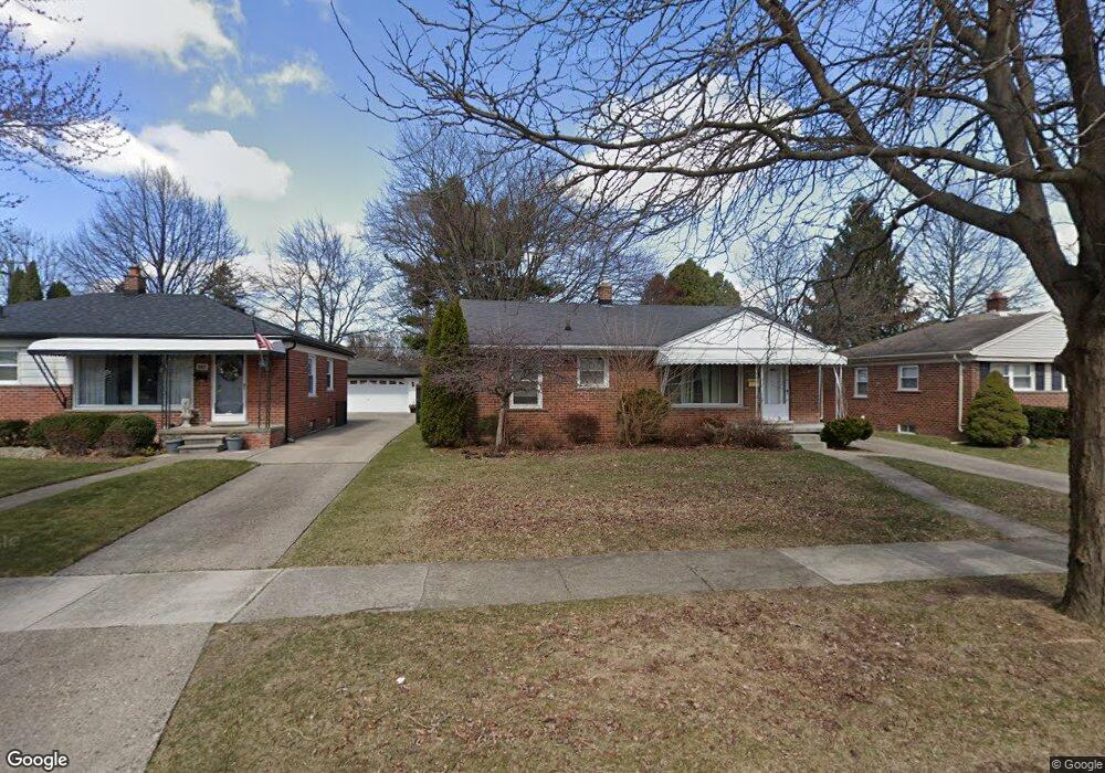
615 E Bloomfield Ave Unit Bldg-Unit Royal Oak, MI 48073
Estimated Value: $324,101 - $359,000
3
Beds
1
Bath
1,030
Sq Ft
$328/Sq Ft
Est. Value
About This Home
This home is located at 615 E Bloomfield Ave Unit Bldg-Unit, Royal Oak, MI 48073 and is currently estimated at $338,025, approximately $328 per square foot. 615 E Bloomfield Ave Unit Bldg-Unit is a home located in Oakland County with nearby schools including Oak Ridge Elementary School, Royal Oak Middle School, and Royal Oak High School.
Ownership History
Date
Name
Owned For
Owner Type
Purchase Details
Closed on
Oct 21, 2003
Sold by
Long Richard W
Bought by
Nicolich Steven M
Current Estimated Value
Purchase Details
Closed on
May 15, 1998
Sold by
Stolz Kevin P
Bought by
Long Richard W
Home Financials for this Owner
Home Financials are based on the most recent Mortgage that was taken out on this home.
Original Mortgage
$127,350
Interest Rate
7.27%
Create a Home Valuation Report for This Property
The Home Valuation Report is an in-depth analysis detailing your home's value as well as a comparison with similar homes in the area
Home Values in the Area
Average Home Value in this Area
Purchase History
| Date | Buyer | Sale Price | Title Company |
|---|---|---|---|
| Nicolich Steven M | $162,000 | -- | |
| Long Richard W | $141,500 | -- |
Source: Public Records
Mortgage History
| Date | Status | Borrower | Loan Amount |
|---|---|---|---|
| Previous Owner | Long Richard W | $127,350 |
Source: Public Records
Tax History Compared to Growth
Tax History
| Year | Tax Paid | Tax Assessment Tax Assessment Total Assessment is a certain percentage of the fair market value that is determined by local assessors to be the total taxable value of land and additions on the property. | Land | Improvement |
|---|---|---|---|---|
| 2024 | $3,804 | $129,110 | $0 | $0 |
| 2022 | $4,149 | $113,460 | $0 | $0 |
| 2020 | $3,669 | $99,870 | $0 | $0 |
| 2018 | $4,149 | $91,400 | $0 | $0 |
| 2017 | $3,811 | $91,400 | $0 | $0 |
| 2015 | -- | $81,060 | $0 | $0 |
| 2014 | -- | $74,650 | $0 | $0 |
| 2011 | -- | $63,630 | $0 | $0 |
Source: Public Records
Map
Nearby Homes
- 608 E Windemere Ave
- 619 E Thirteen Mile Rd
- 623 E Thirteen Mile Rd
- 412 Oak Run Ct Unit 6
- 333 E La Salle Ave
- 2907 N Altadena Ave
- 1023 E 13 Mile Rd
- 3538 Rochester Rd
- 419 Linden Ave
- 345 Midland Blvd
- 3006 N Blair Ave
- 436 Girard Ave
- 423 Woodlawn Ave
- 1221 E 13 Mile Rd
- 140 E Lawrence Ave
- 206 E Windemere Ave
- 1304 Midland Blvd
- 928 Montrose Ave
- 3220 N Connecticut Ave
- 3015 N Wilson Ave
- 615 E Bloomfield Ave
- 607 E Bloomfield Ave
- 619 E Bloomfield Ave
- 603 E Bloomfield Ave
- 627 E Bloomfield Ave
- 527 E Bloomfield Ave
- 703 E Bloomfield Ave
- 606 E Bloomfield Ave
- 602 E Bloomfield Ave
- 612 E Bloomfield Ave
- 618 E Bloomfield Ave
- 523 E Bloomfield Ave
- 707 E Bloomfield Ave
- 530 E Bloomfield Ave
- 622 E Bloomfield Ave
- 517 E Bloomfield Ave
- 526 E Bloomfield Ave
- 711 E Bloomfield Ave
- 704 E Bloomfield Ave
- 522 E Bloomfield Ave