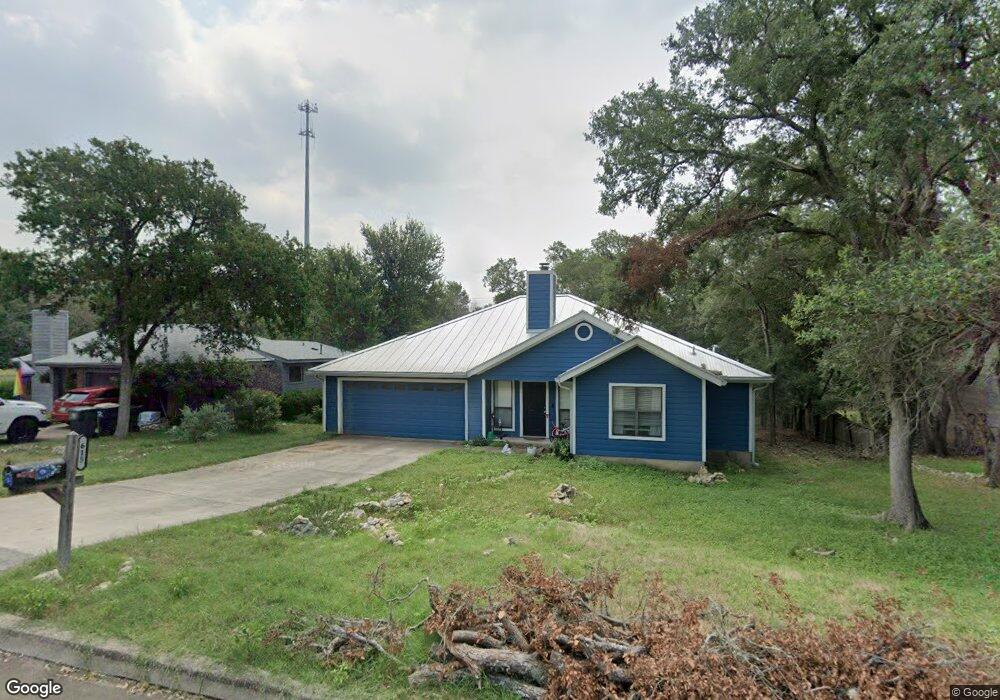
615 Franklin Dr San Marcos, TX 78666
Oak Heights NeighborhoodEstimated Value: $302,000 - $375,000
3
Beds
2
Baths
1,675
Sq Ft
$204/Sq Ft
Est. Value
About This Home
This home is located at 615 Franklin Dr, San Marcos, TX 78666 and is currently estimated at $342,075, approximately $204 per square foot. 615 Franklin Dr is a home located in Hays County with nearby schools including Crockett Elementary School, Dorris Miller Middle School, and San Marcos High School.
Ownership History
Date
Name
Owned For
Owner Type
Purchase Details
Closed on
May 21, 2010
Sold by
Magdalena Gordon and Magdalena Rebecca
Bought by
Winkler Michelle and Winkler Jason
Current Estimated Value
Home Financials for this Owner
Home Financials are based on the most recent Mortgage that was taken out on this home.
Original Mortgage
$152,940
Interest Rate
5.14%
Mortgage Type
Purchase Money Mortgage
Create a Home Valuation Report for This Property
The Home Valuation Report is an in-depth analysis detailing your home's value as well as a comparison with similar homes in the area
Home Values in the Area
Average Home Value in this Area
Purchase History
| Date | Buyer | Sale Price | Title Company |
|---|---|---|---|
| Winkler Michelle | -- | San Marcos Title |
Source: Public Records
Mortgage History
| Date | Status | Borrower | Loan Amount |
|---|---|---|---|
| Previous Owner | Winkler Michelle | $152,940 |
Source: Public Records
Tax History Compared to Growth
Tax History
| Year | Tax Paid | Tax Assessment Tax Assessment Total Assessment is a certain percentage of the fair market value that is determined by local assessors to be the total taxable value of land and additions on the property. | Land | Improvement |
|---|---|---|---|---|
| 2025 | $5,737 | $374,420 | $74,310 | $300,110 |
| 2024 | $5,737 | $348,615 | $74,310 | $280,106 |
| 2023 | $6,028 | $316,923 | $74,310 | $324,010 |
| 2022 | $5,904 | $288,112 | $62,970 | $256,500 |
| 2021 | $5,773 | $261,920 | $56,920 | $205,000 |
| 2020 | $5,625 | $239,190 | $55,710 | $183,480 |
| 2019 | $5,535 | $224,840 | $55,710 | $177,520 |
| 2018 | $5,055 | $204,400 | $26,330 | $178,070 |
| 2017 | $4,539 | $188,782 | $23,400 | $170,780 |
| 2016 | $4,126 | $171,620 | $12,290 | $159,330 |
| 2015 | $3,406 | $162,240 | $12,290 | $149,950 |
Source: Public Records
Map
Nearby Homes
- 140 Coers Dr
- 1007 Earle St
- 1919 Castle Gate Cir
- 108 Dolly St
- 2007 Castle Gate Cir
- 1809 Pearce Ct
- 809-811 Perkins St
- 609 Chicago St
- 1108 Marlton St
- 0 Old Ranch Road 12
- 1837 Pearce Ct
- 821 Old Ranch Road 12
- 1931 Lisa Ln
- 1805 Ramona Cir
- 1000 Advance #2 St
- 2003 Lisa Ln
- 1610 Ramona Cir
- 1000 Advance St
- 1009 Advance St Unit 1011