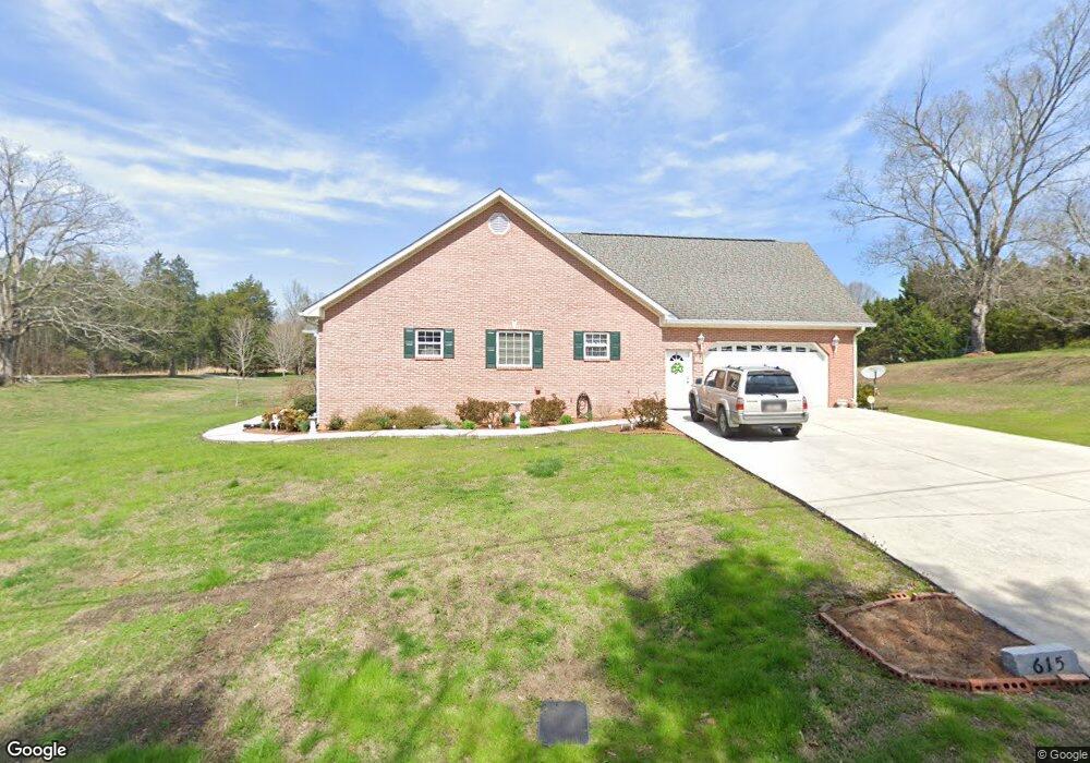
615 Roy Bird Rd Rock Spring, GA 30739
Rock Spring NeighborhoodEstimated Value: $390,184 - $468,000
--
Bed
2
Baths
2,498
Sq Ft
$174/Sq Ft
Est. Value
About This Home
This home is located at 615 Roy Bird Rd, Rock Spring, GA 30739 and is currently estimated at $435,296, approximately $174 per square foot. 615 Roy Bird Rd is a home located in Walker County with nearby schools including Rock Spring Elementary School and Lafayette High School.
Ownership History
Date
Name
Owned For
Owner Type
Purchase Details
Closed on
Oct 26, 2001
Sold by
Holland Ed
Bought by
Swader Robert B and Swader Melanie
Current Estimated Value
Purchase Details
Closed on
Nov 8, 1999
Sold by
91
Bought by
Holland Ed
Purchase Details
Closed on
Sep 30, 1999
Sold by
Bird Roy L
Bought by
91
Purchase Details
Closed on
May 25, 1993
Sold by
Bird Roy and Bird Kittie
Bought by
Bird Roy L
Purchase Details
Closed on
Dec 28, 1992
Sold by
Bird Roy
Bought by
Bird Roy and Bird Kittie
Purchase Details
Closed on
Jan 1, 1972
Bought by
Bird Roy
Create a Home Valuation Report for This Property
The Home Valuation Report is an in-depth analysis detailing your home's value as well as a comparison with similar homes in the area
Home Values in the Area
Average Home Value in this Area
Purchase History
| Date | Buyer | Sale Price | Title Company |
|---|---|---|---|
| Swader Robert B | $16,500 | -- | |
| Holland Ed | $8,900 | -- | |
| 91 | -- | -- | |
| Bird Roy L | -- | -- | |
| Bird Roy | -- | -- | |
| Bird Roy | -- | -- |
Source: Public Records
Tax History Compared to Growth
Tax History
| Year | Tax Paid | Tax Assessment Tax Assessment Total Assessment is a certain percentage of the fair market value that is determined by local assessors to be the total taxable value of land and additions on the property. | Land | Improvement |
|---|---|---|---|---|
| 2024 | $2,910 | $133,951 | $10,669 | $123,282 |
| 2023 | $2,786 | $125,367 | $8,468 | $116,899 |
| 2022 | $2,563 | $107,188 | $7,202 | $99,986 |
| 2021 | $2,543 | $91,150 | $7,202 | $83,948 |
| 2020 | $2,228 | $76,124 | $7,202 | $68,922 |
| 2019 | $2,267 | $76,124 | $7,202 | $68,922 |
| 2018 | $2,014 | $76,124 | $7,202 | $68,922 |
| 2017 | $2,476 | $76,124 | $7,202 | $68,922 |
| 2016 | $1,944 | $76,124 | $7,202 | $68,922 |
| 2015 | $2,117 | $78,296 | $12,556 | $65,740 |
| 2014 | $1,990 | $78,296 | $12,556 | $65,740 |
| 2013 | -- | $78,296 | $12,556 | $65,740 |
Source: Public Records
Map
Nearby Homes
- 5602 Georgia 95
- 00 Georgia 95
- 1003 Highway N Old 27
- 1370 Old Highway 27
- 10180 Us Highway 27
- 1902 Long Hollow Rd
- 701 Bicentennial Trail
- 195 Honeysuckle Dr
- 36 Pheonix Cir
- 0 Cheshire Crossing Dr Unit 1387793
- 285 Cooper Rd
- 23 Willow Cir
- 1476 Arnold Rd
- 16 Willow Cir
- 11 Willow Cir
- The Pearson Plan at Laurel Ridge
- The Benson II Plan at Laurel Ridge
- The Langford Plan at Laurel Ridge
- The Lawson Plan at Laurel Ridge
- The Coleman Plan at Laurel Ridge
- 663 Roy Bird Rd
- 94 Roy Bird Rd
- 578 Roy Bird Rd
- 676 Roy Bird Rd
- 515 Roy Bird Rd
- 620 Roy Bird Rd
- 487 Roy Bird Rd
- 560 Roy Bird Rd
- 445 Roy Bird Rd
- 745 Roy Bird Rd
- 716 Roy Bird Rd
- 409 Roy Bird Rd
- 931 Roy Bird Rd
- 797 Roy Bird Rd
- 442 Roy Bird Rd
- 301 Meadow Brook Dr
- 810 Roy Bird Rd
- 380 Roy Bird Rd
- 355 Roy Bird Rd
- 809 Roy Bird Rd