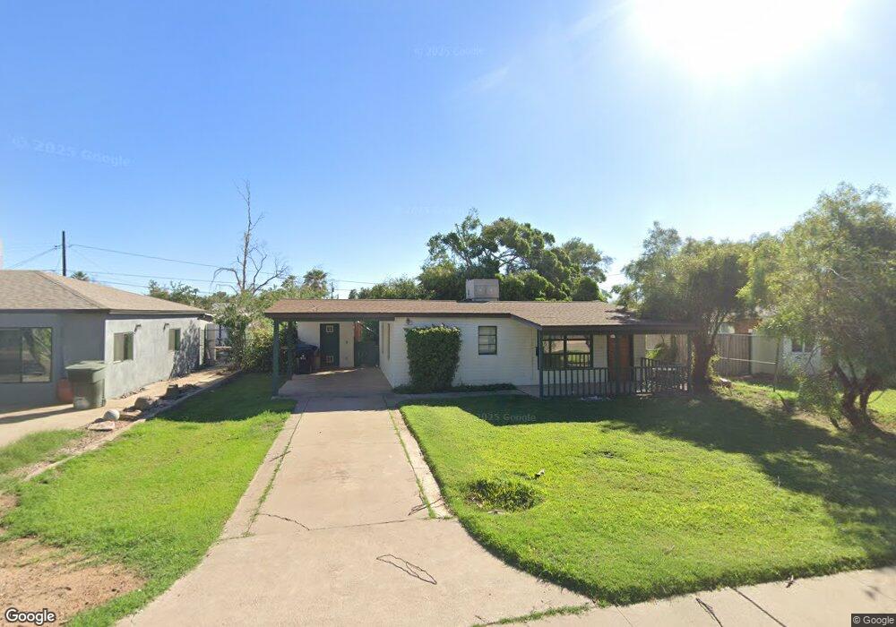
615 W Howe St Tempe, AZ 85281
Mitchell Park West NeighborhoodEstimated Value: $290,000 - $373,111
--
Bed
1
Bath
690
Sq Ft
$500/Sq Ft
Est. Value
About This Home
This home is located at 615 W Howe St, Tempe, AZ 85281 and is currently estimated at $344,778, approximately $499 per square foot. 615 W Howe St is a home located in Maricopa County with nearby schools including Geneva Epps Mosley Middle School, Tempe High School, and New School for the Arts & Academics.
Ownership History
Date
Name
Owned For
Owner Type
Purchase Details
Closed on
Feb 4, 1997
Sold by
Casson Thomas H
Bought by
Connelly William
Current Estimated Value
Home Financials for this Owner
Home Financials are based on the most recent Mortgage that was taken out on this home.
Original Mortgage
$54,400
Outstanding Balance
$5,463
Interest Rate
6.3%
Mortgage Type
New Conventional
Estimated Equity
$339,315
Create a Home Valuation Report for This Property
The Home Valuation Report is an in-depth analysis detailing your home's value as well as a comparison with similar homes in the area
Home Values in the Area
Average Home Value in this Area
Purchase History
| Date | Buyer | Sale Price | Title Company |
|---|---|---|---|
| Connelly William | $72,000 | Capital Title Agency |
Source: Public Records
Mortgage History
| Date | Status | Borrower | Loan Amount |
|---|---|---|---|
| Open | Connelly William | $54,400 |
Source: Public Records
Tax History Compared to Growth
Tax History
| Year | Tax Paid | Tax Assessment Tax Assessment Total Assessment is a certain percentage of the fair market value that is determined by local assessors to be the total taxable value of land and additions on the property. | Land | Improvement |
|---|---|---|---|---|
| 2025 | $1,770 | $14,769 | -- | -- |
| 2024 | $1,634 | $14,065 | -- | -- |
| 2023 | $1,634 | $31,160 | $6,230 | $24,930 |
| 2022 | $1,568 | $25,760 | $5,150 | $20,610 |
| 2021 | $1,579 | $23,530 | $4,700 | $18,830 |
| 2020 | $1,531 | $20,210 | $4,040 | $16,170 |
| 2019 | $1,502 | $16,110 | $3,220 | $12,890 |
| 2018 | $1,464 | $14,850 | $2,970 | $11,880 |
| 2017 | $1,421 | $12,380 | $2,470 | $9,910 |
| 2016 | $1,411 | $11,900 | $2,380 | $9,520 |
| 2015 | $1,355 | $10,970 | $2,190 | $8,780 |
Source: Public Records
Map
Nearby Homes
- 620 W Howe St
- 522 W Howe St
- 538 W 13th St
- 538 W 13th St Unit A
- 1218 S Farmer Ave
- 815 W Elna Rae St
- 1234 S Farmer Ave
- 1219 S Farmer Ave
- 919 S Wilson St Unit 5
- 535 W 15th St
- 63 W 13th St Unit 63 & 69
- 942 S Ash Ave Unit 103
- 117 W 10th St
- 1190 S Maple Ave Unit 1
- 1224 S Maple Ave
- 919 W Parkway Blvd
- 700 W University Dr Unit 122
- 700 W University Dr Unit 253
- 901 W 16th St
- 517 W 17th St
- 611 W Howe St
- 614 W 12th St
- 605 W Howe St
- 609 W Howe St
- 1125 S Judd St
- 618 W 12th St
- 610 W 12th St
- 1134 S Roosevelt St
- 1137 S Judd St
- 1135 S Judd St
- 1132 S Roosevelt St
- 1122 S Roosevelt St
- 616 W Howe St
- 616 W Howe St
- 612 W Howe St
- 1118 S Roosevelt St
- 602 W Howe St
- 624 W Howe St
- 1136 S Roosevelt St
- 701 W Howe St