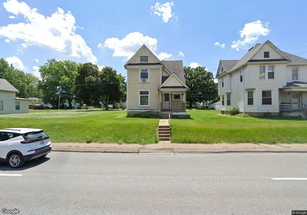
615 W Locust St Davenport, IA 52803
Central Davenport NeighborhoodEstimated Value: $111,000 - $172,382
4
Beds
2
Baths
1,778
Sq Ft
$82/Sq Ft
Est. Value
About This Home
This home is located at 615 W Locust St, Davenport, IA 52803 and is currently estimated at $145,346, approximately $81 per square foot. 615 W Locust St is a home located in Scott County with nearby schools including Crofton Elementary School, Christian County Day Treatment Center Alt, and Casey County Middle School.
Ownership History
Date
Name
Owned For
Owner Type
Purchase Details
Closed on
Mar 3, 2014
Sold by
Monterey Investors Llc
Bought by
St Ambrose University
Current Estimated Value
Purchase Details
Closed on
Nov 22, 2011
Sold by
Curry Michael J and Petersen Curry Cheryl L
Bought by
Wallace Joseph W
Home Financials for this Owner
Home Financials are based on the most recent Mortgage that was taken out on this home.
Original Mortgage
$72,500
Interest Rate
4.08%
Mortgage Type
Future Advance Clause Open End Mortgage
Purchase Details
Closed on
Nov 15, 2007
Sold by
Witte Robert E and Witte Josita A
Bought by
Curry Michael J and Petersen Curry Cheryl L
Home Financials for this Owner
Home Financials are based on the most recent Mortgage that was taken out on this home.
Original Mortgage
$62,000
Interest Rate
6.45%
Mortgage Type
New Conventional
Create a Home Valuation Report for This Property
The Home Valuation Report is an in-depth analysis detailing your home's value as well as a comparison with similar homes in the area
Home Values in the Area
Average Home Value in this Area
Purchase History
| Date | Buyer | Sale Price | Title Company |
|---|---|---|---|
| St Ambrose University | $105,000 | None Available | |
| Wallace Joseph W | $72,500 | None Available | |
| Curry Michael J | $77,500 | None Available |
Source: Public Records
Mortgage History
| Date | Status | Borrower | Loan Amount |
|---|---|---|---|
| Previous Owner | Wallace Joseph W | $72,500 | |
| Previous Owner | Curry Michael J | $62,000 |
Source: Public Records
Tax History Compared to Growth
Tax History
| Year | Tax Paid | Tax Assessment Tax Assessment Total Assessment is a certain percentage of the fair market value that is determined by local assessors to be the total taxable value of land and additions on the property. | Land | Improvement |
|---|---|---|---|---|
| 2025 | -- | $113,440 | $22,500 | $90,940 |
| 2024 | -- | $100,440 | $0 | $0 |
| 2023 | -- | $100,440 | $0 | $0 |
| 2022 | $0 | $79,520 | $0 | $0 |
| 2021 | $0 | $75,940 | $0 | $0 |
| 2020 | $0 | $67,710 | $0 | $0 |
| 2019 | $0 | $0 | $0 | $0 |
| 2018 | $0 | $0 | $0 | $0 |
| 2017 | $0 | $0 | $0 | $0 |
| 2016 | $1,456 | $0 | $0 | $0 |
| 2015 | $1,456 | $65,550 | $0 | $0 |
| 2014 | $1,456 | $65,550 | $0 | $0 |
| 2013 | $1,430 | $0 | $0 | $0 |
| 2012 | -- | $70,290 | $12,500 | $57,790 |
Source: Public Records
Map
Nearby Homes
- 734 W 17th St
- 503 W 17th St
- 1925 Vine St
- 822 W 14th St
- 2133 Warren St
- 1605 N Harrison St
- 1319 Warren St
- 930 W 14th St
- 2211 Western Ave
- 2218 Western Ave
- 617 W 13th St
- 1518 N Main St
- 922 W Lombard St
- 1921 Lillie Ave
- 2038 N Myrtle St
- 1034 W 14th St
- 2230 Warren St
- 816 Spalding Blvd
- 1203 W Locust St
- 1118 W 15th St
- 619 W Locust St Unit 2
- 609 W Locust St
- 625 W Locust St
- 603 W Locust St
- 629 W Locust St
- 629 W Locust St Unit 2
- 539 W Locust St
- 612 W 17th St
- 610 W 17th St
- 616 W 17th St
- 602 W 17th St
- 618 W 17th St
- 535 W Locust St
- 610 W 17th St
- 1721 N Gaines St
- 542 W 17th St
- 604 - 604 1 2 W 17th
- 604-604 1/2 W 17th St
- 1715 N Gaines St
- 604 W 17th St