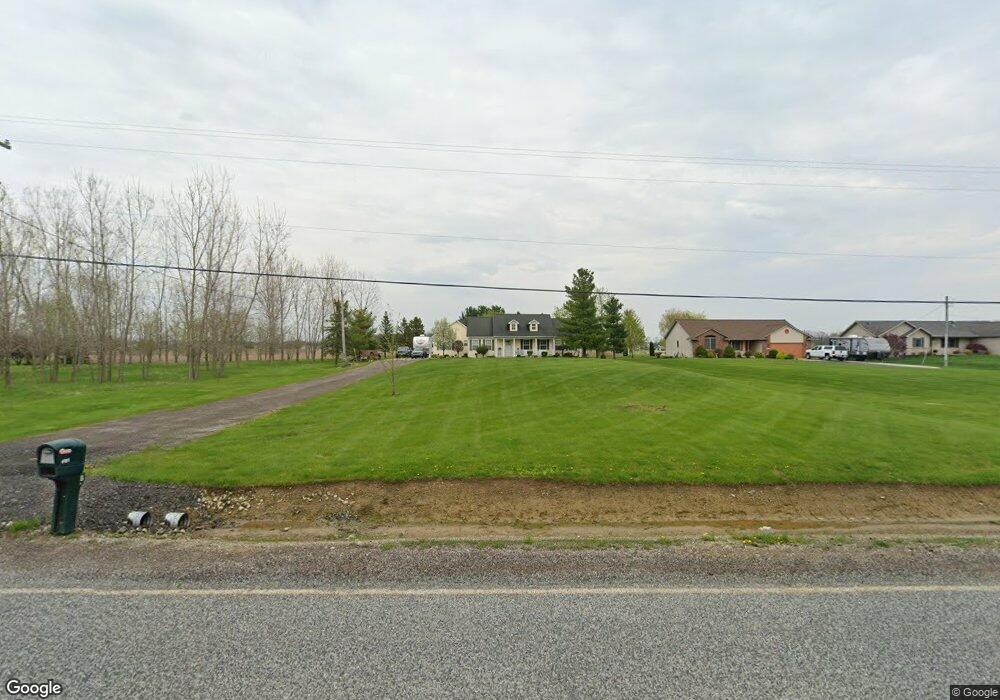
6151 Sharp Rd Swartz Creek, MI 48473
Estimated Value: $331,396 - $388,000
3
Beds
3
Baths
1,457
Sq Ft
$244/Sq Ft
Est. Value
About This Home
This home is located at 6151 Sharp Rd, Swartz Creek, MI 48473 and is currently estimated at $355,349, approximately $243 per square foot. 6151 Sharp Rd is a home located in Genesee County with nearby schools including Elms Road Elementary School, Syring Elementary School, and Morrish Elementary School.
Ownership History
Date
Name
Owned For
Owner Type
Purchase Details
Closed on
Aug 11, 2006
Sold by
Bollinger Cain Karisa
Bought by
Cain Brian E and Bollinger Cain Karisa
Current Estimated Value
Home Financials for this Owner
Home Financials are based on the most recent Mortgage that was taken out on this home.
Original Mortgage
$168,000
Outstanding Balance
$100,974
Interest Rate
6.78%
Mortgage Type
Purchase Money Mortgage
Estimated Equity
$254,375
Purchase Details
Closed on
Aug 22, 2001
Sold by
Woodside Builders Inc
Bought by
Simkins Cory F and Simkins Gina S
Home Financials for this Owner
Home Financials are based on the most recent Mortgage that was taken out on this home.
Original Mortgage
$165,750
Interest Rate
7.28%
Purchase Details
Closed on
Nov 14, 2000
Sold by
Del Pratt Builder Inc
Bought by
Simkins Cory F and Simkins Gina S
Create a Home Valuation Report for This Property
The Home Valuation Report is an in-depth analysis detailing your home's value as well as a comparison with similar homes in the area
Home Values in the Area
Average Home Value in this Area
Purchase History
| Date | Buyer | Sale Price | Title Company |
|---|---|---|---|
| Cain Brian E | -- | Lawyers Title | |
| Bollinger Cain Karisa | $210,000 | Lawyers Title | |
| Simkins Cory F | -- | Sargents Title Company | |
| Simkins Cory F | $26,650 | Cislo Title Company |
Source: Public Records
Mortgage History
| Date | Status | Borrower | Loan Amount |
|---|---|---|---|
| Open | Bollinger Cain Karisa | $168,000 | |
| Closed | Cain Brian E | $42,000 | |
| Previous Owner | Simkins Cory F | $165,750 |
Source: Public Records
Tax History
| Year | Tax Paid | Tax Assessment Tax Assessment Total Assessment is a certain percentage of the fair market value that is determined by local assessors to be the total taxable value of land and additions on the property. | Land | Improvement |
|---|---|---|---|---|
| 2025 | $3,221 | $162,500 | $0 | $0 |
| 2024 | $1,950 | $151,800 | $0 | $0 |
| 2023 | $1,861 | $130,000 | $0 | $0 |
| 2022 | $2,852 | $119,600 | $0 | $0 |
| 2021 | $2,806 | $113,000 | $0 | $0 |
| 2020 | $1,717 | $109,000 | $0 | $0 |
| 2019 | $1,691 | $102,300 | $0 | $0 |
| 2018 | $2,305 | $95,700 | $0 | $0 |
| 2017 | $2,203 | $92,100 | $0 | $0 |
| 2016 | $2,174 | $85,800 | $0 | $0 |
| 2015 | $2,016 | $77,400 | $0 | $0 |
| 2014 | $1,292 | $71,100 | $0 | $0 |
| 2012 | -- | $63,000 | $63,000 | $0 |
Source: Public Records
Map
Nearby Homes
- 6139 Sharp Rd
- 6170 Victoria Ln
- 6237 Victoria Ln
- 6224 Victoria Ln
- 6285 Victoria Ln
- 6309 Victoria Ln
- 5280 O Connor Pass
- 5220 Wyndemere Cir
- 6300 Reid Rd
- 0 Reid Rd Unit 50168280
- 6131 Fountain View Dr Unit 49
- 7292 Grandwood Dr
- 6216 Clubhouse Way
- 5252 Maple Ave
- 0 Mitchell Dr Unit 2918482
- 0000 Grand Blanc Rd
- 0 Hidden Forest Dr Unit 30055886
- 6123 King Arthur Dr
- 5141 Maple Ave
- 5233 Sagamore Dr
Your Personal Tour Guide
Ask me questions while you tour the home.