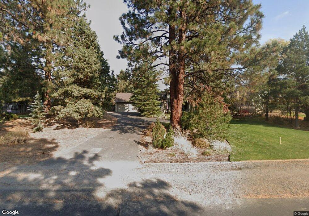
61548 Fargo Ln Bend, OR 97702
Old Farm District NeighborhoodEstimated Value: $773,285 - $857,000
3
Beds
2
Baths
1,943
Sq Ft
$416/Sq Ft
Est. Value
About This Home
This home is located at 61548 Fargo Ln, Bend, OR 97702 and is currently estimated at $807,821, approximately $415 per square foot. 61548 Fargo Ln is a home located in Deschutes County with nearby schools including Silver Rail Elementary School, High Desert Middle School, and Bend Senior High School.
Ownership History
Date
Name
Owned For
Owner Type
Purchase Details
Closed on
Feb 13, 2020
Sold by
Latham Robert A and Latham Mary F
Bought by
Latham Robert A and Latham Mary F
Current Estimated Value
Home Financials for this Owner
Home Financials are based on the most recent Mortgage that was taken out on this home.
Original Mortgage
$25,000
Interest Rate
3.72%
Mortgage Type
New Conventional
Purchase Details
Closed on
Jul 17, 2014
Sold by
Latham Robert Allen and Latham Mary Frances
Bought by
Latham Revocable Trust
Create a Home Valuation Report for This Property
The Home Valuation Report is an in-depth analysis detailing your home's value as well as a comparison with similar homes in the area
Home Values in the Area
Average Home Value in this Area
Purchase History
| Date | Buyer | Sale Price | Title Company |
|---|---|---|---|
| Latham Robert A | -- | Accommodation | |
| Latham Robert A | -- | Accommodation | |
| Latham Revocable Trust | -- | None Available |
Source: Public Records
Mortgage History
| Date | Status | Borrower | Loan Amount |
|---|---|---|---|
| Closed | Latham Robert A | $25,000 |
Source: Public Records
Tax History Compared to Growth
Tax History
| Year | Tax Paid | Tax Assessment Tax Assessment Total Assessment is a certain percentage of the fair market value that is determined by local assessors to be the total taxable value of land and additions on the property. | Land | Improvement |
|---|---|---|---|---|
| 2025 | $5,546 | $328,230 | -- | -- |
| 2024 | $5,336 | $318,670 | -- | -- |
| 2023 | $4,946 | $309,390 | $0 | $0 |
| 2022 | $4,615 | $291,640 | $0 | $0 |
| 2021 | $4,622 | $283,150 | $0 | $0 |
| 2020 | $4,385 | $283,150 | $0 | $0 |
| 2019 | $4,263 | $274,910 | $0 | $0 |
| 2018 | $4,142 | $266,910 | $0 | $0 |
| 2017 | $4,021 | $259,140 | $0 | $0 |
| 2016 | $3,835 | $251,600 | $0 | $0 |
| 2015 | $3,728 | $244,280 | $0 | $0 |
| 2014 | $3,619 | $237,170 | $0 | $0 |
Source: Public Records
Map
Nearby Homes
- 61536 Ascha Rose Ct
- 61570 SE Rockway Terrace
- 61520 SE Admiral Way
- 21116 SE Reed Market Rd
- 21130 SE Reed Market Rd
- 21062 Desert Woods Dr
- 1843 SE Moorwood Ct
- 61445 SE 27th St Unit 86
- 61445 SE 27th St Unit 55
- 61445 SE 27th St Unit 48
- 61445 SE 27th St Unit 59
- 61445 SE 27th St Unit 100
- 61620 Daly Estates Dr
- 61635 Daly Estates Dr Unit 17
- 61556 Twin Lakes Loop
- 61683 Daly Estates Dr
- 20873 Greenmont Dr
- 21035 Clairaway Ave
- 21844 SE Stromboli Ct
- 61585 E Lake Dr
- 61536 Fargo Ln
- 61556 Fargo Ln
- 61563 Range Place
- 6 Avery Ln
- 21058 Perrigan Dr
- 61566 Fargo Ln
- 61551 SE Fargo Ln
- 21050 Perrigan Dr
- 61551 Fargo Ln
- 21050 SE Perrigan Dr
- 61545 SE Fargo Ln
- 61535 SE Fargo Ln
- 61557 Fargo Ln
- 61571 SE Range Place
- 61555 Range Place
- 0 SE Fargo Unit 2708579
- 0 SE Fargo Unit 2708577
- 0 SE Fargo Unit 2708575
- 0 SE Fargo Unit 2801911
- 0 SE Fargo Unit 2801907