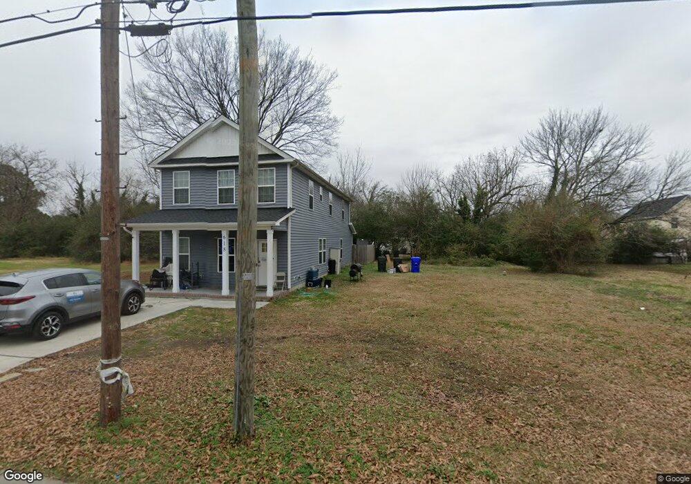
616 Battery Ave Suffolk, VA 23434
Holy Neck NeighborhoodEstimated Value: $300,000 - $321,258
3
Beds
3
Baths
1,680
Sq Ft
$185/Sq Ft
Est. Value
About This Home
This home is located at 616 Battery Ave, Suffolk, VA 23434 and is currently estimated at $310,815, approximately $185 per square foot. 616 Battery Ave is a home located in Suffolk City with nearby schools including Hillpoint Elementary School, Forest Glen Middle School, and Lakeland High School.
Ownership History
Date
Name
Owned For
Owner Type
Purchase Details
Closed on
Dec 30, 2022
Sold by
R & L Development Llc
Bought by
Hinds Michael P
Current Estimated Value
Home Financials for this Owner
Home Financials are based on the most recent Mortgage that was taken out on this home.
Original Mortgage
$275,187
Outstanding Balance
$265,765
Interest Rate
6.58%
Mortgage Type
VA
Estimated Equity
$45,050
Purchase Details
Closed on
Nov 5, 2021
Sold by
Mayo Tony L and Mayo Wanda R
Bought by
R & L Development Llc
Purchase Details
Closed on
Oct 5, 2011
Sold by
B And I Properties Llc
Bought by
Mayo Tony L
Create a Home Valuation Report for This Property
The Home Valuation Report is an in-depth analysis detailing your home's value as well as a comparison with similar homes in the area
Home Values in the Area
Average Home Value in this Area
Purchase History
| Date | Buyer | Sale Price | Title Company |
|---|---|---|---|
| Hinds Michael P | $269,000 | None Listed On Document | |
| R & L Development Llc | $18,500 | Insight Title & Stlmnt Svcs | |
| Mayo Tony L | $21,000 | -- |
Source: Public Records
Mortgage History
| Date | Status | Borrower | Loan Amount |
|---|---|---|---|
| Open | Hinds Michael P | $275,187 |
Source: Public Records
Tax History
| Year | Tax Paid | Tax Assessment Tax Assessment Total Assessment is a certain percentage of the fair market value that is determined by local assessors to be the total taxable value of land and additions on the property. | Land | Improvement |
|---|---|---|---|---|
| 2025 | $3,682 | $302,100 | $46,900 | $255,200 |
| 2024 | $3,682 | $291,500 | $46,900 | $244,600 |
| 2023 | $3,512 | $269,600 | $44,700 | $224,900 |
| 2022 | $1,276 | $117,100 | $31,900 | $85,200 |
| 2021 | $283 | $25,500 | $25,500 | $0 |
| 2020 | $258 | $23,200 | $23,200 | $0 |
| 2019 | $258 | $23,200 | $23,200 | $0 |
| 2018 | $253 | $23,200 | $23,200 | $0 |
| 2017 | $248 | $23,200 | $23,200 | $0 |
| 2016 | $248 | $23,200 | $23,200 | $0 |
| 2015 | $113 | $23,200 | $23,200 | $0 |
| 2014 | $113 | $23,200 | $23,200 | $0 |
Source: Public Records
Map
Nearby Homes
- 608 Battery Ave
- 532 Battery Ave
- LOT 18 Brook Ave
- 721 Ashley Ave Unit A
- 435 Wellons St
- 441 Wellons St
- 439 Wellons St
- 437 Wellons St
- 433 Wellons St
- 730 Brook Ave
- 415 Bosley Ave
- 314 Linden Ave
- 309 Linden Ave
- 201 Brook Ave
- 212 Saint James Ave
- 215 Wellons St
- LOT 83 York St
- 207 Saint James Ave
- 203 Saint James Ave
- 118 Saint James Ave
- 618 Battery Ave
- 622B Battery Ave
- 622 Battery Ave
- 626 Battery Ave Unit B
- 626 Battery Ave Unit B
- 626 Battery Ave
- 619 Ashley Ave
- 621 Ashley Ave
- 609 Ashley Ave
- 615 Battery Ave
- 613 Battery Ave
- 607 Ashley Ave
- 623 Ashley Ave
- 604 Battery Ave
- 623 Battery Ave
- 611 Battery Ave
- 625 Ashley Ave
- 628 Battery Ave
- 602 Battery Ave
- 607 Battery Ave
Your Personal Tour Guide
Ask me questions while you tour the home.