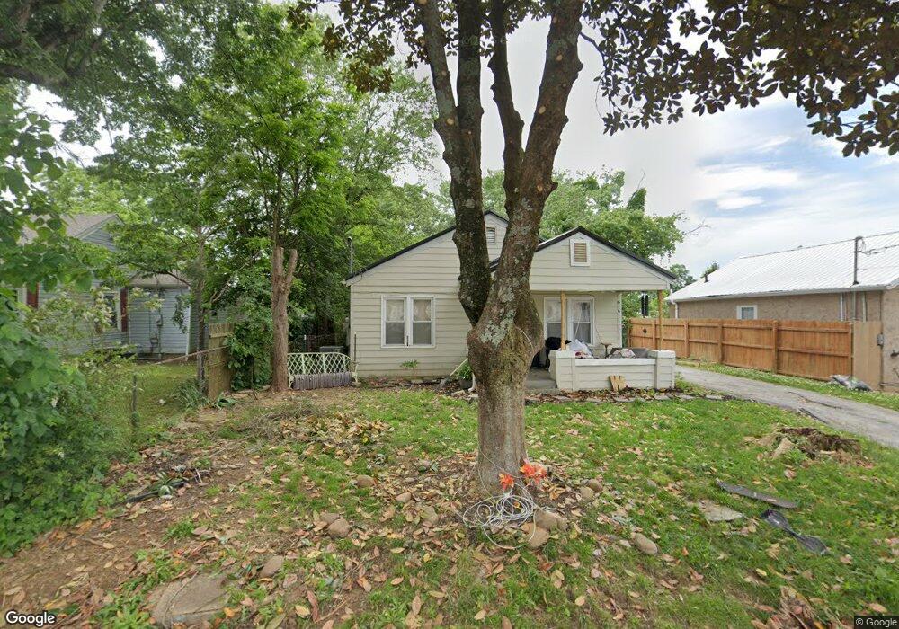
616 Montvue Ave Morristown, TN 37813
Estimated Value: $149,000 - $174,000
2
Beds
1
Bath
892
Sq Ft
$179/Sq Ft
Est. Value
About This Home
This home is located at 616 Montvue Ave, Morristown, TN 37813 and is currently estimated at $159,723, approximately $179 per square foot. 616 Montvue Ave is a home located in Hamblen County with nearby schools including Hillcrest Elementary School, Meadowview Middle School, and Morristown East High School.
Ownership History
Date
Name
Owned For
Owner Type
Purchase Details
Closed on
Jan 16, 2019
Sold by
Kimsey Dennis J and Kimsey Katie L
Bought by
Woelki Carole and Woelki Lothar
Current Estimated Value
Purchase Details
Closed on
Apr 13, 2009
Sold by
Unferth Patricia C
Bought by
Kimsey Dennis J
Purchase Details
Closed on
Aug 25, 1998
Bought by
Unferth Gary P and Unferth Patricia C
Purchase Details
Closed on
Aug 20, 1998
Bought by
Unferth Gary P and Unferth Patricia C
Purchase Details
Closed on
Jun 20, 1969
Bought by
Buttry Joe B and Buttry Nell
Create a Home Valuation Report for This Property
The Home Valuation Report is an in-depth analysis detailing your home's value as well as a comparison with similar homes in the area
Home Values in the Area
Average Home Value in this Area
Purchase History
| Date | Buyer | Sale Price | Title Company |
|---|---|---|---|
| Woelki Carole | $68,000 | None Available | |
| Kimsey Dennis J | $52,000 | -- | |
| Unferth Gary P | $37,900 | -- | |
| Unferth Gary P | -- | -- | |
| Buttry Joe B | $5,800 | -- |
Source: Public Records
Tax History Compared to Growth
Tax History
| Year | Tax Paid | Tax Assessment Tax Assessment Total Assessment is a certain percentage of the fair market value that is determined by local assessors to be the total taxable value of land and additions on the property. | Land | Improvement |
|---|---|---|---|---|
| 2024 | $283 | $16,075 | $3,450 | $12,625 |
| 2023 | $283 | $16,075 | $0 | $0 |
| 2022 | $508 | $16,075 | $3,450 | $12,625 |
| 2021 | $508 | $16,075 | $3,450 | $12,625 |
| 2020 | $507 | $16,075 | $3,450 | $12,625 |
| 2019 | $428 | $12,600 | $3,125 | $9,475 |
| 2018 | $397 | $12,600 | $3,125 | $9,475 |
| 2017 | $390 | $12,600 | $3,125 | $9,475 |
| 2016 | $373 | $12,600 | $3,125 | $9,475 |
| 2015 | $347 | $12,600 | $3,125 | $9,475 |
| 2014 | -- | $12,600 | $3,125 | $9,475 |
| 2013 | -- | $13,900 | $0 | $0 |
Source: Public Records
Map
Nearby Homes
- 712 Williams St
- 417 Cain Ave
- 831 Cave St
- 915 Forgey Ave
- 219 Inman St
- 435 S Hill St
- 525 S Liberty Hill Rd
- 819 Choctaw St
- 0 S Liberty Hill Rd Unit 703697
- 0 Joe Hall Rd Unit 703714
- 816 Choctaw St
- 1200 Liberty Hall Dr
- 518 W Hillcrest Dr
- 926 E Main St
- 1205 Ledford Ave
- 0 Russell Cir
- 323 Pauline Ave
- 811 Crescent St
- 000 Bacon Ln
- 721 E 1st St N
- 616 Montvue Ave
- 622 Montvue Ave
- 610 Montvue Ave
- 606 E Louise Ave
- 600 E Louise Ave
- 626 Montvue Ave
- 602 Montvue Ave
- 632 Montvue Ave
- 526 E Louise Ave
- 523 Cain Ave
- 522 E Louise Ave
- 516 E Louise Ave
- 517 Cain Ave
- 609 E Louise Ave
- 533 E Louise Ave
- 551 Montvue Ave
- 513 Cain Ave
- 706 Montvue Ave
- 547 Montvue Ave
- 514 E Louise Ave