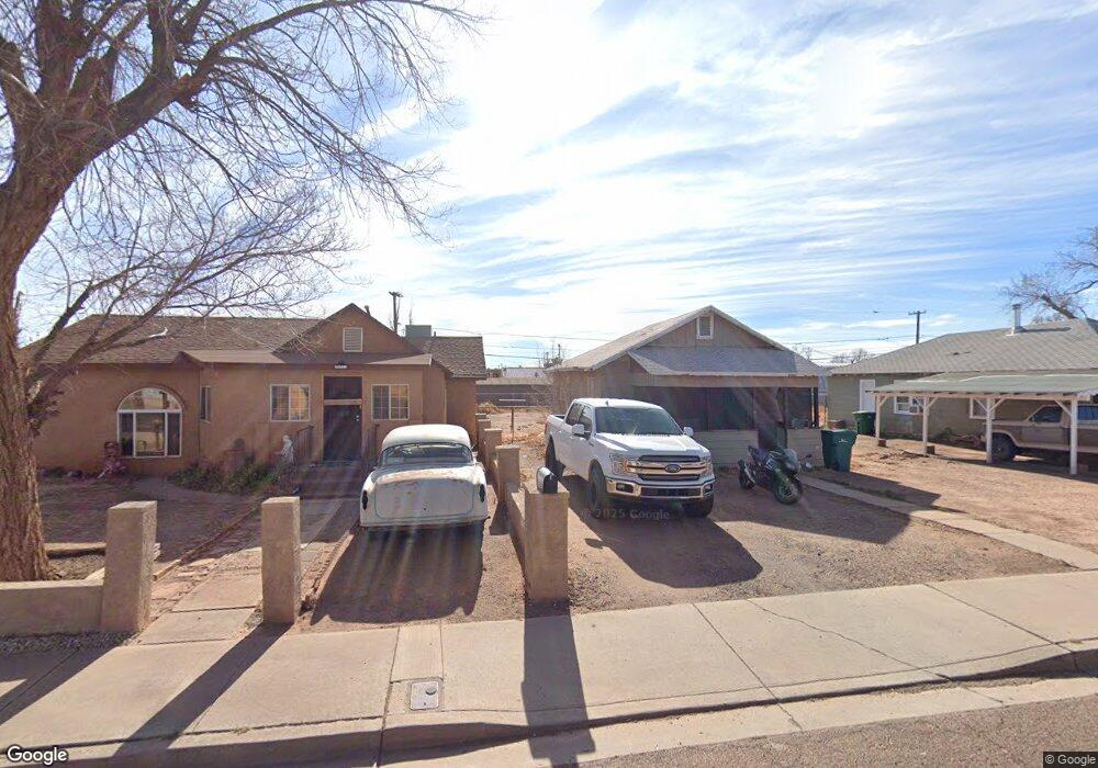
616 N Apache Ave Winslow, AZ 86047
Estimated Value: $84,000 - $130,000
2
Beds
1
Bath
660
Sq Ft
$154/Sq Ft
Est. Value
About This Home
This home is located at 616 N Apache Ave, Winslow, AZ 86047 and is currently estimated at $101,388, approximately $153 per square foot. 616 N Apache Ave is a home located in Navajo County with nearby schools including Winslow High School and Red Sands Christian School.
Ownership History
Date
Name
Owned For
Owner Type
Purchase Details
Closed on
Apr 9, 2021
Sold by
Dallam Michael and Dallam Sherry
Bought by
Wantland Linda and Wilson Kelley
Current Estimated Value
Purchase Details
Closed on
Dec 8, 2008
Sold by
Rfc Us Bank National Association
Bought by
Dallam Michael and Dallam Sherry
Purchase Details
Closed on
Oct 27, 2008
Sold by
Witt H Duane and Witt Stella K
Bought by
Rfc Us Bank National Association
Purchase Details
Closed on
Dec 31, 2007
Sold by
Witt Harold Duane and Witt Stella K
Bought by
Ant Hill Family Trust
Purchase Details
Closed on
Sep 11, 2006
Sold by
Witt Harold D and Duane Witt H
Bought by
Witt H Duane and Witt Stella K
Home Financials for this Owner
Home Financials are based on the most recent Mortgage that was taken out on this home.
Original Mortgage
$68,000
Interest Rate
9%
Mortgage Type
New Conventional
Create a Home Valuation Report for This Property
The Home Valuation Report is an in-depth analysis detailing your home's value as well as a comparison with similar homes in the area
Purchase History
| Date | Buyer | Sale Price | Title Company |
|---|---|---|---|
| Wantland Linda | $53,000 | Pioneer Title Agency Inc | |
| Dallam Michael | $25,000 | First American Title | |
| Rfc Us Bank National Association | $33,600 | Transnation Title | |
| Ant Hill Family Trust | -- | None Available | |
| Witt H Duane | -- | First American Title |
Source: Public Records
Mortgage History
| Date | Status | Borrower | Loan Amount |
|---|---|---|---|
| Previous Owner | Witt H Duane | $68,000 |
Source: Public Records
Tax History
| Year | Tax Paid | Tax Assessment Tax Assessment Total Assessment is a certain percentage of the fair market value that is determined by local assessors to be the total taxable value of land and additions on the property. | Land | Improvement |
|---|---|---|---|---|
| 2026 | $253 | -- | -- | -- |
| 2025 | $241 | $5,753 | $1,000 | $4,753 |
| 2024 | $230 | $5,046 | $845 | $4,201 |
| 2023 | $241 | $3,834 | $845 | $2,989 |
| 2022 | $230 | $0 | $0 | $0 |
| 2021 | $232 | $0 | $0 | $0 |
| 2020 | $262 | $0 | $0 | $0 |
| 2019 | $251 | $0 | $0 | $0 |
| 2018 | $240 | $0 | $0 | $0 |
| 2017 | $230 | $0 | $0 | $0 |
| 2016 | $226 | $0 | $0 | $0 |
| 2015 | $223 | $2,027 | $687 | $1,340 |
Source: Public Records
Map
Nearby Homes
- 222 E Aspinwall St
- 100 E Aspinwall St
- 722 N Warren Ave
- 219 W Elm St
- 113 W Fourth St
- 108 E 2nd St
- 601 N Berry Ave
- 501 N Taylor Ave
- 407 N Cottonwood Ave
- 108 W 1st St
- 909 N Park Dr
- 212 W First St
- 420 W 2nd St
- 901 N Prairie Ave
- 00 E 3rd St
- 0 E 3rd St
- 4323 Old Highway 66
- Parcel 103-34-084
- 1221 E 3rd St
- 801 W Mahoney St
- 612 N Apache Ave
- 618 N Apache Ave
- 608 N Apache Ave
- 315 E Maple St
- 223 E Maple St
- 606 N Apache Ave
- 317 E Maple St
- 219 E Maple St
- 600 N Apache Ave
- 302 E Oak St
- 611 N Colorado Ave
- 621 N Colorado Ave
- 615 N Apache Ave
- 312 E Oak St Unit 318
- 222 E Oak St
- 215 E Maple St
- 216 E Oak St
- 216 E Maple St
- 216 E Maple St Unit 216 1/2 E Maple Stre
- 214 E Oak St
Your Personal Tour Guide
Ask me questions while you tour the home.