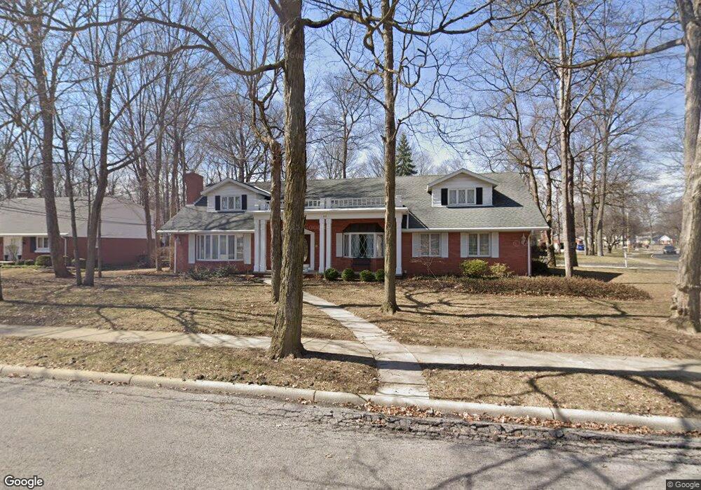
616 Yorkshire Dr Findlay, OH 45840
Estimated Value: $313,000 - $332,033
4
Beds
3
Baths
2,305
Sq Ft
$140/Sq Ft
Est. Value
About This Home
This home is located at 616 Yorkshire Dr, Findlay, OH 45840 and is currently estimated at $322,508, approximately $139 per square foot. 616 Yorkshire Dr is a home located in Hancock County with nearby schools including Wilson Vance Elementary School, Whittier Elementary School, and Donnell Middle School.
Ownership History
Date
Name
Owned For
Owner Type
Purchase Details
Closed on
Nov 24, 2003
Sold by
Patterson Carl Robert and Patterson Carolyn Joan
Bought by
Patterson Carl R and Patterson Carolyn J
Current Estimated Value
Purchase Details
Closed on
Apr 4, 1986
Bought by
Patterson Carl R and Patterson Carolyn
Create a Home Valuation Report for This Property
The Home Valuation Report is an in-depth analysis detailing your home's value as well as a comparison with similar homes in the area
Home Values in the Area
Average Home Value in this Area
Purchase History
| Date | Buyer | Sale Price | Title Company |
|---|---|---|---|
| Patterson Carl R | -- | -- | |
| Patterson Carl R | -- | -- |
Source: Public Records
Tax History Compared to Growth
Tax History
| Year | Tax Paid | Tax Assessment Tax Assessment Total Assessment is a certain percentage of the fair market value that is determined by local assessors to be the total taxable value of land and additions on the property. | Land | Improvement |
|---|---|---|---|---|
| 2024 | $2,885 | $91,030 | $10,640 | $80,390 |
| 2023 | $2,912 | $91,030 | $10,640 | $80,390 |
| 2022 | $2,917 | $91,030 | $10,640 | $80,390 |
| 2021 | $2,484 | $69,770 | $10,640 | $59,130 |
| 2020 | $2,483 | $69,770 | $10,640 | $59,130 |
| 2019 | $2,435 | $69,770 | $10,640 | $59,130 |
| 2018 | $2,419 | $64,400 | $10,640 | $53,760 |
| 2017 | $1,210 | $64,400 | $10,640 | $53,760 |
| 2016 | $2,756 | $64,400 | $10,640 | $53,760 |
| 2015 | $2,338 | $62,210 | $11,310 | $50,900 |
| 2014 | $2,338 | $62,210 | $11,310 | $50,900 |
| 2012 | $2,881 | $74,150 | $11,310 | $62,840 |
Source: Public Records
Map
Nearby Homes
- 601 Yorkshire Dr
- 537 Bristol Dr
- 1825 Greendale Ave
- 1926 Queenswood Dr
- 1932 Queenswood Dr
- 1817 Camelot Ln
- 2047 Imperial Ln
- 822 Bright Rd
- 801 Fox Run Rd
- 534 Deer Lake Dr Unit 41
- 838 Longmeadow Ln
- 845 Fox Run Rd
- 1203 Chateau Ct
- 2245 Fox Run Cir Unit 1037
- 1527 South Ct
- 1364 Chateau Cir Unit 26
- 1364 Chateau Cir Unit 31
- 1521 Middle Ct
- 1018 Cherry Ln
- 1306 Chateau Cir Unit 62
- 608 Yorkshire Dr
- 617 Yorkshire Dr
- 627 Sutton Place
- 1932 Greendale Ave
- 615 Sutton Place
- 604 Yorkshire Dr
- 701 Sutton Place
- 2005 Greendale Ave
- 609 Sutton Place
- 609 Yorkshire Dr
- 2000 Greendale Ave
- 705 Sutton Place
- 605 Sutton Place
- 600 Yorkshire Dr
- 2004 Greendale Ave
- 605 Yorkshire Dr
- 1917 Greendale Ave
- 601 Sutton Place
- 2008 Greendale Ave
- 711 Sutton Place