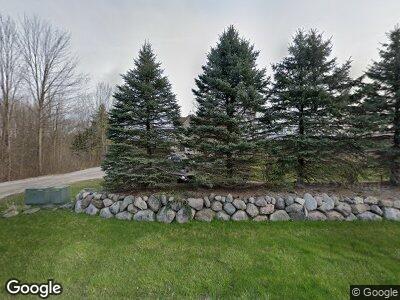
6160 N Territorial Rd Dexter, MI 48130
Estimated Value: $662,000 - $747,566
4
Beds
3
Baths
2,925
Sq Ft
$244/Sq Ft
Est. Value
About This Home
This home is located at 6160 N Territorial Rd, Dexter, MI 48130 and is currently estimated at $713,892, approximately $244 per square foot. 6160 N Territorial Rd is a home located in Washtenaw County with nearby schools including Bates Elementary School, Creekside Intermediate School, and Anchor Elementary School.
Ownership History
Date
Name
Owned For
Owner Type
Purchase Details
Closed on
Oct 29, 2004
Sold by
Sullivan Jerome E
Bought by
Sullivan Jerome E and Sullivan Reba J
Current Estimated Value
Purchase Details
Closed on
Sep 28, 1995
Sold by
Lowell Don R
Bought by
Sullivan Nelson
Home Financials for this Owner
Home Financials are based on the most recent Mortgage that was taken out on this home.
Original Mortgage
$250,000
Interest Rate
3.2%
Mortgage Type
Credit Line Revolving
Purchase Details
Closed on
Sep 25, 1995
Sold by
Lowell Don R and Lowell Glenna G
Bought by
Sullivan Nelson
Home Financials for this Owner
Home Financials are based on the most recent Mortgage that was taken out on this home.
Original Mortgage
$250,000
Interest Rate
3.2%
Mortgage Type
Credit Line Revolving
Create a Home Valuation Report for This Property
The Home Valuation Report is an in-depth analysis detailing your home's value as well as a comparison with similar homes in the area
Home Values in the Area
Average Home Value in this Area
Purchase History
| Date | Buyer | Sale Price | Title Company |
|---|---|---|---|
| Sullivan Jerome E | -- | -- | |
| Sullivan Nelson | -- | -- | |
| Sullivan Nelson | $30,000 | None Available |
Source: Public Records
Mortgage History
| Date | Status | Borrower | Loan Amount |
|---|---|---|---|
| Previous Owner | Sullivan Nelson | $250,000 |
Source: Public Records
Tax History Compared to Growth
Tax History
| Year | Tax Paid | Tax Assessment Tax Assessment Total Assessment is a certain percentage of the fair market value that is determined by local assessors to be the total taxable value of land and additions on the property. | Land | Improvement |
|---|---|---|---|---|
| 2024 | $2,829 | $331,100 | $0 | $0 |
| 2023 | $2,694 | $299,700 | $0 | $0 |
| 2022 | $8,861 | $278,000 | $0 | $0 |
| 2021 | $8,613 | $272,800 | $0 | $0 |
| 2020 | $8,508 | $266,500 | $0 | $0 |
| 2019 | $8,459 | $253,800 | $253,800 | $0 |
| 2018 | $8,290 | $249,100 | $0 | $0 |
| 2017 | $7,938 | $247,800 | $0 | $0 |
| 2016 | $2,316 | $217,973 | $0 | $0 |
| 2015 | -- | $217,322 | $0 | $0 |
| 2014 | -- | $212,835 | $0 | $0 |
| 2013 | -- | $212,835 | $0 | $0 |
Source: Public Records
Map
Nearby Homes
- 7136 N Meadows Trail Unit 6
- 6336 Mast Rd
- 8307 Granite Ct Unit 29
- 7878 N Territorial Rd
- 7940 N Territorial Rd
- 7468 Webster Church Rd
- 8461 Webster Hills Rd
- 7025 Webster Station Dr
- 8045 Trail Ridge
- 8535 Scully Rd
- 8023 Trail Ridge
- 7888 N Territorial Rd
- 4569 Farrell Rd
- 7830 Webster Church Rd
- 3672 W North Territorial Rd
- 7633 Blue Gentian Ct
- 8269 Huron River Dr
- 8099 Huron River Dr
- 3535 Arvilla
- 7737 Brass Creek
- 6160 N Territorial Rd
- 6145 N Territorial Rd
- 6240 N Territorial Rd
- 6201 Donovan Ridge Rd
- 6201 Donovan Rd
- 7111 Donovan Rd
- 6120 Donovan Rd
- 7147 Donovan Rd
- 6310 N Territorial Rd
- 7163 Donovan Rd
- 6420 N Territorial Rd
- 6325 N Territorial Rd
- 6275 N Territorial Rd
- 7185 Donovan Rd
- 7150 Donovan Rd
- 7207 Donovan Rd
- 6435 N Territorial Rd
- 7235 Donovan Rd
- 6444 N Territorial Rd
- 6305 N Territorial Rd
