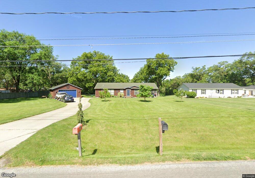
6160 SE 19th St Des Moines, IA 50320
Bloomfield/Allen NeighborhoodEstimated Value: $339,000 - $398,734
3
Beds
2
Baths
1,916
Sq Ft
$192/Sq Ft
Est. Value
About This Home
This home is located at 6160 SE 19th St, Des Moines, IA 50320 and is currently estimated at $368,684, approximately $192 per square foot. 6160 SE 19th St is a home located in Polk County with nearby schools including Lovejoy Elementary School, Mccombs Middle School, and Lincoln High School.
Ownership History
Date
Name
Owned For
Owner Type
Purchase Details
Closed on
May 11, 2007
Sold by
Mitchell Rosemarie
Bought by
Scott Craig A and Scott Vanessa A
Current Estimated Value
Home Financials for this Owner
Home Financials are based on the most recent Mortgage that was taken out on this home.
Original Mortgage
$168,000
Interest Rate
6.21%
Mortgage Type
Purchase Money Mortgage
Purchase Details
Closed on
Mar 19, 2004
Sold by
Dehart Kristopher B
Bought by
Mitchell Eugene D and Mitchell Rosemarie
Purchase Details
Closed on
Jun 27, 2003
Sold by
Dehart William and Dehart Karen
Bought by
Dehart Kristopher B
Home Financials for this Owner
Home Financials are based on the most recent Mortgage that was taken out on this home.
Original Mortgage
$160,000
Interest Rate
5.51%
Mortgage Type
Balloon
Purchase Details
Closed on
Nov 27, 2000
Sold by
Firstar Bank Cedar Rapids Na
Bought by
Guaranty Bank
Create a Home Valuation Report for This Property
The Home Valuation Report is an in-depth analysis detailing your home's value as well as a comparison with similar homes in the area
Home Values in the Area
Average Home Value in this Area
Purchase History
| Date | Buyer | Sale Price | Title Company |
|---|---|---|---|
| Scott Craig A | $209,500 | None Available | |
| Mitchell Eugene D | $189,500 | -- | |
| Dehart Kristopher B | -- | -- | |
| Guaranty Bank | -- | -- |
Source: Public Records
Mortgage History
| Date | Status | Borrower | Loan Amount |
|---|---|---|---|
| Previous Owner | Scott Craig A | $168,000 | |
| Previous Owner | Dehart Kristopher B | $160,000 |
Source: Public Records
Tax History Compared to Growth
Tax History
| Year | Tax Paid | Tax Assessment Tax Assessment Total Assessment is a certain percentage of the fair market value that is determined by local assessors to be the total taxable value of land and additions on the property. | Land | Improvement |
|---|---|---|---|---|
| 2025 | $5,146 | $312,300 | $62,000 | $250,300 |
| 2024 | $5,146 | $272,100 | $53,400 | $218,700 |
| 2023 | $5,072 | $272,100 | $53,400 | $218,700 |
| 2022 | $5,032 | $224,100 | $45,400 | $178,700 |
| 2021 | $5,240 | $224,100 | $45,400 | $178,700 |
| 2020 | $5,438 | $218,600 | $44,200 | $174,400 |
| 2019 | $4,932 | $218,600 | $44,200 | $174,400 |
| 2018 | $4,876 | $192,000 | $38,100 | $153,900 |
| 2017 | $4,516 | $192,000 | $38,100 | $153,900 |
| 2016 | $4,394 | $175,500 | $34,200 | $141,300 |
| 2015 | $4,394 | $175,500 | $34,200 | $141,300 |
| 2014 | $4,038 | $166,600 | $32,100 | $134,500 |
Source: Public Records
Map
Nearby Homes
- 5705 SE 19th St
- 1660 E Army Post Rd
- 5841 SE 22nd Ct
- 2200 Hart Ave Unit 5
- 2220 Hart Ave Unit 2
- 2241 Hart Ave Unit 1
- 2241 Hart Ave Unit 2
- 2321 Hart Ave Unit 2
- 2321 Hart Ave Unit 5
- 5806 SE 24th St
- 7085 Bloomfield Rd Unit 200
- 2341 Hart Ave Unit 2
- 2323 E Porter Ave Unit 75
- 2323 E Porter Ave Unit 36
- 7500 SE Bloomfield Rd Unit 40
- 6901 SE 14th St Unit 75
- 6901 SE 14th St Unit 30
- 6901 SE 14th St Unit 245
- 2458 E Highview Dr
- 1750 E Mckinley Ave
- 6120 SE 19th St
- 6190 SE 19th St
- 6220 SE 19th St
- 6155 SE 19th St
- 6240 SE 19th St
- 6195 SE 19th St
- 6050 SE 19th St
- 6225 SE 19th St
- 6065 SE 19th St
- 6255 SE 19th St
- 5950 SE 19th St
- 6025 SE 19th St
- 6125 SE 19th St
- 6135 SE 19th St
- 5940 SE 19th St
- 5985 SE 19th St
- 1910 E Army Post Rd
- 1820 E Army Post Rd
- 5965 SE 19th St
- 1720 E Diehl Ave