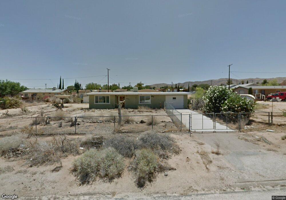
61601 Palm Vista Dr Joshua Tree, CA 92252
Estimated Value: $231,540 - $398,000
2
Beds
1
Bath
936
Sq Ft
$350/Sq Ft
Est. Value
About This Home
This home is located at 61601 Palm Vista Dr, Joshua Tree, CA 92252 and is currently estimated at $327,135, approximately $349 per square foot. 61601 Palm Vista Dr is a home located in San Bernardino County with nearby schools including Joshua Tree Elementary School, La Contenta Middle School, and Yucca Valley High School.
Ownership History
Date
Name
Owned For
Owner Type
Purchase Details
Closed on
Dec 7, 2003
Sold by
Froylan Alfaro
Bought by
Zerehi Hadi and Zerehi Martha E
Current Estimated Value
Purchase Details
Closed on
Dec 1, 2003
Sold by
Gothard David E and Gothard La Quede M
Bought by
Magyar Homes Llc
Purchase Details
Closed on
Jul 24, 2002
Sold by
Barlow Timothy
Bought by
Vine Jo Lynn Turner Barlow and Turner Barlow Jo Lynn
Purchase Details
Closed on
Jul 16, 2002
Sold by
Vine Anthony James
Bought by
Vine Jo Lynn Turner Barlow and Turner Barlow Jo Lynn
Purchase Details
Closed on
Feb 25, 2002
Sold by
Decker Howard J
Bought by
Decker Celia Jayne and Turner Celia Jayne
Purchase Details
Closed on
Mar 4, 1998
Sold by
Velazquez Jorge L
Bought by
Velazquez Alfonso and Velazquez Maria L
Create a Home Valuation Report for This Property
The Home Valuation Report is an in-depth analysis detailing your home's value as well as a comparison with similar homes in the area
Home Values in the Area
Average Home Value in this Area
Purchase History
| Date | Buyer | Sale Price | Title Company |
|---|---|---|---|
| Zerehi Hadi | $5,000 | -- | |
| Magyar Homes Llc | $230,000 | First American | |
| Vine Jo Lynn Turner Barlow | -- | Chicago Title Co | |
| Vine Jo Lynn Turner Barlow | -- | Chicago Title Co | |
| Decker Celia Jayne | -- | Chicago Title Co | |
| Velazquez Alfonso | -- | Northern Counties Title |
Source: Public Records
Tax History Compared to Growth
Tax History
| Year | Tax Paid | Tax Assessment Tax Assessment Total Assessment is a certain percentage of the fair market value that is determined by local assessors to be the total taxable value of land and additions on the property. | Land | Improvement |
|---|---|---|---|---|
| 2025 | $694 | $40,061 | $2,831 | $37,230 |
| 2024 | $694 | $39,275 | $2,775 | $36,500 |
| 2023 | $681 | $38,505 | $2,721 | $35,784 |
| 2022 | $667 | $37,750 | $2,668 | $35,082 |
| 2021 | $657 | $37,010 | $2,616 | $34,394 |
| 2020 | $649 | $36,630 | $2,589 | $34,041 |
| 2019 | $675 | $35,912 | $2,538 | $33,374 |
| 2018 | $512 | $35,208 | $2,488 | $32,720 |
| 2017 | $507 | $34,517 | $2,439 | $32,078 |
| 2016 | $499 | $33,840 | $2,391 | $31,449 |
| 2015 | $470 | $33,332 | $2,355 | $30,977 |
| 2014 | $491 | $32,679 | $2,309 | $30,370 |
Source: Public Records
Map
Nearby Homes
- 61619 Palm Vista Dr
- 61610 Sunburst Dr
- 61529 Palm Vista Dr
- 61627 El Cajon Dr
- 61680 Valley View Dr
- 61503 Sunburst Dr
- 61494 Sunburst Dr
- 61638 La Jolla Dr
- 6746 Hillview Rd
- 61593 Capilla Dr
- 61619 Granada Dr
- 61581 Granada Dr
- 6896 Conejo Ave
- 61504 Capilla Dr
- 61538 El Reposo St
- 6967 Park Blvd
- 61454 Adobe Dr
- 61773 Crest Circle Dr
- 61493 Desert Air Rd
- 61853 Grand View Cir
- 61602 Sunburst Dr
- 61579 Palm Vista Dr
- 61620 Sunburst Dr
- 6909 Hillview Rd
- 61600 Palm Vista Dr Unit Room Rental in Main House
- 61600 Palm Vista Dr Unit Casita
- 61600 Palm Vista Dr Unit Main House
- 61600 Palm Vista Dr
- 61610 Palm Vista Dr
- 61631 Palm Vista Dr
- 0 Palm Vista Unit JT15244336
- 61620 Palm Vista Dr
- 61632 Sunburst Dr
- 61582 Palm Vista Dr
- 61641 Palm Vista Dr
- 61561 Palm Vista Dr
- 61642 Palm Vista Dr
- 61640 Sunburst Dr
- 61601 Valley View Dr
- 61601 Sunburst Dr