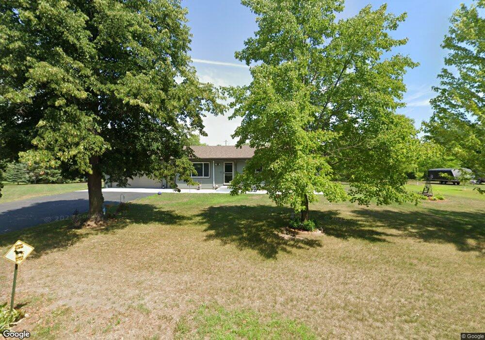
6165 Highway 10 S St. Cloud, MN 56304
Estimated Value: $272,000 - $314,000
3
Beds
1
Bath
1,092
Sq Ft
$270/Sq Ft
Est. Value
About This Home
This home is located at 6165 Highway 10 S, St. Cloud, MN 56304 and is currently estimated at $294,814, approximately $269 per square foot. 6165 Highway 10 S is a home located in Sherburne County with nearby schools including Clearview Elementary School and South Junior High School.
Ownership History
Date
Name
Owned For
Owner Type
Purchase Details
Closed on
Jul 20, 2009
Sold by
Barrett Stephen F
Bought by
Wentworth Gregory G and Wentworth Jean M
Current Estimated Value
Create a Home Valuation Report for This Property
The Home Valuation Report is an in-depth analysis detailing your home's value as well as a comparison with similar homes in the area
Home Values in the Area
Average Home Value in this Area
Purchase History
| Date | Buyer | Sale Price | Title Company |
|---|---|---|---|
| Wentworth Gregory G | $139,000 | -- |
Source: Public Records
Tax History Compared to Growth
Tax History
| Year | Tax Paid | Tax Assessment Tax Assessment Total Assessment is a certain percentage of the fair market value that is determined by local assessors to be the total taxable value of land and additions on the property. | Land | Improvement |
|---|---|---|---|---|
| 2025 | $1,794 | $257,300 | $91,100 | $166,200 |
| 2024 | $1,764 | $236,800 | $73,900 | $162,900 |
| 2023 | $1,714 | $236,700 | $77,100 | $159,600 |
| 2022 | $1,498 | $219,800 | $56,900 | $162,900 |
| 2020 | $1,366 | $168,100 | $39,600 | $128,500 |
| 2019 | $1,332 | $156,600 | $39,200 | $117,400 |
| 2018 | $1,274 | $150,400 | $40,900 | $109,500 |
| 2017 | $1,264 | $141,800 | $40,900 | $100,900 |
| 2016 | $1,168 | $137,700 | $39,200 | $98,500 |
| 2015 | $1,088 | $108,700 | $33,100 | $75,600 |
| 2014 | $968 | $96,900 | $30,800 | $66,100 |
| 2013 | -- | $85,200 | $24,500 | $60,700 |
Source: Public Records
Map
Nearby Homes
- 6581 Haven Rd SE
- 6601 Haven Rd SE
- 6485 46th Ave SE
- Howard Plan at Parkside
- Briggs Plan at Parkside
- Mayfield Plan at Parkside
- Anoka Plan at Parkside
- Hancock Plan at Parkside
- Cedar Plan at Parkside
- Rachel Plan at Parkside
- Floyd Plan at Parkside
- Locke Plan at Parkside
- Noble Plan at Parkside
- Foster Plan at Parkside
- Becker Plan at Parkside
- 8395 Walnut St
- 8422 Walnut St
- 8300 Walnut St
- 8139 Whitetail Ln
- 8010 Center St
- 6165 Highway 10 S
- 6165 U S 10
- 6133 Highway 10 S
- 6201 Highway 10 S
- 6229 Highway 10 S
- 6101 Highway 10 S
- 6257 Highway 10 S
- 6285 Highway 10 S
- 6151 Haven Rd SE
- 6093 Haven Rd SE
- 6321 Highway 10 S
- XXX Haven Rd SE
- 5948 Haven Rd SE
- 5948 County Road 66 SE
- 5851 60th St SE
- 6383 Highway 10 S
- 5944 60th St SE
- 6397 Highway 10 S
- 6397 Highway 10 S
- 5898 60th St SE