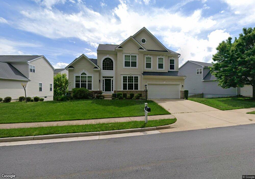
6165 Token Forest Dr Manassas, VA 20112
South Manassas NeighborhoodEstimated Value: $736,214 - $863,000
4
Beds
4
Baths
2,896
Sq Ft
$283/Sq Ft
Est. Value
About This Home
This home is located at 6165 Token Forest Dr, Manassas, VA 20112 and is currently estimated at $820,554, approximately $283 per square foot. 6165 Token Forest Dr is a home located in Prince William County with nearby schools including Charles J. Colgan Senior High School, Thurgood Marshall Elementary School, and Louise A. Benton Middle School.
Ownership History
Date
Name
Owned For
Owner Type
Purchase Details
Closed on
Nov 25, 2013
Sold by
The Ryland Group Inc
Bought by
Khan Agha K
Current Estimated Value
Home Financials for this Owner
Home Financials are based on the most recent Mortgage that was taken out on this home.
Original Mortgage
$273,000
Outstanding Balance
$204,370
Interest Rate
4.25%
Mortgage Type
New Conventional
Estimated Equity
$616,184
Create a Home Valuation Report for This Property
The Home Valuation Report is an in-depth analysis detailing your home's value as well as a comparison with similar homes in the area
Home Values in the Area
Average Home Value in this Area
Purchase History
| Date | Buyer | Sale Price | Title Company |
|---|---|---|---|
| Khan Agha K | $479,670 | -- |
Source: Public Records
Mortgage History
| Date | Status | Borrower | Loan Amount |
|---|---|---|---|
| Open | Khan Agha K | $273,000 |
Source: Public Records
Tax History
| Year | Tax Paid | Tax Assessment Tax Assessment Total Assessment is a certain percentage of the fair market value that is determined by local assessors to be the total taxable value of land and additions on the property. | Land | Improvement |
|---|---|---|---|---|
| 2025 | $6,400 | $663,900 | $160,300 | $503,600 |
| 2024 | $6,400 | $643,500 | $155,600 | $487,900 |
| 2023 | $6,353 | $610,600 | $150,200 | $460,400 |
| 2022 | $6,657 | $601,100 | $141,500 | $459,600 |
| 2021 | $6,703 | $550,600 | $141,500 | $409,100 |
| 2020 | $7,426 | $479,100 | $131,700 | $347,400 |
| 2019 | $6,885 | $444,200 | $126,500 | $317,700 |
| 2018 | $5,454 | $451,700 | $126,500 | $325,200 |
| 2017 | $5,576 | $453,000 | $126,500 | $326,500 |
| 2016 | $5,784 | $474,900 | $132,300 | $342,600 |
| 2015 | $5,501 | $476,200 | $132,300 | $343,900 |
| 2014 | $5,501 | $441,600 | $122,300 | $319,300 |
Source: Public Records
Map
Nearby Homes
- 6338 Etheridge Ln
- 6163 Tamborine Ct
- 12975 Torchlight Dr
- 6242 Oakland Dr
- 13048 Brierly Forest Ct
- 12841 Hoadly Manor Dr
- 12704 Purcell Rd
- 13151 Opal Ln
- 13379 Packard Dr
- 6658 Fox Den Rd
- 13485 Carapace Ct
- 5897 Penacle Ct
- 13217 Nickleson Dr
- 13208 Nickleson Dr
- 13357 Pelican Rd
- 12790 Lost Creek Ct
- 13450 Orangewood Dr
- 13457 Orangewood Dr
- 13370 Nationville Ln
- 12170 Ivakota Ct
- 6169 Token Forest Dr
- 6161 Token Forest Dr
- 6227 Glen Wood Loop
- 6223 Glen Wood Loop
- 6231 Glen Wood Loop
- 6173 Token Forest Dr
- 6157 Token Forest Dr
- 6230 Glen Wood Loop
- 6219 Glen Wood Loop
- 6235 Glen Wood Loop
- 6177 Token Forest Dr
- 6153 Token Forest Dr
- 6215 Glen Wood Loop
- 6181 Token Forest Dr
- 6066 Olivewood Dr
- 6239 Glen Wood Loop
- 6238 Glen Wood Loop
- 6214 Glen Wood Loop
- 6214 Glen Wood Loop
- 6250 Glen Wood Loop
Your Personal Tour Guide
Ask me questions while you tour the home.