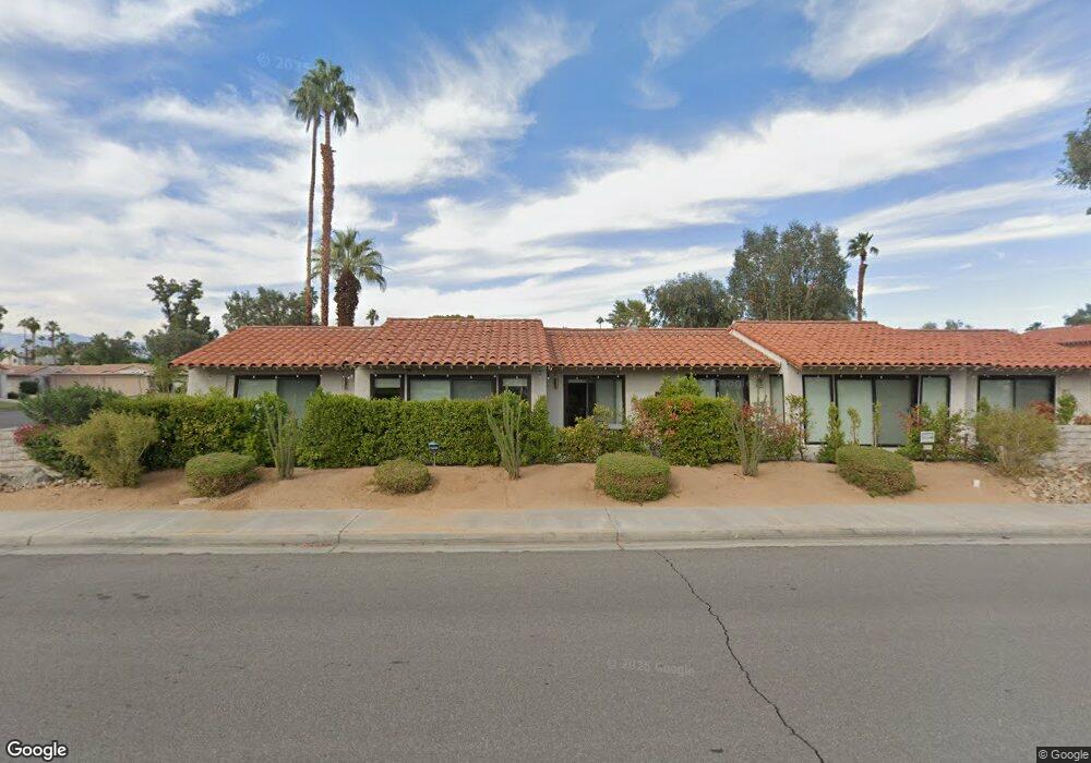
6166 E Driver Rd Palm Springs, CA 92264
South East Palm Springs NeighborhoodEstimated Value: $423,000 - $487,307
2
Beds
2
Baths
1,700
Sq Ft
$271/Sq Ft
Est. Value
About This Home
This home is located at 6166 E Driver Rd, Palm Springs, CA 92264 and is currently estimated at $460,327, approximately $270 per square foot. 6166 E Driver Rd is a home located in Riverside County with nearby schools including Cathedral City Elementary School, Nellie N. Coffman Middle School, and Cathedral City High School.
Ownership History
Date
Name
Owned For
Owner Type
Purchase Details
Closed on
Aug 19, 2020
Sold by
Brown Stephen E
Bought by
Hewitt John M
Current Estimated Value
Purchase Details
Closed on
Jun 26, 2008
Sold by
Mcclanahan Michael Hugh and Brown Stephen
Bought by
Mcclanahan Michael H and Brown Stephen E
Home Financials for this Owner
Home Financials are based on the most recent Mortgage that was taken out on this home.
Original Mortgage
$175,100
Interest Rate
6%
Mortgage Type
Stand Alone Refi Refinance Of Original Loan
Purchase Details
Closed on
Feb 29, 2008
Sold by
Gregg Anna J
Bought by
Mcclanahan Michael Hugh and Brown Stephen
Purchase Details
Closed on
May 4, 2004
Sold by
Gregg Anna J
Bought by
Gregg Anna J
Create a Home Valuation Report for This Property
The Home Valuation Report is an in-depth analysis detailing your home's value as well as a comparison with similar homes in the area
Home Values in the Area
Average Home Value in this Area
Purchase History
| Date | Buyer | Sale Price | Title Company |
|---|---|---|---|
| Hewitt John M | $299,500 | First American Title Company | |
| Mcclanahan Michael H | -- | First American Title Company | |
| Mcclanahan Michael Hugh | $240,000 | Orange Coast Title Co | |
| Gregg Anna J | -- | -- |
Source: Public Records
Mortgage History
| Date | Status | Borrower | Loan Amount |
|---|---|---|---|
| Previous Owner | Mcclanahan Michael H | $175,100 |
Source: Public Records
Tax History
| Year | Tax Paid | Tax Assessment Tax Assessment Total Assessment is a certain percentage of the fair market value that is determined by local assessors to be the total taxable value of land and additions on the property. | Land | Improvement |
|---|---|---|---|---|
| 2025 | $4,117 | $324,185 | $37,884 | $286,301 |
| 2023 | $4,117 | $311,599 | $36,414 | $275,185 |
| 2022 | $4,197 | $305,490 | $35,700 | $269,790 |
| 2021 | $4,115 | $299,500 | $35,000 | $264,500 |
| 2020 | $3,640 | $279,583 | $69,628 | $209,955 |
| 2019 | $3,545 | $271,440 | $67,600 | $203,840 |
| 2018 | $3,416 | $261,000 | $65,000 | $196,000 |
| 2017 | $3,131 | $237,000 | $59,000 | $178,000 |
| 2016 | $3,100 | $237,000 | $59,000 | $178,000 |
| 2015 | $3,013 | $237,000 | $59,000 | $178,000 |
| 2014 | $2,495 | $194,000 | $48,000 | $146,000 |
Source: Public Records
Map
Nearby Homes
- 6230 Driver Rd
- 6263 E Driver Rd
- 356 Saguaro Dr
- 284 Saguaro Dr
- 268 Encino Dr
- 57 Portola Dr
- 2 Calle Abajo
- 103 Via de Azulejos
- 132 Calle Arriba
- 5985 Spoon Rd
- 9 Calle Abajo
- 147 Vista de Oeste
- 60 Calle Abajo
- 6749 Rockwood Cir
- 6117 Arroyo Rd Unit 4
- 64 Calle de Estrellas
- 2420 Los Coyotes Dr
- 199 Juniper Dr
- 6733 Harwood Cir
- 6134 Arroyo Rd Unit 4
- 6166 Driver Rd
- 6120 Driver Rd
- 6172 E Driver Rd
- 6172 Driver Rd
- 6112 Driver Rd
- 6176 E Driver Rd
- 6176 Driver Rd
- 6100 Driver Rd
- 6121 E Driver Rd
- 6151 Driver Rd
- 6155 Driver Rd
- 6155 Driver Rd
- 6163 E Driver Rd
- 6163 Driver Rd
- 6169 Driver Rd
- 6169 E Driver Rd
- 6090 E Driver Rd
- 6090 Driver Rd
- 6143 Mashie Rd
- 6159 Driver Rd
Your Personal Tour Guide
Ask me questions while you tour the home.