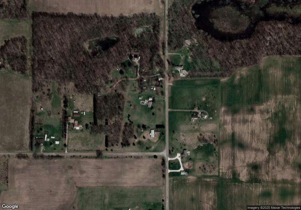
61670 Roberts Rd Three Rivers, MI 49093
Estimated Value: $221,000 - $311,000
3
Beds
2
Baths
2,000
Sq Ft
$132/Sq Ft
Est. Value
About This Home
This home is located at 61670 Roberts Rd, Three Rivers, MI 49093 and is currently estimated at $263,050, approximately $131 per square foot. 61670 Roberts Rd is a home located in St. Joseph County.
Ownership History
Date
Name
Owned For
Owner Type
Purchase Details
Closed on
Jun 9, 2008
Sold by
Fosdick Joyce A and Fosdick Roger E
Bought by
Rathburn Steve and Rathburn Lori
Current Estimated Value
Home Financials for this Owner
Home Financials are based on the most recent Mortgage that was taken out on this home.
Original Mortgage
$108,400
Outstanding Balance
$69,702
Interest Rate
6.09%
Mortgage Type
Purchase Money Mortgage
Estimated Equity
$193,348
Purchase Details
Closed on
Jun 28, 1995
Sold by
Schnepp Ronald D and Schnepp Rose M
Bought by
Fosdick Roger E and Fosdick Joyce A
Create a Home Valuation Report for This Property
The Home Valuation Report is an in-depth analysis detailing your home's value as well as a comparison with similar homes in the area
Home Values in the Area
Average Home Value in this Area
Purchase History
| Date | Buyer | Sale Price | Title Company |
|---|---|---|---|
| Rathburn Steve | $135,500 | Devon Title Three Rivers | |
| Fosdick Roger E | $81,000 | -- |
Source: Public Records
Mortgage History
| Date | Status | Borrower | Loan Amount |
|---|---|---|---|
| Open | Rathburn Steve | $108,400 |
Source: Public Records
Tax History Compared to Growth
Tax History
| Year | Tax Paid | Tax Assessment Tax Assessment Total Assessment is a certain percentage of the fair market value that is determined by local assessors to be the total taxable value of land and additions on the property. | Land | Improvement |
|---|---|---|---|---|
| 2025 | $1,321 | $99,800 | $21,900 | $77,900 |
| 2024 | $547 | $86,300 | $15,400 | $70,900 |
| 2023 | $522 | $77,900 | $9,600 | $68,300 |
| 2022 | $0 | $59,700 | $8,900 | $50,800 |
| 2021 | $681 | $57,100 | $8,900 | $48,200 |
| 2020 | $1,221 | $57,700 | $7,800 | $49,900 |
| 2019 | $467 | $46,400 | $7,800 | $38,600 |
| 2018 | $1,047 | $43,200 | $7,800 | $35,400 |
| 2017 | $1,042 | $43,400 | $43,400 | $0 |
| 2016 | -- | $42,200 | $42,200 | $0 |
| 2015 | -- | $50,500 | $0 | $0 |
| 2014 | -- | $50,500 | $50,500 | $0 |
| 2012 | -- | $53,400 | $53,400 | $0 |
Source: Public Records
Map
Nearby Homes
- 13191 Harder Rd
- 14308 Garber Rd
- 12675 Harder Rd
- 11670 Harder Rd
- 63779 Youngs Prairie Rd
- 13060 Broadway Rd
- 14765 Millard Rd
- 60241 Constantine Rd
- 815 Swartz St
- 911 S Lincoln Ave
- 810 S Constantine St
- 513 Hill St
- 14694 Coon Hollow Rd
- 1 S Tolbert Dr Unit V/L
- 902 Millard St
- 609 S Constantine St
- 18 & 19 Elizabeth Dr
- 633 S Constantine St
- 59120 S Us Highway 131
- 59688 Summit St
- 61620 Roberts Rd
- 61718 Roberts Rd
- 61600 Roberts Rd
- 61600 Roberts Rd
- 61689 Roberts Rd
- 61751 Roberts Rd
- 61577 Roberts Rd
- 61864 Roberts Rd
- 14058 Drummond Rd
- 14022 Harder Rd
- 14058 Drummond Rd
- 14100 Harder Rd
- 13898 Harder Rd
- 14348 Drummond Rd
- 14386 Drummond Rd
- 14470 Drummond Rd
- 13873 Harder Rd
- 14600 Drummond Rd
- 61427 Roberts Rd
- 0 Drummond Rd
