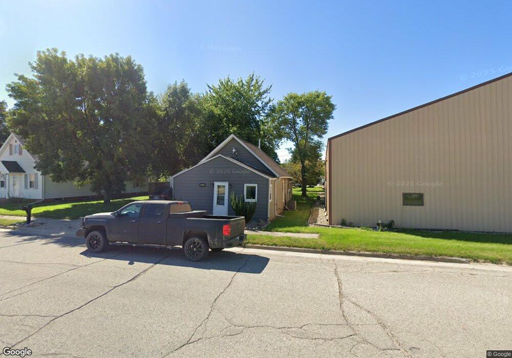
617 Broad St Whittemore, IA 50598
Estimated Value: $68,294 - $109,000
2
Beds
1
Bath
850
Sq Ft
$102/Sq Ft
Est. Value
About This Home
This home is located at 617 Broad St, Whittemore, IA 50598 and is currently estimated at $86,824, approximately $102 per square foot. 617 Broad St is a home located in Kossuth County with nearby schools including Bertha Godfrey Elementary School, Bryant Elementary School, and Lucia Wallace Elementary School.
Ownership History
Date
Name
Owned For
Owner Type
Purchase Details
Closed on
Jan 14, 2021
Sold by
Sidelnyk Serhii and Sidelnyk Kateryna
Bought by
Berte Jacob
Current Estimated Value
Purchase Details
Closed on
Sep 27, 2019
Sold by
Kent Elbert and Elbert Jamie
Bought by
Sidelnyk Sergill and Sidelnyk Kateyna
Purchase Details
Closed on
Dec 2, 2008
Sold by
Estate Of Frances Monson
Bought by
Howe Julie
Home Financials for this Owner
Home Financials are based on the most recent Mortgage that was taken out on this home.
Original Mortgage
$8,500
Interest Rate
6.04%
Mortgage Type
Future Advance Clause Open End Mortgage
Create a Home Valuation Report for This Property
The Home Valuation Report is an in-depth analysis detailing your home's value as well as a comparison with similar homes in the area
Home Values in the Area
Average Home Value in this Area
Purchase History
| Date | Buyer | Sale Price | Title Company |
|---|---|---|---|
| Berte Jacob | $50,000 | None Available | |
| Sidelnyk Sergill | $20,000 | -- | |
| Howe Julie | $103,625 | None Available |
Source: Public Records
Mortgage History
| Date | Status | Borrower | Loan Amount |
|---|---|---|---|
| Previous Owner | Howe Julie | $8,500 |
Source: Public Records
Tax History Compared to Growth
Tax History
| Year | Tax Paid | Tax Assessment Tax Assessment Total Assessment is a certain percentage of the fair market value that is determined by local assessors to be the total taxable value of land and additions on the property. | Land | Improvement |
|---|---|---|---|---|
| 2025 | $724 | $49,674 | $4,376 | $45,298 |
| 2024 | $724 | $43,072 | $4,376 | $38,696 |
| 2023 | $11 | $43,072 | $4,376 | $38,696 |
| 2022 | $671 | $41,389 | $4,376 | $37,013 |
| 2021 | $320 | $36,170 | $4,376 | $31,794 |
| 2020 | $468 | $26,064 | $5,067 | $20,997 |
| 2019 | $430 | $23,091 | $0 | $0 |
| 2018 | $414 | $23,091 | $0 | $0 |
| 2017 | $202 | $19,756 | $0 | $0 |
| 2016 | $200 | $19,756 | $0 | $0 |
| 2015 | $200 | $15,649 | $0 | $0 |
| 2014 | $122 | $15,649 | $0 | $0 |
Source: Public Records
Map
Nearby Homes