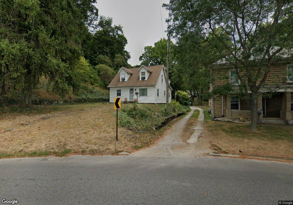
617 E Fair Ave Lancaster, OH 43130
Estimated Value: $210,875 - $248,000
3
Beds
2
Baths
1,232
Sq Ft
$187/Sq Ft
Est. Value
About This Home
This home is located at 617 E Fair Ave, Lancaster, OH 43130 and is currently estimated at $230,219, approximately $186 per square foot. 617 E Fair Ave is a home located in Fairfield County with nearby schools including Thomas Ewing Junior High School, Lancaster High School, and St Mary Elementary School.
Ownership History
Date
Name
Owned For
Owner Type
Purchase Details
Closed on
Oct 10, 2001
Sold by
Peters Michael D
Bought by
Davis Kevin H
Current Estimated Value
Home Financials for this Owner
Home Financials are based on the most recent Mortgage that was taken out on this home.
Original Mortgage
$87,797
Outstanding Balance
$32,686
Interest Rate
6.99%
Mortgage Type
FHA
Estimated Equity
$197,533
Purchase Details
Closed on
Nov 2, 1992
Sold by
Saultz Harold A
Bought by
Peters Michael D
Create a Home Valuation Report for This Property
The Home Valuation Report is an in-depth analysis detailing your home's value as well as a comparison with similar homes in the area
Home Values in the Area
Average Home Value in this Area
Purchase History
| Date | Buyer | Sale Price | Title Company |
|---|---|---|---|
| Davis Kevin H | $88,500 | -- | |
| Peters Michael D | $40,000 | -- |
Source: Public Records
Mortgage History
| Date | Status | Borrower | Loan Amount |
|---|---|---|---|
| Open | Davis Kevin H | $87,797 |
Source: Public Records
Tax History
| Year | Tax Paid | Tax Assessment Tax Assessment Total Assessment is a certain percentage of the fair market value that is determined by local assessors to be the total taxable value of land and additions on the property. | Land | Improvement |
|---|---|---|---|---|
| 2025 | $4,260 | $67,610 | $20,370 | $47,240 |
| 2024 | $4,260 | $47,390 | $13,760 | $33,630 |
| 2023 | $1,724 | $47,390 | $13,760 | $33,630 |
| 2022 | $1,731 | $47,390 | $13,760 | $33,630 |
| 2021 | $1,412 | $36,230 | $11,540 | $24,690 |
| 2020 | $1,353 | $36,230 | $11,540 | $24,690 |
| 2019 | $1,287 | $36,230 | $11,540 | $24,690 |
| 2018 | $1,028 | $29,810 | $11,540 | $18,270 |
| 2017 | $1,028 | $27,500 | $9,880 | $17,620 |
| 2016 | $1,002 | $27,500 | $9,880 | $17,620 |
| 2015 | $1,006 | $26,810 | $9,880 | $16,930 |
| 2014 | $958 | $26,810 | $9,880 | $16,930 |
| 2013 | $958 | $26,810 | $9,880 | $16,930 |
Source: Public Records
Map
Nearby Homes
- 664 Smithfield Ave
- 712 N Mount Pleasant Ave
- 705 Madison Ave
- 810 N Eastwood Ave
- 617 N Maple St
- 731 Boyd St
- 311 E Allen St
- 17 Red Bud Ln
- 610 E 5th Ave
- 612 Oakwood Ave
- 701 Franklin Ave
- 165 Lake St
- 600 N High St
- 621 Harding Ave
- 430 N High St
- 859 E Mulberry St
- 869 E Mulberry St
- 153 King St
- 130 W Fair Ave
- 844 E Wheeling St
Your Personal Tour Guide
Ask me questions while you tour the home.